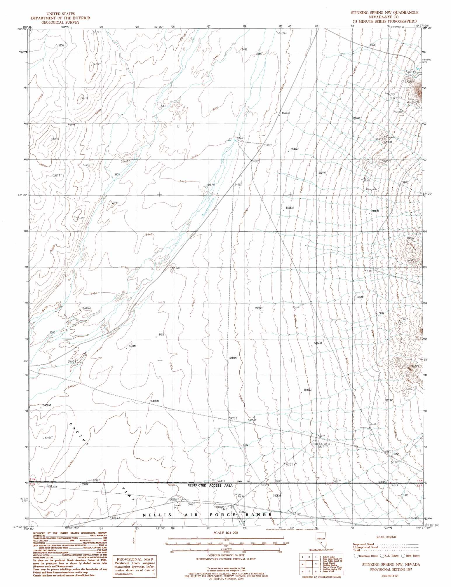
Stinking Spring Nw Topo Map Nevada
To zoom in, hover over the map of Stinking Spring Nw
USGS Topo Quad 37116h6 - 1:24,000 scale
| Topo Map Name: | Stinking Spring Nw |
| USGS Topo Quad ID: | 37116h6 |
| Print Size: | ca. 21 1/4" wide x 27" high |
| Southeast Coordinates: | 37.875° N latitude / 116.625° W longitude |
| Map Center Coordinates: | 37.9375° N latitude / 116.6875° W longitude |
| U.S. State: | NV |
| Filename: | o37116h6.jpg |
| Download Map JPG Image: | Stinking Spring Nw topo map 1:24,000 scale |
| Map Type: | Topographic |
| Topo Series: | 7.5´ |
| Map Scale: | 1:24,000 |
| Source of Map Images: | United States Geological Survey (USGS) |
| Alternate Map Versions: |
Stinking Spring NW NV 1987, updated 1988 Download PDF Buy paper map |
1:24,000 Topo Quads surrounding Stinking Spring Nw
Hannapah |
Mud Spring |
Stone Cabin Ranch |
Stone Cabin Ranch Ne |
Warm Springs Summit |
Mckinney Tanks |
Yellow Cone |
Stone Cabin Ranch Sw |
Stone Cabin Ranch Se |
Bellehelen |
Monitor Peak |
Reeds Ranch |
Stinking Spring Nw |
Stinking Spring |
Kawich Peak |
Cactus Peak |
East Of Cactus Peak |
Stinking Spring Sw |
Breen Creek |
Kawich Peak Sw |
White Patch Draw |
Cactus Spring |
Roller Coaster Knob |
Mellan |
Wild Horse Ranch |
> Back to 37116e1 at 1:100,000 scale
> Back to 37116a1 at 1:250,000 scale
> Back to U.S. Topo Maps home
Stinking Spring Nw topo map: Gazetteer
Stinking Spring Nw: Wells
Towers Well elevation 1775m 5823′Twin Mills elevation 1668m 5472′
Stinking Spring Nw digital topo map on disk
Buy this Stinking Spring Nw topo map showing relief, roads, GPS coordinates and other geographical features, as a high-resolution digital map file on DVD: