Last Chance Range Se Topo Map California
To zoom in, hover over the map of Last Chance Range Se
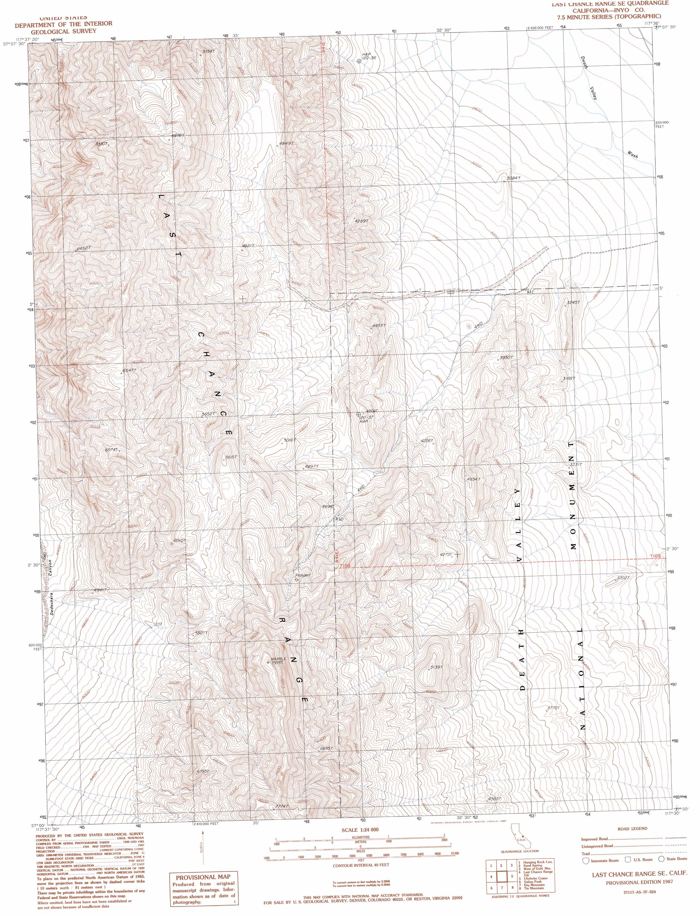
USGS Topo Quad 37117a5 - 1:24,000 scale
| Topo Map Name: | Last Chance Range Se |
| USGS Topo Quad ID: | 37117a5 |
| Print Size: | ca. 21 1/4" wide x 27" high |
| Southeast Coordinates: | 37° N latitude / 117.5° W longitude |
| Map Center Coordinates: | 37.0625° N latitude / 117.5625° W longitude |
| U.S. State: | CA |
| Filename: | o37117a5.jpg |
| Download Map JPG Image: | Last Chance Range Se topo map 1:24,000 scale |
| Map Type: | Topographic |
| Topo Series: | 7.5´ |
| Map Scale: | 1:24,000 |
| Source of Map Images: | United States Geological Survey (USGS) |
| Alternate Map Versions: |
Last Chance Range SE CA 1987, updated 1987 Download PDF Buy paper map Last Chance Range SE CA 2012 Download PDF Buy paper map Last Chance Range SE CA 2015 Download PDF Buy paper map |
1:24,000 Topo Quads surrounding Last Chance Range Se
Horse Thief Canyon |
Last Chance Mountain |
Tule Canyon |
Gold Point Sw |
Gold Point |
East Of Joshua Flats |
Hanging Rock Canyon |
Sand Spring |
West Of Gold Mountain |
Gold Mountain |
East Of Waucoba Spring |
Last Chance Range Sw |
Last Chance Range Se |
Ubehebe Crater |
Scottys Castle |
East Of Waucoba Canyon |
Saline Mountain |
Dry Mountain |
Tin Mountain |
East Of Tin Mountain |
Lower Warm Springs |
West Of Teakettle Junction |
Teakettle Junction |
White Top Mountain |
Dry Bone Canyon |
> Back to 37117a1 at 1:100,000 scale
> Back to 37116a1 at 1:250,000 scale
> Back to U.S. Topo Maps home
No gazetteer data is available for the Last Chance Range Se topo map sheet.
Last Chance Range Se digital topo map on disk
Buy this Last Chance Range Se topo map showing relief, roads, GPS coordinates and other geographical features, as a high-resolution digital map file on DVD: