Last Chance Range Sw Topo Map California
To zoom in, hover over the map of Last Chance Range Sw
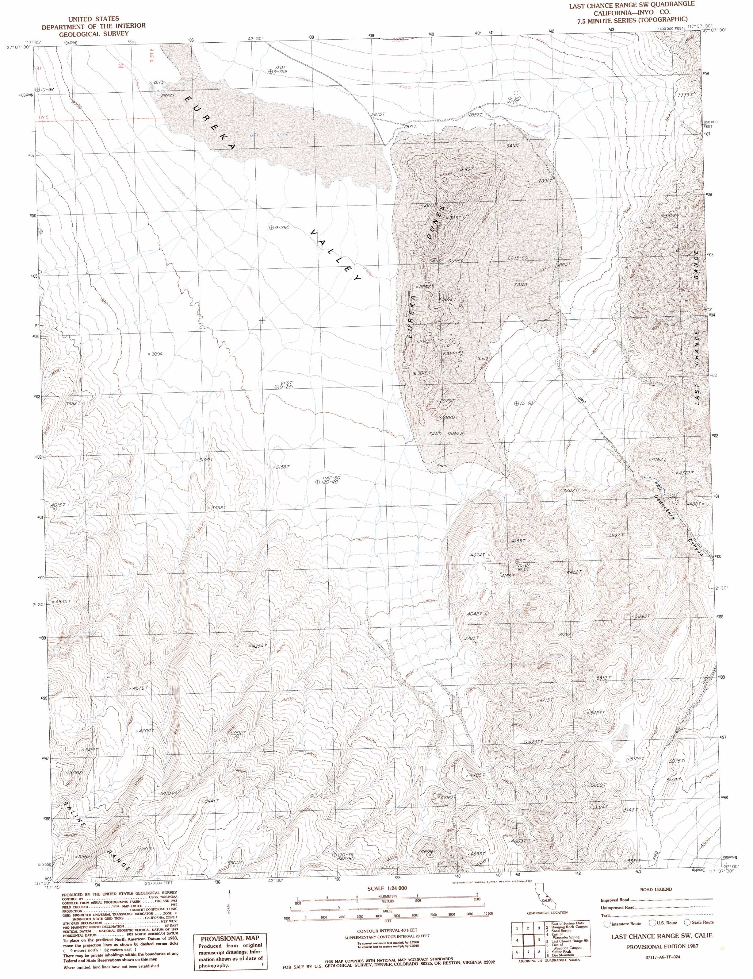
USGS Topo Quad 37117a6 - 1:24,000 scale
| Topo Map Name: | Last Chance Range Sw |
| USGS Topo Quad ID: | 37117a6 |
| Print Size: | ca. 21 1/4" wide x 27" high |
| Southeast Coordinates: | 37° N latitude / 117.625° W longitude |
| Map Center Coordinates: | 37.0625° N latitude / 117.6875° W longitude |
| U.S. State: | CA |
| Filename: | o37117a6.jpg |
| Download Map JPG Image: | Last Chance Range Sw topo map 1:24,000 scale |
| Map Type: | Topographic |
| Topo Series: | 7.5´ |
| Map Scale: | 1:24,000 |
| Source of Map Images: | United States Geological Survey (USGS) |
| Alternate Map Versions: |
Last Chance Range SW CA 1987, updated 1987 Download PDF Buy paper map Last Chance Range SW CA 2012 Download PDF Buy paper map Last Chance Range SW CA 2015 Download PDF Buy paper map |
1:24,000 Topo Quads surrounding Last Chance Range Sw
Soldier Pass |
Horse Thief Canyon |
Last Chance Mountain |
Tule Canyon |
Gold Point Sw |
Joshua Flats |
East Of Joshua Flats |
Hanging Rock Canyon |
Sand Spring |
West Of Gold Mountain |
Waucoba Spring |
East Of Waucoba Spring |
Last Chance Range Sw |
Last Chance Range Se |
Ubehebe Crater |
Waucoba Canyon |
East Of Waucoba Canyon |
Saline Mountain |
Dry Mountain |
Tin Mountain |
Pat Keyes Canyon |
Lower Warm Springs |
West Of Teakettle Junction |
Teakettle Junction |
White Top Mountain |
> Back to 37117a1 at 1:100,000 scale
> Back to 37116a1 at 1:250,000 scale
> Back to U.S. Topo Maps home
Last Chance Range Sw topo map: Gazetteer
Last Chance Range Sw: Basins
Eureka Valley elevation 869m 2851′Last Chance Range Sw: Summits
Eureka Dunes elevation 1077m 3533′Last Chance Range Sw: Valleys
Dedeckera Canyon elevation 1113m 3651′Last Chance Range Sw digital topo map on disk
Buy this Last Chance Range Sw topo map showing relief, roads, GPS coordinates and other geographical features, as a high-resolution digital map file on DVD: