Gold Mountain Topo Map Nevada
To zoom in, hover over the map of Gold Mountain
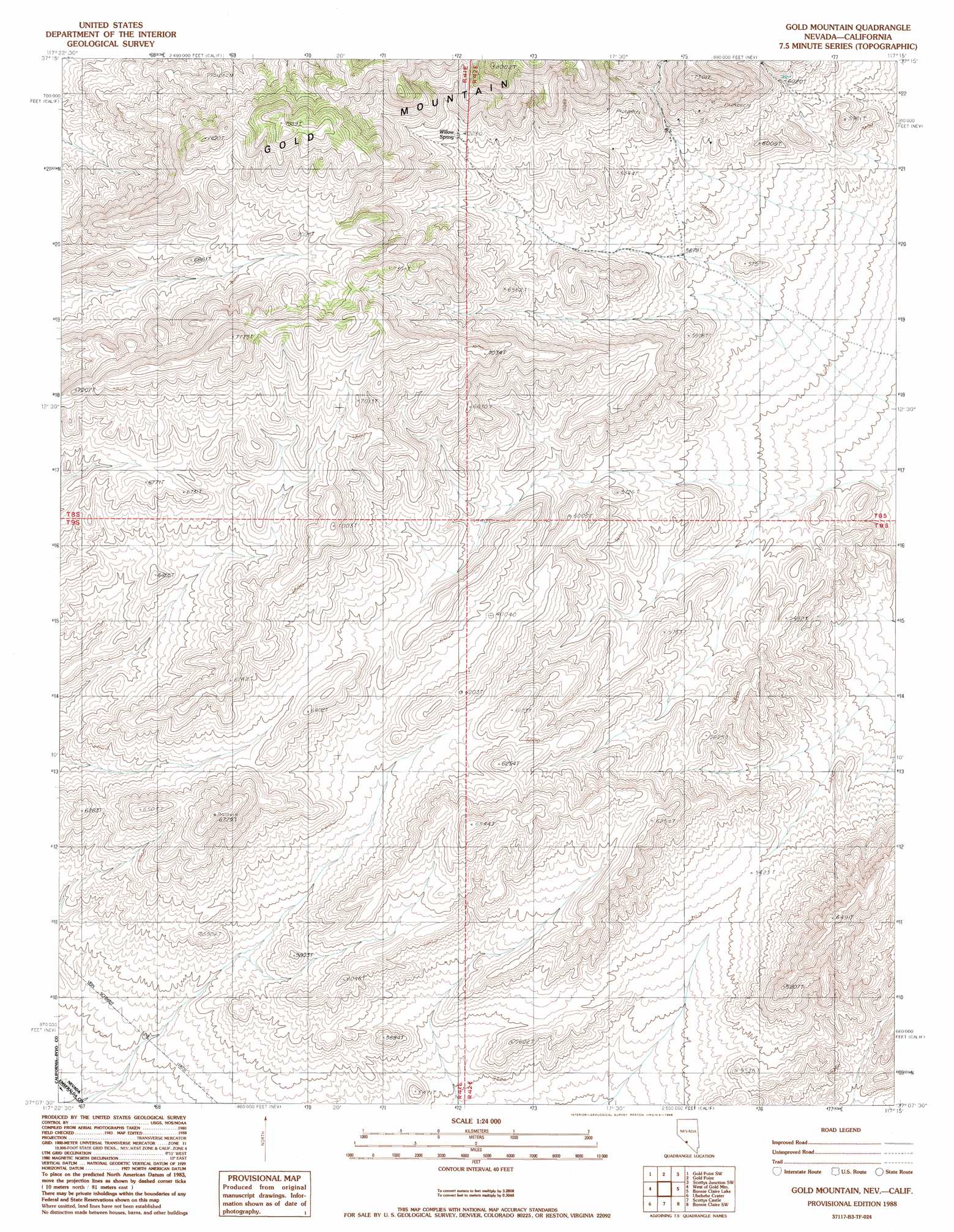
USGS Topo Quad 37117b3 - 1:24,000 scale
| Topo Map Name: | Gold Mountain |
| USGS Topo Quad ID: | 37117b3 |
| Print Size: | ca. 21 1/4" wide x 27" high |
| Southeast Coordinates: | 37.125° N latitude / 117.25° W longitude |
| Map Center Coordinates: | 37.1875° N latitude / 117.3125° W longitude |
| U.S. States: | NV, CA |
| Filename: | o37117b3.jpg |
| Download Map JPG Image: | Gold Mountain topo map 1:24,000 scale |
| Map Type: | Topographic |
| Topo Series: | 7.5´ |
| Map Scale: | 1:24,000 |
| Source of Map Images: | United States Geological Survey (USGS) |
| Alternate Map Versions: |
Gold Mountain NV 1988, updated 1988 Download PDF Buy paper map Gold Mountain NV 2012 Download PDF Buy paper map Gold Mountain NV 2014 Download PDF Buy paper map |
1:24,000 Topo Quads surrounding Gold Mountain
Magruder Mountain |
Lida |
Mount Jackson |
Stonewall Pass |
Scottys Junction Ne |
Tule Canyon |
Gold Point Sw |
Gold Point |
Scottys Junction Sw |
Scottys Junction |
Sand Spring |
West Of Gold Mountain |
Gold Mountain |
Bonnie Claire Lake |
Bonnie Claire |
Last Chance Range Se |
Ubehebe Crater |
Scottys Castle |
Bonnie Claire Sw |
Bonnie Claire Se |
Dry Mountain |
Tin Mountain |
East Of Tin Mountain |
Grapevine Peak |
Wahguyhe Peak |
> Back to 37117a1 at 1:100,000 scale
> Back to 37116a1 at 1:250,000 scale
> Back to U.S. Topo Maps home
Gold Mountain topo map: Gazetteer
Gold Mountain: Ranges
Gold Mountain Range elevation 1816m 5958′Gold Mountain: Springs
Willow Spring elevation 2024m 6640′Gold Mountain digital topo map on disk
Buy this Gold Mountain topo map showing relief, roads, GPS coordinates and other geographical features, as a high-resolution digital map file on DVD: