East Of Joshua Flats Topo Map California
To zoom in, hover over the map of East Of Joshua Flats
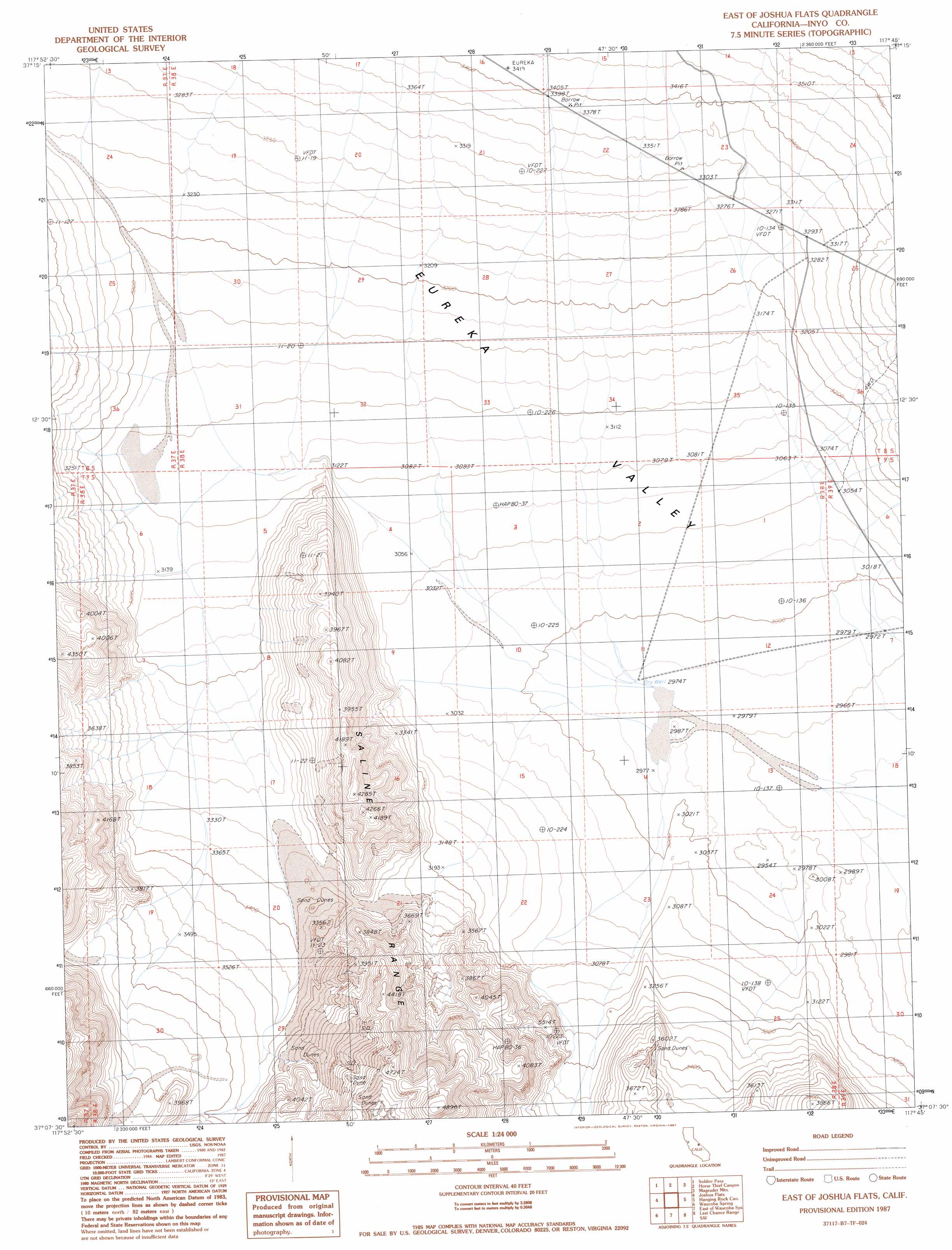
USGS Topo Quad 37117b7 - 1:24,000 scale
| Topo Map Name: | East Of Joshua Flats |
| USGS Topo Quad ID: | 37117b7 |
| Print Size: | ca. 21 1/4" wide x 27" high |
| Southeast Coordinates: | 37.125° N latitude / 117.75° W longitude |
| Map Center Coordinates: | 37.1875° N latitude / 117.8125° W longitude |
| U.S. State: | CA |
| Filename: | o37117b7.jpg |
| Download Map JPG Image: | East Of Joshua Flats topo map 1:24,000 scale |
| Map Type: | Topographic |
| Topo Series: | 7.5´ |
| Map Scale: | 1:24,000 |
| Source of Map Images: | United States Geological Survey (USGS) |
| Alternate Map Versions: |
East of Joshua Flats CA 1987, updated 1987 Download PDF Buy paper map East of Joshua Flats CA 2012 Download PDF Buy paper map East of Joshua Flats CA 2015 Download PDF Buy paper map |
1:24,000 Topo Quads surrounding East Of Joshua Flats
Crooked Creek |
Chocolate Mountain |
Sylvania Canyon |
Sylvania Mountains |
Magruder Mountain |
Deep Springs Lake |
Soldier Pass |
Horse Thief Canyon |
Last Chance Mountain |
Tule Canyon |
Cowhorn Valley |
Joshua Flats |
East Of Joshua Flats |
Hanging Rock Canyon |
Sand Spring |
Waucoba Mountain |
Waucoba Spring |
East Of Waucoba Spring |
Last Chance Range Sw |
Last Chance Range Se |
Mazourka Peak |
Waucoba Canyon |
East Of Waucoba Canyon |
Saline Mountain |
Dry Mountain |
> Back to 37117a1 at 1:100,000 scale
> Back to 37116a1 at 1:250,000 scale
> Back to U.S. Topo Maps home
East Of Joshua Flats topo map: Gazetteer
East Of Joshua Flats: Valleys
Hanging Rock Canyon elevation 941m 3087′Marble Canyon elevation 1110m 3641′
East Of Joshua Flats digital topo map on disk
Buy this East Of Joshua Flats topo map showing relief, roads, GPS coordinates and other geographical features, as a high-resolution digital map file on DVD: