Scottys Junction Sw Topo Map Nevada
To zoom in, hover over the map of Scottys Junction Sw
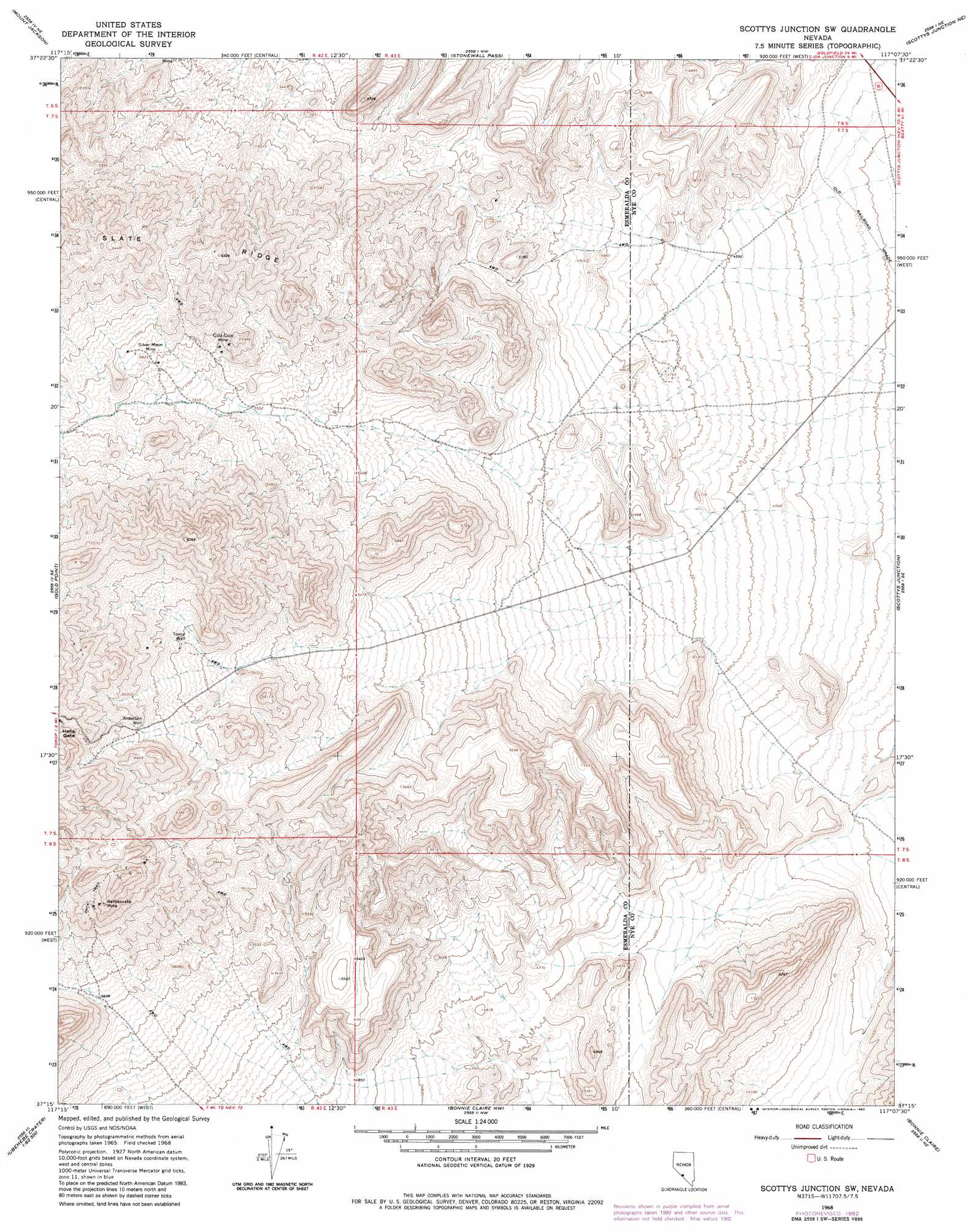
USGS Topo Quad 37117c2 - 1:24,000 scale
| Topo Map Name: | Scottys Junction Sw |
| USGS Topo Quad ID: | 37117c2 |
| Print Size: | ca. 21 1/4" wide x 27" high |
| Southeast Coordinates: | 37.25° N latitude / 117.125° W longitude |
| Map Center Coordinates: | 37.3125° N latitude / 117.1875° W longitude |
| U.S. State: | NV |
| Filename: | o37117c2.jpg |
| Download Map JPG Image: | Scottys Junction Sw topo map 1:24,000 scale |
| Map Type: | Topographic |
| Topo Series: | 7.5´ |
| Map Scale: | 1:24,000 |
| Source of Map Images: | United States Geological Survey (USGS) |
| Alternate Map Versions: |
Scottys Junction SW NV 1968, updated 1970 Download PDF Buy paper map Scottys Junction SW NV 1968, updated 1982 Download PDF Buy paper map Scottys Junction SW NV 2011 Download PDF Buy paper map Scottys Junction SW NV 2014 Download PDF Buy paper map |
1:24,000 Topo Quads surrounding Scottys Junction Sw
Montezuma Peak Sw |
Montezuma Peak Se |
Ralston |
Stonewall Spring |
Pack Rat Canyon |
Lida |
Mount Jackson |
Stonewall Pass |
Scottys Junction Ne |
Tolicha Peak Nw |
Gold Point Sw |
Gold Point |
Scottys Junction Sw |
Scottys Junction |
Tolicha Peak Sw |
West Of Gold Mountain |
Gold Mountain |
Bonnie Claire Lake |
Bonnie Claire |
Springdale Nw |
Ubehebe Crater |
Scottys Castle |
Bonnie Claire Sw |
Bonnie Claire Se |
Springdale Sw |
> Back to 37117a1 at 1:100,000 scale
> Back to 37116a1 at 1:250,000 scale
> Back to U.S. Topo Maps home
Scottys Junction Sw topo map: Gazetteer
Scottys Junction Sw: Gaps
Hells Gate elevation 1975m 6479′Scottys Junction Sw: Mines
Gold Coin Mine elevation 1754m 5754′Rattlesnake Mine elevation 1914m 6279′
Silver Moon Mine elevation 1772m 5813′
Treasure Mine elevation 1874m 6148′
Scottys Junction Sw: Wells
Anderson Well elevation 1896m 6220′Tokop Well elevation 1825m 5987′
Scottys Junction Sw digital topo map on disk
Buy this Scottys Junction Sw topo map showing relief, roads, GPS coordinates and other geographical features, as a high-resolution digital map file on DVD: