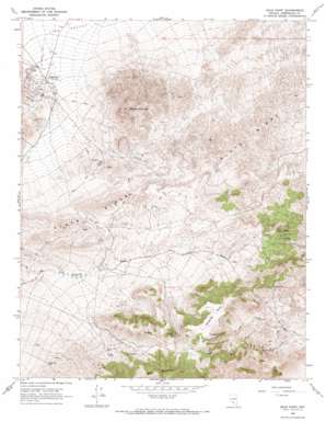
Gold Point Topo Map Nevada
To zoom in, hover over the map of Gold Point
USGS Topo Quad 37117c3 - 1:24,000 scale
| Topo Map Name: | Gold Point |
| USGS Topo Quad ID: | 37117c3 |
| Print Size: | ca. 21 1/4" wide x 27" high |
| Southeast Coordinates: | 37.25° N latitude / 117.25° W longitude |
| Map Center Coordinates: | 37.3125° N latitude / 117.3125° W longitude |
| U.S. State: | NV |
| Filename: | o37117c3.jpg |
| Download Map JPG Image: | Gold Point topo map 1:24,000 scale |
| Map Type: | Topographic |
| Topo Series: | 7.5´ |
| Map Scale: | 1:24,000 |
| Source of Map Images: | United States Geological Survey (USGS) |
| Alternate Map Versions: |
Gold Point NV 1968, updated 1970 Download PDF Buy paper map Gold Point NV 1968, updated 1979 Download PDF Buy paper map Gold Point NV 2011 Download PDF Buy paper map Gold Point NV 2014 Download PDF Buy paper map |
1:24,000 Topo Quads surrounding Gold Point
> Back to 37117a1 at 1:100,000 scale
> Back to 37116a1 at 1:250,000 scale
> Back to U.S. Topo Maps home
Gold Point topo map: Gazetteer
Gold Point: Cliffs
Lime Point elevation 1626m 5334′Gold Point: Mines
Alberto Mine elevation 2038m 6686′Big Blossom Mine elevation 1909m 6263′
Checkmate Mine elevation 1997m 6551′
Courbet Mine elevation 2149m 7050′
Dunfee Shaft elevation 1834m 6017′
Empress Mine elevation 2219m 7280′
Gold Mountain Mine elevation 1874m 6148′
Great Western Mine elevation 1687m 5534′
Hidden Treasure Mine elevation 2174m 7132′
Huson Mine elevation 2118m 6948′
Ohio Mine elevation 1647m 5403′
Oriental Mine elevation 1922m 6305′
Redemption Mine elevation 1722m 5649′
Silver Chain Mine elevation 1822m 5977′
Wonder Mine elevation 2043m 6702′
Wylie Green Mine elevation 1958m 6423′
Gold Point: Populated Places
Gold Point elevation 1641m 5383′Old Camp elevation 2115m 6938′
Tokop elevation 2114m 6935′
Gold Point: Post Offices
Gold Point Post Office (historical) elevation 1641m 5383′Oriental Post Office elevation 2129m 6984′
Gold Point: Ridges
Slate Ridge elevation 1966m 6450′Gold Point: Summits
Gold Mountain elevation 2484m 8149′Gold Mountain Peak elevation 2484m 8149′
Hanging Mesa elevation 2312m 7585′
Mount Dunfee elevation 2116m 6942′
Gold Point: Wells
Frenchman Well elevation 1899m 6230′Gold Point digital topo map on disk
Buy this Gold Point topo map showing relief, roads, GPS coordinates and other geographical features, as a high-resolution digital map file on DVD:


