Gold Point Sw Topo Map Nevada
To zoom in, hover over the map of Gold Point Sw
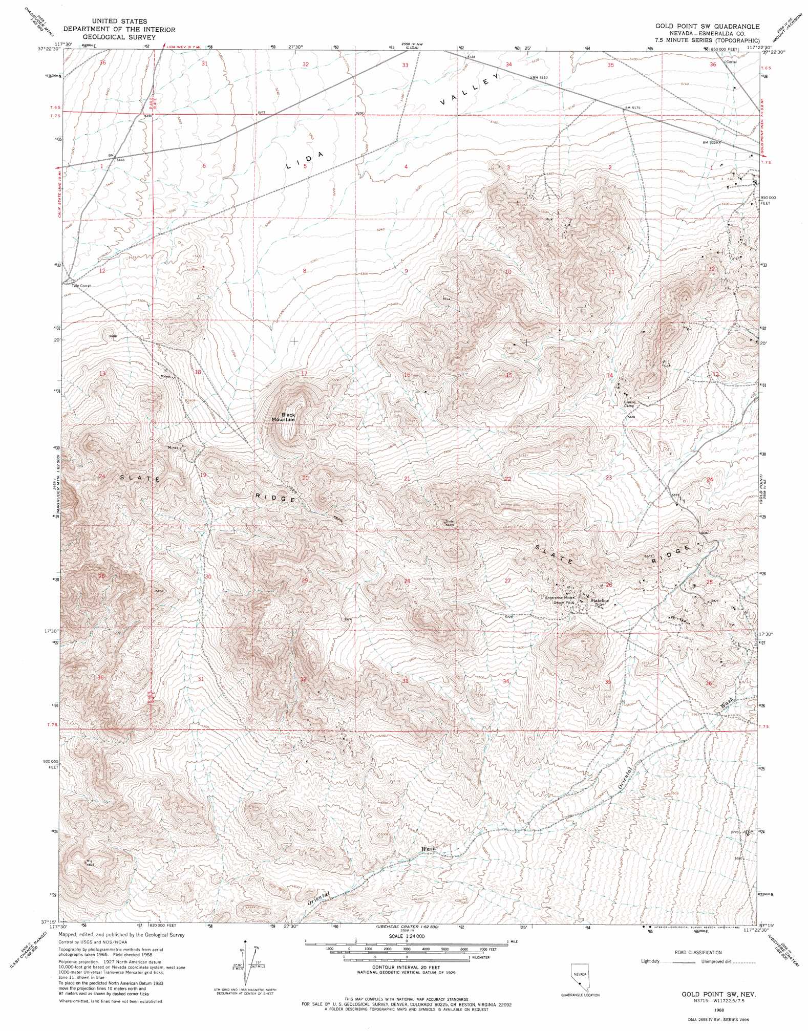
USGS Topo Quad 37117c4 - 1:24,000 scale
| Topo Map Name: | Gold Point Sw |
| USGS Topo Quad ID: | 37117c4 |
| Print Size: | ca. 21 1/4" wide x 27" high |
| Southeast Coordinates: | 37.25° N latitude / 117.375° W longitude |
| Map Center Coordinates: | 37.3125° N latitude / 117.4375° W longitude |
| U.S. State: | NV |
| Filename: | o37117c4.jpg |
| Download Map JPG Image: | Gold Point Sw topo map 1:24,000 scale |
| Map Type: | Topographic |
| Topo Series: | 7.5´ |
| Map Scale: | 1:24,000 |
| Source of Map Images: | United States Geological Survey (USGS) |
| Alternate Map Versions: |
Gold Point SW NV 1968, updated 1970 Download PDF Buy paper map Gold Point SW NV 1968, updated 1982 Download PDF Buy paper map Gold Point SW NV 1968, updated 1982 Download PDF Buy paper map Gold Point SW NV 2012 Download PDF Buy paper map Gold Point SW NV 2014 Download PDF Buy paper map |
1:24,000 Topo Quads surrounding Gold Point Sw
Lida Wash Sw |
Lida Wash |
Montezuma Peak Sw |
Montezuma Peak Se |
Ralston |
Sylvania Mountains |
Magruder Mountain |
Lida |
Mount Jackson |
Stonewall Pass |
Last Chance Mountain |
Tule Canyon |
Gold Point Sw |
Gold Point |
Scottys Junction Sw |
Hanging Rock Canyon |
Sand Spring |
West Of Gold Mountain |
Gold Mountain |
Bonnie Claire Lake |
Last Chance Range Sw |
Last Chance Range Se |
Ubehebe Crater |
Scottys Castle |
Bonnie Claire Sw |
> Back to 37117a1 at 1:100,000 scale
> Back to 37116a1 at 1:250,000 scale
> Back to U.S. Topo Maps home
Gold Point Sw topo map: Gazetteer
Gold Point Sw: Mines
Enterprise Mine elevation 1794m 5885′Ora Mae Mine elevation 1834m 6017′
Orleans Mine elevation 1774m 5820′
Seibeck Mine elevation 1618m 5308′
Snake Pit Mine elevation 1806m 5925′
State Line Mine elevation 1791m 5875′
Gold Point Sw: Populated Places
Stateline elevation 1795m 5889′Gold Point Sw: Post Offices
Gold Mountain Post Office elevation 1769m 5803′Gold Point Sw: Summits
Black Mountain elevation 1864m 6115′Gold Point Sw digital topo map on disk
Buy this Gold Point Sw topo map showing relief, roads, GPS coordinates and other geographical features, as a high-resolution digital map file on DVD: