Split Mountain Topo Map Nevada
To zoom in, hover over the map of Split Mountain
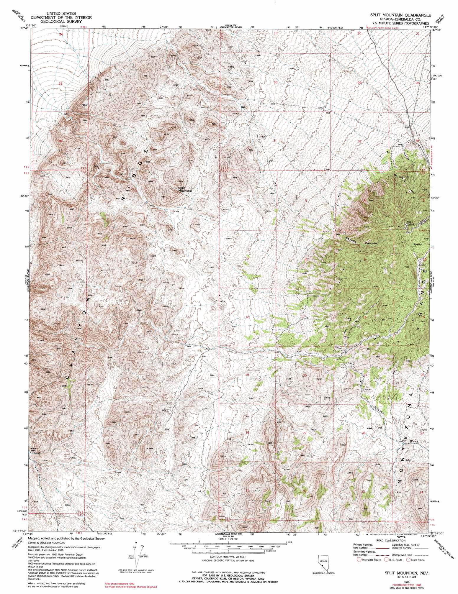
USGS Topo Quad 37117f4 - 1:24,000 scale
| Topo Map Name: | Split Mountain |
| USGS Topo Quad ID: | 37117f4 |
| Print Size: | ca. 21 1/4" wide x 27" high |
| Southeast Coordinates: | 37.625° N latitude / 117.375° W longitude |
| Map Center Coordinates: | 37.6875° N latitude / 117.4375° W longitude |
| U.S. State: | NV |
| Filename: | o37117f4.jpg |
| Download Map JPG Image: | Split Mountain topo map 1:24,000 scale |
| Map Type: | Topographic |
| Topo Series: | 7.5´ |
| Map Scale: | 1:24,000 |
| Source of Map Images: | United States Geological Survey (USGS) |
| Alternate Map Versions: |
Split Mountain NV 1970, updated 1973 Download PDF Buy paper map Split Mountain NV 1970, updated 1990 Download PDF Buy paper map Split Mountain NV 1970, updated 1992 Download PDF Buy paper map Split Mountain NV 2012 Download PDF Buy paper map Split Mountain NV 2014 Download PDF Buy paper map |
1:24,000 Topo Quads surrounding Split Mountain
North Of Silver Peak |
Weepah |
Paymaster Canyon |
Klondike |
Mud Lake Nw |
Silver Peak |
Goat Island |
Paymaster Ridge |
Alkali |
Mcmahon Ridge |
Lida Wash Nw |
Alcatraz Island |
Split Mountain |
Montezuma Peak |
Goldfield |
Lida Wash Sw |
Lida Wash |
Montezuma Peak Sw |
Montezuma Peak Se |
Ralston |
Sylvania Mountains |
Magruder Mountain |
Lida |
Mount Jackson |
Stonewall Pass |
> Back to 37117e1 at 1:100,000 scale
> Back to 37116a1 at 1:250,000 scale
> Back to U.S. Topo Maps home
Split Mountain topo map: Gazetteer
Split Mountain: Ridges
Clayton Ridge elevation 1880m 6167′Split Mountain: Summits
Split Mountain elevation 1906m 6253′Split Mountain: Valleys
Nevada Canyon elevation 1810m 5938′Split Mountain digital topo map on disk
Buy this Split Mountain topo map showing relief, roads, GPS coordinates and other geographical features, as a high-resolution digital map file on DVD: