Rhyolite Ridge Sw Topo Map Nevada
To zoom in, hover over the map of Rhyolite Ridge Sw
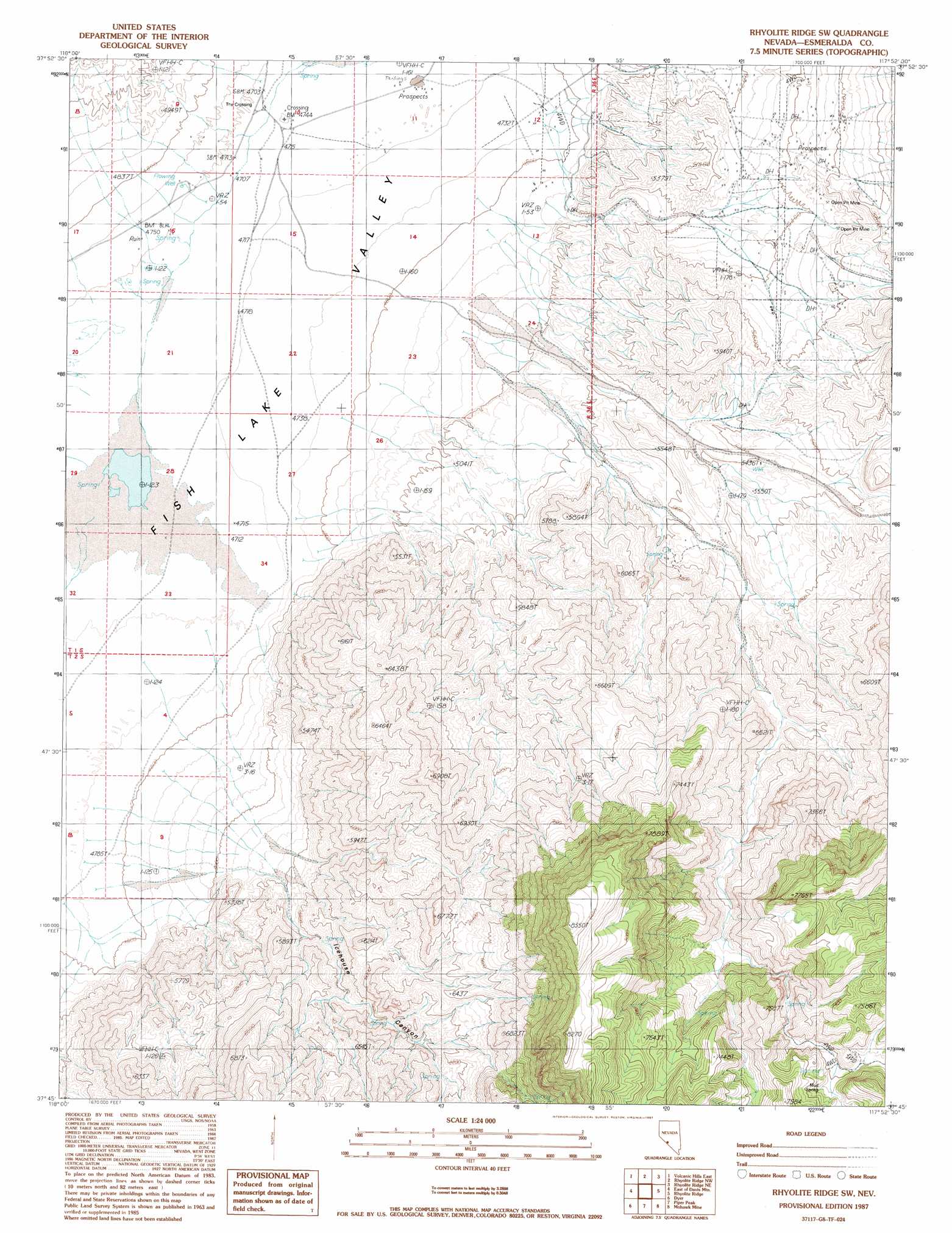
USGS Topo Quad 37117g8 - 1:24,000 scale
| Topo Map Name: | Rhyolite Ridge Sw |
| USGS Topo Quad ID: | 37117g8 |
| Print Size: | ca. 21 1/4" wide x 27" high |
| Southeast Coordinates: | 37.75° N latitude / 117.875° W longitude |
| Map Center Coordinates: | 37.8125° N latitude / 117.9375° W longitude |
| U.S. State: | NV |
| Filename: | o37117g8.jpg |
| Download Map JPG Image: | Rhyolite Ridge Sw topo map 1:24,000 scale |
| Map Type: | Topographic |
| Topo Series: | 7.5´ |
| Map Scale: | 1:24,000 |
| Source of Map Images: | United States Geological Survey (USGS) |
| Alternate Map Versions: |
Rhyolite Ridge SW NV 1987, updated 1987 Download PDF Buy paper map Rhyolite Ridge SW NV 2011 Download PDF Buy paper map Rhyolite Ridge SW NV 2015 Download PDF Buy paper map |
1:24,000 Topo Quads surrounding Rhyolite Ridge Sw
Miller Mountain |
Columbus |
Coaldale |
Blair Junction |
Devils Gate |
Volcanic Hills West |
Volcanic Hills East |
Rhyolite Ridge Nw |
Rhyolite Ridge Ne |
North Of Silver Peak |
Davis Mountain |
East Of Davis Mountain |
Rhyolite Ridge Sw |
Rhyolite Ridge |
Silver Peak |
Juniper Mountain |
Dyer |
Piper Peak |
Mohawk Mine |
Lida Wash Nw |
Mount Barcroft |
Station Peak |
Indian Garden Creek |
Oasis Divide |
Lida Wash Sw |
> Back to 37117e1 at 1:100,000 scale
> Back to 37116a1 at 1:250,000 scale
> Back to U.S. Topo Maps home
Rhyolite Ridge Sw topo map: Gazetteer
Rhyolite Ridge Sw: Populated Places
Fish Lake (historical) elevation 1436m 4711′The Crossing elevation 1436m 4711′
Rhyolite Ridge Sw: Post Offices
Fish Lake Post Office (historical) elevation 1436m 4711′Rhyolite Ridge Sw: Springs
Deep Spring elevation 1652m 5419′Mud Spring elevation 2151m 7057′
Rhyolite Ridge Sw: Streams
Rock Creek elevation 1435m 4708′Rhyolite Ridge Sw: Valleys
Icehouse Canyon elevation 1573m 5160′Rhyolite Ridge Sw digital topo map on disk
Buy this Rhyolite Ridge Sw topo map showing relief, roads, GPS coordinates and other geographical features, as a high-resolution digital map file on DVD: