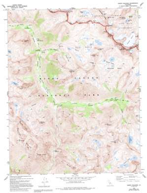
North Palisade Topo Map California
To zoom in, hover over the map of North Palisade
USGS Topo Quad 37118a5 - 1:24,000 scale
| Topo Map Name: | North Palisade |
| USGS Topo Quad ID: | 37118a5 |
| Print Size: | ca. 21 1/4" wide x 27" high |
| Southeast Coordinates: | 37° N latitude / 118.5° W longitude |
| Map Center Coordinates: | 37.0625° N latitude / 118.5625° W longitude |
| U.S. State: | CA |
| Filename: | o37118a5.jpg |
| Download Map JPG Image: | North Palisade topo map 1:24,000 scale |
| Map Type: | Topographic |
| Topo Series: | 7.5´ |
| Map Scale: | 1:24,000 |
| Source of Map Images: | United States Geological Survey (USGS) |
| Alternate Map Versions: |
North Palisade CA 1982, updated 1983 Download PDF Buy paper map North Palisade CA 1982, updated 1986 Download PDF Buy paper map North Palisade CA 1982, updated 1994 Download PDF Buy paper map North Palisade CA 1994, updated 1997 Download PDF Buy paper map North Palisade CA 2012 Download PDF Buy paper map North Palisade CA 2015 Download PDF Buy paper map |
| FStopo: | US Forest Service topo North Palisade is available: Download FStopo PDF Download FStopo TIF |
1:24,000 Topo Quads surrounding North Palisade
> Back to 37118a1 at 1:100,000 scale
> Back to 37118a1 at 1:250,000 scale
> Back to U.S. Topo Maps home
North Palisade topo map: Gazetteer
North Palisade: Basins
Devils Washbowl elevation 2824m 9265′Dusy Basin elevation 3419m 11217′
Palisade Basin elevation 3417m 11210′
North Palisade: Cliffs
Great Cliffs elevation 3495m 11466′North Palisade: Flats
Big Pete Meadow elevation 2818m 9245′Deer Meadow elevation 2713m 8900′
Grouse Meadows elevation 2930m 9612′
Little Pete Meadow elevation 3249m 10659′
Sam Mack Meadow elevation 3366m 11043′
North Palisade: Gaps
Agassiz Col elevation 3992m 13097′Bishop Pass elevation 3649m 11971′
Jigsaw Pass elevation 3857m 12654′
Knapsack Pass elevation 3381m 11092′
Potluck Pass elevation 3698m 12132′
North Palisade: Glaciers
Palisade Glacier elevation 3870m 12696′North Palisade: Lakes
Amphitheater Lake elevation 3469m 11381′Barrett Lakes elevation 3545m 11630′
Bishop Lake elevation 3425m 11236′
Doe Lake elevation 3263m 10705′
Dumbbell Lakes elevation 3321m 10895′
Rainbow Lakes elevation 3281m 10764′
Sam Mack Lake elevation 3596m 11797′
North Palisade: Ridges
Windy Cliff elevation 2979m 9773′North Palisade: Streams
Cataract Creek elevation 2714m 8904′Dusy Branch elevation 3056m 10026′
Glacier Creek elevation 2687m 8815′
Palisade Creek elevation 2644m 8674′
Rambaud Creek elevation 2793m 9163′
North Palisade: Summits
Aperture Peak elevation 4033m 13231′Columbine Peak elevation 3397m 11145′
Devils Crags elevation 3691m 12109′
Giraud Peak elevation 3540m 11614′
Isosceles Peak elevation 3479m 11414′
Langille Peak elevation 3487m 11440′
Mount Agassiz elevation 4220m 13845′
Mount Gayley elevation 4066m 13339′
Mount Goode elevation 3981m 13061′
Mount Robinson elevation 3951m 12962′
Mount Shakespare elevation 3341m 10961′
Mount Sill elevation 4204m 13792′
Mount Winchell elevation 4091m 13421′
Mount Woodworth elevation 3454m 11332′
North Palisade elevation 4348m 14265′
Observation Peak elevation 3388m 11115′
Polemonium Peak elevation 4254m 13956′
Rambaud Peak elevation 3388m 11115′
The Citadel elevation 3340m 10958′
Thunderbolt Peak elevation 4247m 13933′
North Palisade: Valleys
Le Conte Canyon elevation 2440m 8005′North Palisade digital topo map on disk
Buy this North Palisade topo map showing relief, roads, GPS coordinates and other geographical features, as a high-resolution digital map file on DVD:


