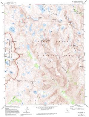
Mount Goddard Topo Map California
To zoom in, hover over the map of Mount Goddard
USGS Topo Quad 37118a6 - 1:24,000 scale
| Topo Map Name: | Mount Goddard |
| USGS Topo Quad ID: | 37118a6 |
| Print Size: | ca. 21 1/4" wide x 27" high |
| Southeast Coordinates: | 37° N latitude / 118.625° W longitude |
| Map Center Coordinates: | 37.0625° N latitude / 118.6875° W longitude |
| U.S. State: | CA |
| Filename: | o37118a6.jpg |
| Download Map JPG Image: | Mount Goddard topo map 1:24,000 scale |
| Map Type: | Topographic |
| Topo Series: | 7.5´ |
| Map Scale: | 1:24,000 |
| Source of Map Images: | United States Geological Survey (USGS) |
| Alternate Map Versions: |
Mt. Goddard CA 1983, updated 1983 Download PDF Buy paper map Mt. Goddard CA 1983, updated 1986 Download PDF Buy paper map Mt. Goddard CA 1983, updated 1994 Download PDF Buy paper map Mount Goddard CA 2004, updated 2007 Download PDF Buy paper map Mount Goddard CA 2004, updated 2007 Download PDF Buy paper map Mount Goddard CA 2012 Download PDF Buy paper map Mount Goddard CA 2015 Download PDF Buy paper map |
| FStopo: | US Forest Service topo Mount Goddard is available: Download FStopo PDF Download FStopo TIF |
1:24,000 Topo Quads surrounding Mount Goddard
> Back to 37118a1 at 1:100,000 scale
> Back to 37118a1 at 1:250,000 scale
> Back to U.S. Topo Maps home
Mount Goddard topo map: Gazetteer
Mount Goddard: Basins
Ionian Basin elevation 3362m 11030′Mount Goddard: Gaps
Muir Pass elevation 3650m 11975′Mount Goddard: Lakes
Battalion Lake elevation 3376m 11076′Cathedral Lake elevation 3281m 10764′
Chapel Lake elevation 3301m 10830′
Eve Lake elevation 3389m 11118′
Helen Lake elevation 3543m 11624′
Hester Lake elevation 3542m 11620′
Ladder Lake elevation 3292m 10800′
Lake McDermand elevation 3520m 11548′
Martha Lake elevation 3356m 11010′
Pearl Lake elevation 3242m 10636′
Regiment Lake elevation 3348m 10984′
Tunemah Lake elevation 3394m 11135′
Valor Lake elevation 3423m 11230′
Wanda Lake elevation 3484m 11430′
Mount Goddard: Ridges
Black Divide elevation 3821m 12536′Goddard Divide elevation 3801m 12470′
Ragged Spur elevation 3653m 11984′
White Divide elevation 3518m 11541′
Mount Goddard: Streams
Disappearing Creek elevation 2128m 6981′Mount Goddard: Summits
Black Giant elevation 4063m 13330′Blue Canyon Peak elevation 3591m 11781′
Charybdis elevation 3920m 12860′
Finger Peak elevation 3780m 12401′
Mount Goddard elevation 4126m 13536′
Mount McDuffie elevation 4047m 13277′
Mount Reinstein elevation 3834m 12578′
Mount Solomons elevation 3967m 13015′
Scylla elevation 3940m 12926′
The Three Sirens elevation 3854m 12644′
Wheel Mountain elevation 3883m 12739′
Mount Goddard: Valleys
Enchanted Gorge elevation 2162m 7093′Mount Goddard digital topo map on disk
Buy this Mount Goddard topo map showing relief, roads, GPS coordinates and other geographical features, as a high-resolution digital map file on DVD:


