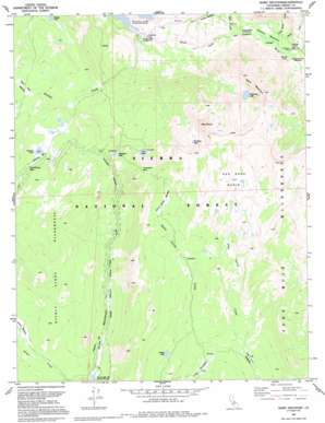
Ward Mountain Topo Map California
To zoom in, hover over the map of Ward Mountain
USGS Topo Quad 37118b8 - 1:24,000 scale
| Topo Map Name: | Ward Mountain |
| USGS Topo Quad ID: | 37118b8 |
| Print Size: | ca. 21 1/4" wide x 27" high |
| Southeast Coordinates: | 37.125° N latitude / 118.875° W longitude |
| Map Center Coordinates: | 37.1875° N latitude / 118.9375° W longitude |
| U.S. State: | CA |
| Filename: | o37118b8.jpg |
| Download Map JPG Image: | Ward Mountain topo map 1:24,000 scale |
| Map Type: | Topographic |
| Topo Series: | 7.5´ |
| Map Scale: | 1:24,000 |
| Source of Map Images: | United States Geological Survey (USGS) |
| Alternate Map Versions: |
Ward Mountain CA 1982, updated 1983 Download PDF Buy paper map Ward Mountain CA 1982, updated 1987 Download PDF Buy paper map Ward Mountain CA 1990, updated 1994 Download PDF Buy paper map Ward Mountain CA 2004, updated 2007 Download PDF Buy paper map Ward Mountain CA 2012 Download PDF Buy paper map Ward Mountain CA 2015 Download PDF Buy paper map |
| FStopo: | US Forest Service topo Ward Mountain is available: Download FStopo PDF Download FStopo TIF |
1:24,000 Topo Quads surrounding Ward Mountain
> Back to 37118a1 at 1:100,000 scale
> Back to 37118a1 at 1:250,000 scale
> Back to U.S. Topo Maps home
Ward Mountain topo map: Gazetteer
Ward Mountain: Basins
Red Rock Basin elevation 3045m 9990′Ward Mountain: Flats
Blayney Meadows elevation 2322m 7618′Burnt Corral Meadow elevation 2948m 9671′
Double Meadow elevation 2413m 7916′
Dusy Meadow elevation 2538m 8326′
Dutch Oven Meadow elevation 2875m 9432′
Long Meadow elevation 2610m 8562′
Post Corral Meadows elevation 2520m 8267′
Shooting Star Meadow elevation 2374m 7788′
Ward Mountain: Gaps
Hot Springs Pass elevation 2896m 9501′Thompson Pass elevation 3112m 10209′
Ward Mountain: Lakes
Hidden Lake elevation 2790m 9153′Hobler Lake elevation 2740m 8989′
Lost Lake elevation 2899m 9511′
Mount Shinn Lake elevation 3024m 9921′
Summit Lake elevation 2875m 9432′
Thompson Lake elevation 2909m 9543′
Ward Mountain Lake elevation 2984m 9790′
Ward Mountain: Springs
Hot Springs elevation 2341m 7680′Ward Mountain: Streams
Boulder Creek elevation 2247m 7372′Burnt Corral Creek elevation 2524m 8280′
Sallie Keyes Creek elevation 2324m 7624′
Senger Creek elevation 2330m 7644′
Ward Mountain: Summits
Mount Shinn elevation 3336m 10944′Ward Mountain elevation 3301m 10830′
Ward Mountain digital topo map on disk
Buy this Ward Mountain topo map showing relief, roads, GPS coordinates and other geographical features, as a high-resolution digital map file on DVD:


