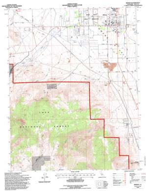
Bishop Topo Map California
To zoom in, hover over the map of Bishop
USGS Topo Quad 37118c4 - 1:24,000 scale
| Topo Map Name: | Bishop |
| USGS Topo Quad ID: | 37118c4 |
| Print Size: | ca. 21 1/4" wide x 27" high |
| Southeast Coordinates: | 37.25° N latitude / 118.375° W longitude |
| Map Center Coordinates: | 37.3125° N latitude / 118.4375° W longitude |
| U.S. State: | CA |
| Filename: | o37118c4.jpg |
| Download Map JPG Image: | Bishop topo map 1:24,000 scale |
| Map Type: | Topographic |
| Topo Series: | 7.5´ |
| Map Scale: | 1:24,000 |
| Source of Map Images: | United States Geological Survey (USGS) |
| Alternate Map Versions: |
Bishop CA 1984, updated 1984 Download PDF Buy paper map Bishop CA 1984, updated 1994 Download PDF Buy paper map Bishop CA 1994, updated 1997 Download PDF Buy paper map Bishop CA 2012 Download PDF Buy paper map Bishop CA 2015 Download PDF Buy paper map |
| FStopo: | US Forest Service topo Bishop is available: Download FStopo PDF Download FStopo TIF |
1:24,000 Topo Quads surrounding Bishop
> Back to 37118a1 at 1:100,000 scale
> Back to 37118a1 at 1:250,000 scale
> Back to U.S. Topo Maps home
Bishop topo map: Gazetteer
Bishop: Canals
Bishop Creek Canal elevation 1256m 4120′Owens River Canal elevation 1317m 4320′
Bishop: Mines
Bishop Mine elevation 1405m 4609′Brown Prospect elevation 1774m 5820′
Chipmunk Mine elevation 1861m 6105′
Hilltop Mine elevation 1519m 4983′
Nunsinger Prospect elevation 2999m 9839′
Rossi Mine elevation 1332m 4370′
Yaney Mine elevation 1546m 5072′
Bishop: Parks
Bishop City Park elevation 1264m 4146′Izaak Walton Park elevation 1323m 4340′
Tri-County Fairgrounds elevation 1267m 4156′
Bishop: Populated Places
Bishop elevation 1264m 4146′Bishop Trail Park elevation 1263m 4143′
Genes Mobile Home Park elevation 1292m 4238′
J Diamond Trailer and Recreational Vehicle Park elevation 1266m 4153′
Keough Hot Springs elevation 1283m 4209′
Mountain View Mobile and Recreational Vehicle Park elevation 1265m 4150′
Oteys Sierra Village elevation 1357m 4452′
Peterson Mill elevation 2722m 8930′
Rocking K elevation 1391m 4563′
Shady Rest Trailer and Recreational Vehicle Park elevation 1261m 4137′
Sierra Trailer Park elevation 1265m 4150′
Sunland (historical) elevation 1283m 4209′
Sunrise Mobile Home Park elevation 1265m 4150′
West Bishop elevation 1342m 4402′
Bishop: Post Offices
Bishop Post Office elevation 1268m 4160′Bishop: Streams
Birch Creek elevation 1361m 4465′Bishop Creek elevation 1366m 4481′
East Fork Coyote Creek elevation 2719m 8920′
Freeman Creek elevation 1284m 4212′
Rawson Creek elevation 1299m 4261′
South Fork Bishop Creek elevation 1359m 4458′
West Fork Coyote Creek elevation 2746m 9009′
Bishop: Summits
Red Hill elevation 1412m 4632′Bishop: Valleys
Owens Valley elevation 1257m 4124′Bishop digital topo map on disk
Buy this Bishop topo map showing relief, roads, GPS coordinates and other geographical features, as a high-resolution digital map file on DVD:


