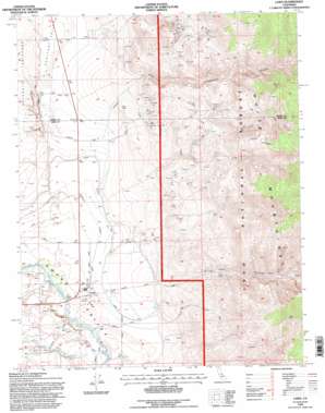
Laws Topo Map California
To zoom in, hover over the map of Laws
USGS Topo Quad 37118d3 - 1:24,000 scale
| Topo Map Name: | Laws |
| USGS Topo Quad ID: | 37118d3 |
| Print Size: | ca. 21 1/4" wide x 27" high |
| Southeast Coordinates: | 37.375° N latitude / 118.25° W longitude |
| Map Center Coordinates: | 37.4375° N latitude / 118.3125° W longitude |
| U.S. State: | CA |
| Filename: | o37118d3.jpg |
| Download Map JPG Image: | Laws topo map 1:24,000 scale |
| Map Type: | Topographic |
| Topo Series: | 7.5´ |
| Map Scale: | 1:24,000 |
| Source of Map Images: | United States Geological Survey (USGS) |
| Alternate Map Versions: |
Laws CA 1984, updated 1984 Download PDF Buy paper map Laws CA 1984, updated 1994 Download PDF Buy paper map Laws CA 1994, updated 1997 Download PDF Buy paper map Laws CA 2012 Download PDF Buy paper map Laws CA 2015 Download PDF Buy paper map |
| FStopo: | US Forest Service topo Laws is available: Download FStopo PDF Download FStopo TIF |
1:24,000 Topo Quads surrounding Laws
> Back to 37118a1 at 1:100,000 scale
> Back to 37118a1 at 1:250,000 scale
> Back to U.S. Topo Maps home
Laws topo map: Gazetteer
Laws: Canals
Laws Ditch elevation 1251m 4104′North McNally Canal elevation 1266m 4153′
South McNally Canal elevation 1261m 4137′
Laws: Mines
Churchill Pit elevation 1784m 5853′Gunter Canyon Mine elevation 1884m 6181′
Southern Belle Mine elevation 1489m 4885′
White Gull Pit elevation 1683m 5521′
Laws: Populated Places
Laws elevation 1255m 4117′Laws: Streams
Gunter Creek elevation 1265m 4150′North Fork Bishop Creek elevation 1239m 4064′
Laws: Valleys
Chalfant Valley elevation 1259m 4130′Coldwater Canyon elevation 1501m 4924′
Silver Canyon elevation 1340m 4396′
Laws digital topo map on disk
Buy this Laws topo map showing relief, roads, GPS coordinates and other geographical features, as a high-resolution digital map file on DVD:


