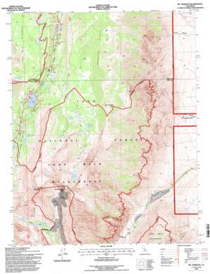
Mount Morgan Topo Map California
To zoom in, hover over the map of Mount Morgan
USGS Topo Quad 37118d6 - 1:24,000 scale
| Topo Map Name: | Mount Morgan |
| USGS Topo Quad ID: | 37118d6 |
| Print Size: | ca. 21 1/4" wide x 27" high |
| Southeast Coordinates: | 37.375° N latitude / 118.625° W longitude |
| Map Center Coordinates: | 37.4375° N latitude / 118.6875° W longitude |
| U.S. State: | CA |
| Filename: | o37118d6.jpg |
| Download Map JPG Image: | Mount Morgan topo map 1:24,000 scale |
| Map Type: | Topographic |
| Topo Series: | 7.5´ |
| Map Scale: | 1:24,000 |
| Source of Map Images: | United States Geological Survey (USGS) |
| Alternate Map Versions: |
Mt. Morgan CA 1982, updated 1982 Download PDF Buy paper map Mt. Morgan CA 1982, updated 1986 Download PDF Buy paper map Mt. Morgan CA 1982, updated 1994 Download PDF Buy paper map Mt. Morgan CA 1994, updated 1997 Download PDF Buy paper map Mount Morgan CA 2012 Download PDF Buy paper map Mount Morgan CA 2015 Download PDF Buy paper map |
| FStopo: | US Forest Service topo Mount Morgan is available: Download FStopo PDF Download FStopo TIF |
1:24,000 Topo Quads surrounding Mount Morgan
> Back to 37118a1 at 1:100,000 scale
> Back to 37118a1 at 1:250,000 scale
> Back to U.S. Topo Maps home
Mount Morgan topo map: Gazetteer
Mount Morgan: Flats
Ainslee Meadow elevation 1701m 5580′Mosquito Flat elevation 3120m 10236′
Wells Meadow elevation 1564m 5131′
Mount Morgan: Lakes
Buck Lake elevation 3547m 11637′Dorothy Lake elevation 3206m 10518′
Eastern Brook Lakes elevation 3155m 10351′
Finch Lake elevation 3272m 10734′
Francis Lake elevation 3348m 10984′
Kenneth Lake elevation 3170m 10400′
Lower Morgan Lake elevation 3263m 10705′
Patricia Lake elevation 3180m 10433′
Rock Creek Lake elevation 2957m 9701′
Serene Lake elevation 3123m 10246′
Tamarack Lakes elevation 3533m 11591′
Upper Morgan Lake elevation 3334m 10938′
Mount Morgan: Mines
Adamson Mine elevation 3597m 11801′Pine Creek Mine elevation 3494m 11463′
Round Valley Peak Prospect elevation 3401m 11158′
Mount Morgan: Populated Places
Scheelite elevation 2112m 6929′Mount Morgan: Ridges
Wheeler Ridge elevation 4165m 13664′Mount Morgan: Streams
East Fork Rock Creek elevation 2811m 9222′Mount Morgan: Summits
Broken Finger Peak elevation 3983m 13067′Mount Morgan elevation 4135m 13566′
Round Valley Peak elevation 3646m 11961′
Mount Morgan: Valleys
Little Lakes Valley elevation 2957m 9701′Mayfield Canyon elevation 1630m 5347′
Mount Morgan digital topo map on disk
Buy this Mount Morgan topo map showing relief, roads, GPS coordinates and other geographical features, as a high-resolution digital map file on DVD:


