Chidago Canyon Topo Map California
To zoom in, hover over the map of Chidago Canyon
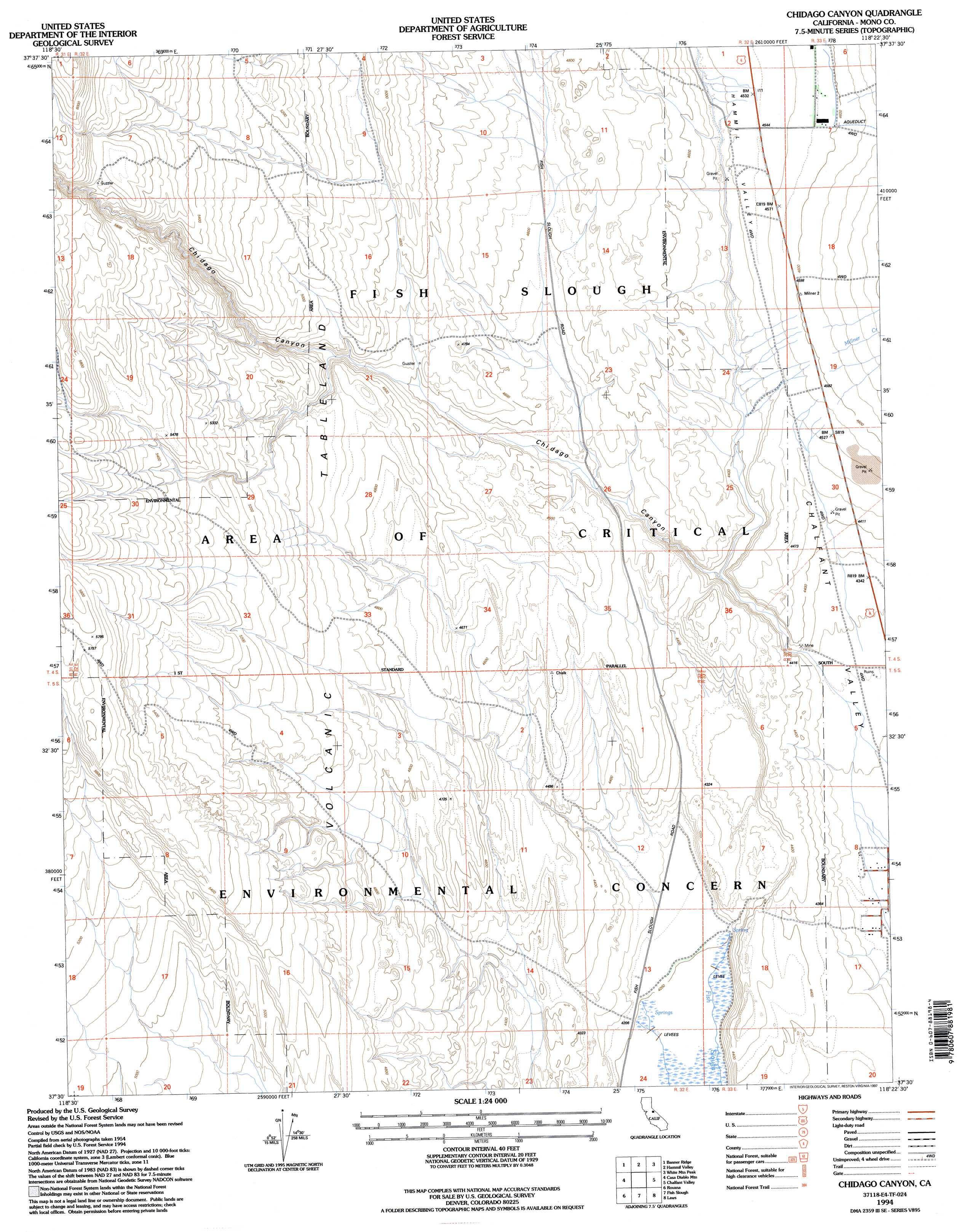
USGS Topo Quad 37118e4 - 1:24,000 scale
| Topo Map Name: | Chidago Canyon |
| USGS Topo Quad ID: | 37118e4 |
| Print Size: | ca. 21 1/4" wide x 27" high |
| Southeast Coordinates: | 37.5° N latitude / 118.375° W longitude |
| Map Center Coordinates: | 37.5625° N latitude / 118.4375° W longitude |
| U.S. State: | CA |
| Filename: | o37118e4.jpg |
| Download Map JPG Image: | Chidago Canyon topo map 1:24,000 scale |
| Map Type: | Topographic |
| Topo Series: | 7.5´ |
| Map Scale: | 1:24,000 |
| Source of Map Images: | United States Geological Survey (USGS) |
| Alternate Map Versions: |
Chidago Canyon CA 1987, updated 1987 Download PDF Buy paper map Chidago Canyon CA 1994, updated 1997 Download PDF Buy paper map Chidago Canyon CA 1994, updated 1997 Download PDF Buy paper map Chidago Canyon CA 2012 Download PDF Buy paper map Chidago Canyon CA 2015 Download PDF Buy paper map |
| FStopo: | US Forest Service topo Chidago Canyon is available: Download FStopo PDF Download FStopo TIF |
1:24,000 Topo Quads surrounding Chidago Canyon
Glass Mountain |
Benton Hot Spirngs |
Benton |
Boundary Peak |
Davis Mountain |
Watterson Canyon |
Banner Ridge |
Hammil Valley |
White Mountain Peak |
Juniper Mountain |
Toms Place |
Casa Diablo Mountain |
Chidago Canyon |
Chalfant Valley |
Mount Barcroft |
Mount Morgan |
Rovana |
Fish Slough |
Laws |
Blanco Mountain |
Mount Tom |
Tungsten Hills |
Bishop |
Poleta Canyon |
Westgard Pass |
> Back to 37118e1 at 1:100,000 scale
> Back to 37118a1 at 1:250,000 scale
> Back to U.S. Topo Maps home
Chidago Canyon topo map: Gazetteer
Chidago Canyon: Streams
Millner Creek elevation 1360m 4461′Spring Canyon Creek elevation 1407m 4616′
Chidago Canyon: Valleys
Chidago Canyon elevation 1326m 4350′Hammil Valley elevation 1346m 4416′
Chidago Canyon digital topo map on disk
Buy this Chidago Canyon topo map showing relief, roads, GPS coordinates and other geographical features, as a high-resolution digital map file on DVD: