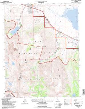
Convict Lake Topo Map California
To zoom in, hover over the map of Convict Lake
USGS Topo Quad 37118e7 - 1:24,000 scale
| Topo Map Name: | Convict Lake |
| USGS Topo Quad ID: | 37118e7 |
| Print Size: | ca. 21 1/4" wide x 27" high |
| Southeast Coordinates: | 37.5° N latitude / 118.75° W longitude |
| Map Center Coordinates: | 37.5625° N latitude / 118.8125° W longitude |
| U.S. State: | CA |
| Filename: | o37118e7.jpg |
| Download Map JPG Image: | Convict Lake topo map 1:24,000 scale |
| Map Type: | Topographic |
| Topo Series: | 7.5´ |
| Map Scale: | 1:24,000 |
| Source of Map Images: | United States Geological Survey (USGS) |
| Alternate Map Versions: |
Convict Lake CA 1983, updated 1984 Download PDF Buy paper map Convict Lake CA 1994, updated 1997 Download PDF Buy paper map Convict Lake CA 2012 Download PDF Buy paper map Convict Lake CA 2015 Download PDF Buy paper map |
| FStopo: | US Forest Service topo Convict Lake is available: Download FStopo PDF Download FStopo TIF |
1:24,000 Topo Quads surrounding Convict Lake
> Back to 37118e1 at 1:100,000 scale
> Back to 37118a1 at 1:250,000 scale
> Back to U.S. Topo Maps home
Convict Lake topo map: Gazetteer
Convict Lake: Airports
Mammoth Lakes Airport elevation 2167m 7109′Convict Lake: Falls
Horsetail Falls elevation 2761m 9058′Convict Lake: Flats
Tobacco Flat elevation 2288m 7506′Convict Lake: Gaps
McGee Pass elevation 3620m 11876′Convict Lake: Lakes
Bright Dot Lake elevation 3212m 10538′Constance Lake elevation 3295m 10810′
Convict Lake elevation 2311m 7582′
Davis Lake elevation 2996m 9829′
Grass Lake elevation 2997m 9832′
Convict Lake: Mines
Hilton Creek Mine elevation 3031m 9944′Scheeldre Mine elevation 3525m 11564′
Tiptop Prospect elevation 3032m 9947′
Convict Lake: Ridges
Nevahbe Ridge elevation 3956m 12979′Convict Lake: Springs
Buzztail Spring elevation 2528m 8293′Convict Lake: Streams
Convict Creek elevation 2067m 6781′McGee Creek elevation 2071m 6794′
Convict Lake: Summits
McGee Mountain elevation 3305m 10843′Mono Jim Peak elevation 3252m 10669′
Mount Aggie elevation 3520m 11548′
Mount Baldwin elevation 3838m 12591′
Mount Morgan elevation 3962m 12998′
Mount Morrison elevation 3731m 12240′
Red Slate Mountain elevation 4005m 13139′
Convict Lake: Valleys
Esha Canyon elevation 2465m 8087′Convict Lake digital topo map on disk
Buy this Convict Lake topo map showing relief, roads, GPS coordinates and other geographical features, as a high-resolution digital map file on DVD:


