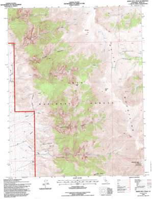
White Mountain Peak Topo Map California
To zoom in, hover over the map of White Mountain Peak
USGS Topo Quad 37118f3 - 1:24,000 scale
| Topo Map Name: | White Mountain Peak |
| USGS Topo Quad ID: | 37118f3 |
| Print Size: | ca. 21 1/4" wide x 27" high |
| Southeast Coordinates: | 37.625° N latitude / 118.25° W longitude |
| Map Center Coordinates: | 37.6875° N latitude / 118.3125° W longitude |
| U.S. State: | CA |
| Filename: | o37118f3.jpg |
| Download Map JPG Image: | White Mountain Peak topo map 1:24,000 scale |
| Map Type: | Topographic |
| Topo Series: | 7.5´ |
| Map Scale: | 1:24,000 |
| Source of Map Images: | United States Geological Survey (USGS) |
| Alternate Map Versions: |
White Mtn. Peak CA 1987, updated 1987 Download PDF Buy paper map White Mtn. Peak CA 1987, updated 1987 Download PDF Buy paper map White Mtn. Peak CA 1994, updated 1997 Download PDF Buy paper map White Mountain Peak CA 2012 Download PDF Buy paper map White Mountain Peak CA 2015 Download PDF Buy paper map |
| FStopo: | US Forest Service topo White Mountain Peak is available: Download FStopo PDF Download FStopo TIF |
1:24,000 Topo Quads surrounding White Mountain Peak
> Back to 37118e1 at 1:100,000 scale
> Back to 37118a1 at 1:250,000 scale
> Back to U.S. Topo Maps home
White Mountain Peak topo map: Gazetteer
White Mountain Peak: Flats
Chiatovich Flats elevation 3253m 10672′White Mountain Peak: Mines
Mountain View and Proctor Mine elevation 1876m 6154′Mountain View Mine elevation 2213m 7260′
Proctor Mine elevation 2165m 7103′
White Mountain Peak: Ranges
White-Inyo Range elevation 4336m 14225′White Mountain Peak: Streams
Birch Creek elevation 1641m 5383′Willow Creek elevation 1765m 5790′
White Mountain Peak: Summits
Headley Peak elevation 3858m 12657′Indian Peak elevation 3443m 11295′
Mount Hogue elevation 3884m 12742′
White Mountain Peak elevation 4338m 14232′
White Mountain Peak: Valleys
Cottonwood Canyon elevation 1732m 5682′Middle Canyon elevation 1689m 5541′
White Mountain Peak digital topo map on disk
Buy this White Mountain Peak topo map showing relief, roads, GPS coordinates and other geographical features, as a high-resolution digital map file on DVD:


