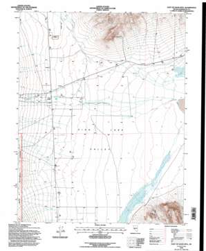
East Of Davis Mountain Topo Map Nevada
To zoom in, hover over the map of East Of Davis Mountain
USGS Topo Quad 37118g1 - 1:24,000 scale
| Topo Map Name: | East Of Davis Mountain |
| USGS Topo Quad ID: | 37118g1 |
| Print Size: | ca. 21 1/4" wide x 27" high |
| Southeast Coordinates: | 37.75° N latitude / 118° W longitude |
| Map Center Coordinates: | 37.8125° N latitude / 118.0625° W longitude |
| U.S. State: | NV |
| Filename: | o37118g1.jpg |
| Download Map JPG Image: | East Of Davis Mountain topo map 1:24,000 scale |
| Map Type: | Topographic |
| Topo Series: | 7.5´ |
| Map Scale: | 1:24,000 |
| Source of Map Images: | United States Geological Survey (USGS) |
| Alternate Map Versions: |
East of Davis Mtn. NV 1987, updated 1987 Download PDF Buy paper map East of Davis Mtn. NV 1994, updated 1997 Download PDF Buy paper map East of Davis Mountain NV 2012 Download PDF Buy paper map East of Davis Mountain NV 2014 Download PDF Buy paper map |
| FStopo: | US Forest Service topo East of Davis Mountain is available: Download FStopo PDF Download FStopo TIF |
1:24,000 Topo Quads surrounding East Of Davis Mountain
> Back to 37118e1 at 1:100,000 scale
> Back to 37118a1 at 1:250,000 scale
> Back to U.S. Topo Maps home
East Of Davis Mountain topo map: Gazetteer
East Of Davis Mountain: Airports
North Valley Landing Strip elevation 1508m 4947′East Of Davis Mountain: Basins
Fish Lake Valley elevation 1441m 4727′East Of Davis Mountain: Mines
Riek Mine elevation 1563m 5127′East Of Davis Mountain: Populated Places
Arlemont (historical) elevation 1489m 4885′East Of Davis Mountain: Post Offices
Arlemont Post Office (historical) elevation 1489m 4885′East Of Davis Mountain: Springs
Deep Spring elevation 1452m 4763′East Of Davis Mountain: Streams
Chiatovich Creek elevation 1439m 4721′Dry Creek elevation 1528m 5013′
Marble Creek elevation 1497m 4911′
East Of Davis Mountain: Valleys
Fish Lake Valley elevation 1441m 4727′East Of Davis Mountain digital topo map on disk
Buy this East Of Davis Mountain topo map showing relief, roads, GPS coordinates and other geographical features, as a high-resolution digital map file on DVD:


