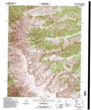
Boundary Peak Topo Map Nevada
To zoom in, hover over the map of Boundary Peak
USGS Topo Quad 37118g3 - 1:24,000 scale
| Topo Map Name: | Boundary Peak |
| USGS Topo Quad ID: | 37118g3 |
| Print Size: | ca. 21 1/4" wide x 27" high |
| Southeast Coordinates: | 37.75° N latitude / 118.25° W longitude |
| Map Center Coordinates: | 37.8125° N latitude / 118.3125° W longitude |
| U.S. States: | NV, CA |
| Filename: | o37118g3.jpg |
| Download Map JPG Image: | Boundary Peak topo map 1:24,000 scale |
| Map Type: | Topographic |
| Topo Series: | 7.5´ |
| Map Scale: | 1:24,000 |
| Source of Map Images: | United States Geological Survey (USGS) |
| Alternate Map Versions: |
Boundary Peak NV 1987, updated 1987 Download PDF Buy paper map Boundary Peak NV 1994, updated 1997 Download PDF Buy paper map Boundary Peak NV 2012 Download PDF Buy paper map Boundary Peak NV 2015 Download PDF Buy paper map |
| FStopo: | US Forest Service topo Boundary Peak is available: Download FStopo PDF Download FStopo TIF |
1:24,000 Topo Quads surrounding Boundary Peak
> Back to 37118e1 at 1:100,000 scale
> Back to 37118a1 at 1:250,000 scale
> Back to U.S. Topo Maps home
Boundary Peak topo map: Gazetteer
Boundary Peak: Flats
Pellisier Flats elevation 3972m 13031′Boundary Peak: Forests
Inyo National Forest elevation 2819m 9248′Boundary Peak: Gaps
Trail Canyon Saddle elevation 3291m 10797′Boundary Peak: Mines
Container Mine elevation 2296m 7532′Sundown Mine elevation 2437m 7995′
Boundary Peak: Streams
North Fork Chatworth Creek elevation 2517m 8257′North Fork Chiatovich Creek elevation 2524m 8280′
South Fork Chatworth Creek elevation 2517m 8257′
South Fork Chiatovich Creek elevation 2521m 8270′
Boundary Peak: Summits
Black Mountain elevation 2963m 9721′Boundary Peak elevation 4002m 13129′
Montgomery Peak elevation 4098m 13444′
Mount Dubois elevation 4126m 13536′
The Jumpoff elevation 4057m 13310′
Boundary Peak digital topo map on disk
Buy this Boundary Peak topo map showing relief, roads, GPS coordinates and other geographical features, as a high-resolution digital map file on DVD:


