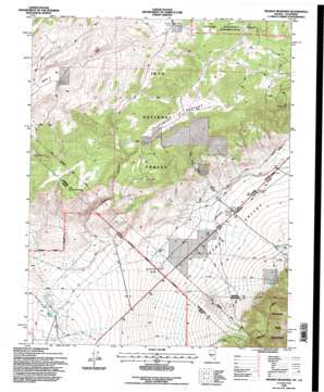
Truman Meadows Topo Map Nevada
To zoom in, hover over the map of Truman Meadows
USGS Topo Quad 37118h4 - 1:24,000 scale
| Topo Map Name: | Truman Meadows |
| USGS Topo Quad ID: | 37118h4 |
| Print Size: | ca. 21 1/4" wide x 27" high |
| Southeast Coordinates: | 37.875° N latitude / 118.375° W longitude |
| Map Center Coordinates: | 37.9375° N latitude / 118.4375° W longitude |
| U.S. States: | NV, CA |
| Filename: | o37118h4.jpg |
| Download Map JPG Image: | Truman Meadows topo map 1:24,000 scale |
| Map Type: | Topographic |
| Topo Series: | 7.5´ |
| Map Scale: | 1:24,000 |
| Source of Map Images: | United States Geological Survey (USGS) |
| Alternate Map Versions: |
Truman Meadows NV 1987, updated 1987 Download PDF Buy paper map Truman Meadows NV 1994, updated 1997 Download PDF Buy paper map Truman Meadows NV 2012 Download PDF Buy paper map Truman Meadows NV 2015 Download PDF Buy paper map |
| FStopo: | US Forest Service topo Truman Meadows is available: Download FStopo PDF Download FStopo TIF |
1:24,000 Topo Quads surrounding Truman Meadows
> Back to 37118e1 at 1:100,000 scale
> Back to 37118a1 at 1:250,000 scale
> Back to U.S. Topo Maps home
Truman Meadows topo map: Gazetteer
Truman Meadows: Flats
McBride Flat elevation 2359m 7739′Truman Meadows elevation 2210m 7250′
Truman Meadows: Forests
Toiyabe National Forest elevation 2350m 7709′Truman Meadows: Post Offices
Queen Post Office (historical) elevation 1989m 6525′Truman Meadows: Ranges
Huntoon Mountains elevation 2406m 7893′Truman Meadows: Springs
McBride Springs elevation 2361m 7746′Orchard Spring elevation 2150m 7053′
Sagehen Spring elevation 2373m 7785′
Truman Spring elevation 2173m 7129′
Wilson Spring elevation 2375m 7791′
Truman Meadows: Streams
Hutchinson Creek elevation 1679m 5508′Truman Meadows: Valleys
Buffalo Canyon elevation 2083m 6833′Queen Valley elevation 1771m 5810′
Truman Canyon elevation 1858m 6095′
West Queen Canyon elevation 1868m 6128′
Truman Meadows digital topo map on disk
Buy this Truman Meadows topo map showing relief, roads, GPS coordinates and other geographical features, as a high-resolution digital map file on DVD:


