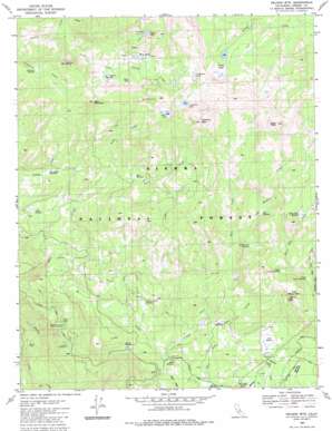
Nelson Mountain Topo Map California
To zoom in, hover over the map of Nelson Mountain
USGS Topo Quad 37119a1 - 1:24,000 scale
| Topo Map Name: | Nelson Mountain |
| USGS Topo Quad ID: | 37119a1 |
| Print Size: | ca. 21 1/4" wide x 27" high |
| Southeast Coordinates: | 37° N latitude / 119° W longitude |
| Map Center Coordinates: | 37.0625° N latitude / 119.0625° W longitude |
| U.S. State: | CA |
| Filename: | o37119a1.jpg |
| Download Map JPG Image: | Nelson Mountain topo map 1:24,000 scale |
| Map Type: | Topographic |
| Topo Series: | 7.5´ |
| Map Scale: | 1:24,000 |
| Source of Map Images: | United States Geological Survey (USGS) |
| Alternate Map Versions: |
Nelson Mtn. CA 1983, updated 1983 Download PDF Buy paper map Nelson Mountain CA 2004, updated 2007 Download PDF Buy paper map Nelson Mountain CA 2012 Download PDF Buy paper map Nelson Mountain CA 2015 Download PDF Buy paper map |
| FStopo: | US Forest Service topo Nelson Mountain is available: Download FStopo PDF Download FStopo TIF |
1:24,000 Topo Quads surrounding Nelson Mountain
> Back to 37119a1 at 1:100,000 scale
> Back to 37118a1 at 1:250,000 scale
> Back to U.S. Topo Maps home
Nelson Mountain topo map: Gazetteer
Nelson Mountain: Basins
Muley Hole elevation 1499m 4917′Nelson Mountain: Flats
Ahart Meadow elevation 2226m 7303′Arkansas Meadow elevation 2474m 8116′
Bear Meadow elevation 2225m 7299′
Brush Meadow elevation 2072m 6797′
Buck Meadow elevation 2098m 6883′
Cabin Meadow elevation 2125m 6971′
Excheque Meadow elevation 2227m 7306′
Hall Meadow elevation 2188m 7178′
House Meadow elevation 2116m 6942′
Huckleberry Meadow elevation 2457m 8061′
Log Meadow elevation 2503m 8211′
Lower Coyote Meadow elevation 2433m 7982′
Red Top Meadows elevation 2146m 7040′
Short Hair Meadow elevation 2678m 8786′
Snow Corral Meadow elevation 2142m 7027′
Tule Meadow elevation 2166m 7106′
Upper Coyote Meadow elevation 2484m 8149′
Nelson Mountain: Lakes
Betty Lake elevation 2656m 8713′Chinquapin Lakes elevation 2781m 9124′
Grouse Lake elevation 2799m 9183′
Hatch Lake elevation 2722m 8930′
Mud Lakes elevation 2641m 8664′
Nelson Lakes elevation 2763m 9064′
Sportsman Lake elevation 2822m 9258′
Virginia Lake elevation 2588m 8490′
Nelson Mountain: Mines
Game Dike Mine elevation 2693m 8835′Nelson Mountain: Streams
East Fork Deer Creek elevation 2048m 6719′East Short Hair Creek elevation 2416m 7926′
Log Meadow Creek elevation 2339m 7673′
Ruby Creek elevation 2225m 7299′
Snow Corral Creek elevation 2058m 6751′
Swamp Creek elevation 2439m 8001′
Nelson Mountain: Summits
Bear Mountain elevation 2881m 9452′Eagle Peak elevation 3125m 10252′
Hall Mountain elevation 2621m 8599′
Marble Point elevation 2699m 8854′
Nelson Mountain elevation 3120m 10236′
Nelson Mountain: Woods
McKinley Grove elevation 2052m 6732′Nelson Mountain digital topo map on disk
Buy this Nelson Mountain topo map showing relief, roads, GPS coordinates and other geographical features, as a high-resolution digital map file on DVD:


