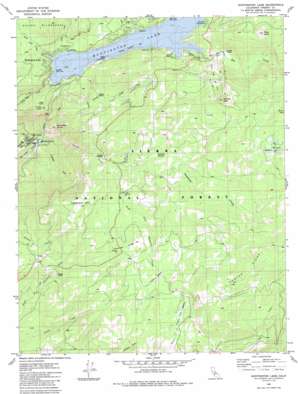
Huntington Lake Topo Map California
To zoom in, hover over the map of Huntington Lake
USGS Topo Quad 37119b2 - 1:24,000 scale
| Topo Map Name: | Huntington Lake |
| USGS Topo Quad ID: | 37119b2 |
| Print Size: | ca. 21 1/4" wide x 27" high |
| Southeast Coordinates: | 37.125° N latitude / 119.125° W longitude |
| Map Center Coordinates: | 37.1875° N latitude / 119.1875° W longitude |
| U.S. State: | CA |
| Filename: | o37119b2.jpg |
| Download Map JPG Image: | Huntington Lake topo map 1:24,000 scale |
| Map Type: | Topographic |
| Topo Series: | 7.5´ |
| Map Scale: | 1:24,000 |
| Source of Map Images: | United States Geological Survey (USGS) |
| Alternate Map Versions: |
Huntington Lake CA 1982, updated 1983 Download PDF Buy paper map Huntington Lake CA 1982, updated 1983 Download PDF Buy paper map Huntington Lake CA 1982, updated 1986 Download PDF Buy paper map Huntington Lake CA 2004, updated 2007 Download PDF Buy paper map Huntington Lake CA 2012 Download PDF Buy paper map Huntington Lake CA 2015 Download PDF Buy paper map |
| FStopo: | US Forest Service topo Huntington Lake is available: Download FStopo PDF Download FStopo TIF |
1:24,000 Topo Quads surrounding Huntington Lake
> Back to 37119a1 at 1:100,000 scale
> Back to 37118a1 at 1:250,000 scale
> Back to U.S. Topo Maps home
Huntington Lake topo map: Gazetteer
Huntington Lake: Dams
Big Creek Number 4 104-004 Dam elevation 1467m 4812′Huntington Lake 1 104-010 Dam elevation 2105m 6906′
Huntington Lake: Flats
Boneyard Meadow elevation 2239m 7345′Cutts Meadow elevation 2281m 7483′
Tamarack Meadow elevation 2278m 7473′
Huntington Lake: Lakes
Mirror Lake elevation 2643m 8671′West Lake elevation 2671m 8763′
Huntington Lake: Parks
Huntington Lake Game Refuge elevation 2120m 6955′Huntington Lake: Populated Places
Big Creek elevation 1519m 4983′Cedar Crest elevation 2157m 7076′
Huntington Lake elevation 2142m 7027′
Huntington Lake: Post Offices
Cedar Crest Post Office (historical) elevation 2157m 7076′Huntington Lake Post Office (historical) elevation 2142m 7027′
Huntington Lake: Reservoirs
Huntington Lake elevation 2095m 6873′Huntington Lake: Ridges
Foster Ridge elevation 2586m 8484′Tamarack Ridge elevation 2319m 7608′
Huntington Lake: Streams
Billy Creek elevation 2120m 6955′Coon Creek elevation 2127m 6978′
Grouse Creek elevation 2013m 6604′
Home Camp Creek elevation 2120m 6955′
Huckleberry Creek elevation 2120m 6955′
Line Creek elevation 2132m 6994′
Pitman Creek elevation 1498m 4914′
Snowslide Creek elevation 1498m 4914′
South Fork Tamarack Creek elevation 2176m 7139′
Tamarack Creek elevation 2174m 7132′
Huntington Lake: Summits
Bear Butte elevation 2498m 8195′Chinese Peak elevation 2599m 8526′
Kerckhoff Dome elevation 1914m 6279′
Sunset Point elevation 2191m 7188′
Tamarack Mountain elevation 2406m 7893′
Huntington Lake: Trails
Mono Trail elevation 2268m 7440′Red Mountain Trail elevation 2532m 8307′
Shaver Trail elevation 2244m 7362′
Huntington Lake digital topo map on disk
Buy this Huntington Lake topo map showing relief, roads, GPS coordinates and other geographical features, as a high-resolution digital map file on DVD:


