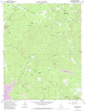
Knowles Topo Map California
To zoom in, hover over the map of Knowles
USGS Topo Quad 37119b7 - 1:24,000 scale
| Topo Map Name: | Knowles |
| USGS Topo Quad ID: | 37119b7 |
| Print Size: | ca. 21 1/4" wide x 27" high |
| Southeast Coordinates: | 37.125° N latitude / 119.75° W longitude |
| Map Center Coordinates: | 37.1875° N latitude / 119.8125° W longitude |
| U.S. State: | CA |
| Filename: | o37119b7.jpg |
| Download Map JPG Image: | Knowles topo map 1:24,000 scale |
| Map Type: | Topographic |
| Topo Series: | 7.5´ |
| Map Scale: | 1:24,000 |
| Source of Map Images: | United States Geological Survey (USGS) |
| Alternate Map Versions: |
Knowles CA 1962, updated 1963 Download PDF Buy paper map Knowles CA 1962, updated 1981 Download PDF Buy paper map Knowles CA 2012 Download PDF Buy paper map Knowles CA 2015 Download PDF Buy paper map |
| FStopo: | US Forest Service topo Knowles is available: Download FStopo PDF Download FStopo TIF |
1:24,000 Topo Quads surrounding Knowles
> Back to 37119a1 at 1:100,000 scale
> Back to 37118a1 at 1:250,000 scale
> Back to U.S. Topo Maps home
Knowles topo map: Gazetteer
Knowles: Dams
Black Hawk 687 Dam elevation 302m 990′Middle Lake 1681 Dam elevation 355m 1164′
Spring 687-002 Dam elevation 364m 1194′
Knowles: Mines
Madera Quarry elevation 310m 1017′Raymond Quarry elevation 299m 980′
Knowles: Parks
Savage Monument (historical) elevation 165m 541′Knowles: Populated Places
Fresno Crossing elevation 336m 1102′Knowles elevation 283m 928′
Yosemite Lakes elevation 385m 1263′
Yosemite Lakes Park elevation 375m 1230′
Knowles: Reservoirs
Black Hawk Lake elevation 302m 990′Knowles: Springs
Daulton Spring elevation 386m 1266′Pecan Spring elevation 251m 823′
Rogers Spring elevation 532m 1745′
Vichy Spring elevation 290m 951′
Knowles: Streams
Ashbrook Creek elevation 232m 761′Coarse Gold Creek elevation 202m 662′
Spangle Gold Creek elevation 336m 1102′
Knowles: Summits
Adkins Mountain elevation 533m 1748′Buford Mountain elevation 581m 1906′
Lilley Mountain elevation 586m 1922′
Knowles: Valleys
Bean Gulch elevation 336m 1102′Buzzard Canyon elevation 168m 551′
Happy Hollow elevation 294m 964′
Long Hollow elevation 303m 994′
Water Gulch elevation 314m 1030′
Wild Hog Canyon elevation 303m 994′
Knowles digital topo map on disk
Buy this Knowles topo map showing relief, roads, GPS coordinates and other geographical features, as a high-resolution digital map file on DVD:


