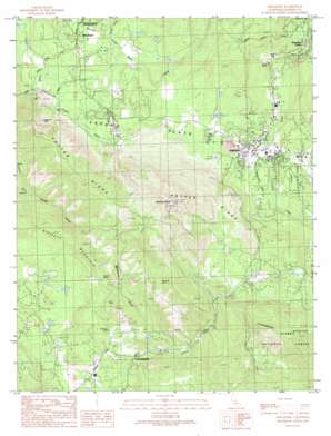
Ahwahnee Topo Map California
To zoom in, hover over the map of Ahwahnee
USGS Topo Quad 37119c6 - 1:24,000 scale
| Topo Map Name: | Ahwahnee |
| USGS Topo Quad ID: | 37119c6 |
| Print Size: | ca. 21 1/4" wide x 27" high |
| Southeast Coordinates: | 37.25° N latitude / 119.625° W longitude |
| Map Center Coordinates: | 37.3125° N latitude / 119.6875° W longitude |
| U.S. State: | CA |
| Filename: | o37119c6.jpg |
| Download Map JPG Image: | Ahwahnee topo map 1:24,000 scale |
| Map Type: | Topographic |
| Topo Series: | 7.5´ |
| Map Scale: | 1:24,000 |
| Source of Map Images: | United States Geological Survey (USGS) |
| Alternate Map Versions: |
Ahwahnee CA 1990, updated 1990 Download PDF Buy paper map Ahwahnee CA 1990, updated 1990 Download PDF Buy paper map Ahwahnee CA 2004, updated 2007 Download PDF Buy paper map Ahwahnee CA 2004, updated 2007 Download PDF Buy paper map Ahwahnee CA 2012 Download PDF Buy paper map Ahwahnee CA 2015 Download PDF Buy paper map |
| FStopo: | US Forest Service topo Ahwahnee is available: Download FStopo PDF Download FStopo TIF |
1:24,000 Topo Quads surrounding Ahwahnee
> Back to 37119a1 at 1:100,000 scale
> Back to 37118a1 at 1:250,000 scale
> Back to U.S. Topo Maps home
Ahwahnee topo map: Gazetteer
Ahwahnee: Flats
Fresno Flats elevation 649m 2129′Ahwahnee: Mines
Enterprise Mine elevation 751m 2463′Hawkeye Mine elevation 887m 2910′
Lily Mine elevation 883m 2896′
Rich Hill Mines elevation 806m 2644′
Texas Flat Mine elevation 731m 2398′
Ahwahnee: Parks
Fresno Flats Historic Park elevation 693m 2273′Wassama Round House State Historic Park elevation 692m 2270′
Ahwahnee: Populated Places
Ahwahnee elevation 709m 2326′Ahwahnee Estates elevation 697m 2286′
Coarsegold elevation 676m 2217′
Oakhurst elevation 693m 2273′
Yosemite Forks elevation 886m 2906′
Ahwahnee: Post Offices
Ahwahnee Post Office elevation 698m 2290′Ahwahnee Post Office (historical) elevation 709m 2326′
Coarsegold Post Office elevation 692m 2270′
Oakhurst Post Office elevation 686m 2250′
Ahwahnee: Ridges
Potter Ridge elevation 1188m 3897′Ahwahnee: Streams
Carter Creek elevation 655m 2148′China Creek elevation 681m 2234′
Crooks Creek elevation 574m 1883′
Lewis Fork elevation 765m 2509′
Miami Creek elevation 612m 2007′
Nelder Creek elevation 765m 2509′
Peterson Creek elevation 647m 2122′
Ahwahnee: Summits
Buckeye Mountain elevation 930m 3051′Deadwood Peak elevation 1373m 4504′
Ahwahnee: Valleys
Deadwood Gulch elevation 680m 2230′French Gulch elevation 485m 1591′
Ahwahnee digital topo map on disk
Buy this Ahwahnee topo map showing relief, roads, GPS coordinates and other geographical features, as a high-resolution digital map file on DVD:


