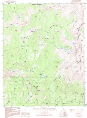
Sing Peak Topo Map California
To zoom in, hover over the map of Sing Peak
USGS Topo Quad 37119e4 - 1:24,000 scale
| Topo Map Name: | Sing Peak |
| USGS Topo Quad ID: | 37119e4 |
| Print Size: | ca. 21 1/4" wide x 27" high |
| Southeast Coordinates: | 37.5° N latitude / 119.375° W longitude |
| Map Center Coordinates: | 37.5625° N latitude / 119.4375° W longitude |
| U.S. State: | CA |
| Filename: | o37119e4.jpg |
| Download Map JPG Image: | Sing Peak topo map 1:24,000 scale |
| Map Type: | Topographic |
| Topo Series: | 7.5´ |
| Map Scale: | 1:24,000 |
| Source of Map Images: | United States Geological Survey (USGS) |
| Alternate Map Versions: |
Sing Peak CA 1990, updated 1990 Download PDF Buy paper map Sing Peak CA 1992, updated 1995 Download PDF Buy paper map Sing Peak CA 2004, updated 2007 Download PDF Buy paper map Sing Peak CA 2012 Download PDF Buy paper map Sing Peak CA 2015 Download PDF Buy paper map |
| FStopo: | US Forest Service topo Sing Peak is available: Download FStopo PDF Download FStopo TIF |
1:24,000 Topo Quads surrounding Sing Peak
> Back to 37119e1 at 1:100,000 scale
> Back to 37118a1 at 1:250,000 scale
> Back to U.S. Topo Maps home
Sing Peak topo map: Gazetteer
Sing Peak: Flats
Brophy Meadow elevation 2387m 7831′Cold Springs Meadow elevation 2391m 7844′
Cold Springs Meadow elevation 2459m 8067′
Givens Meadow elevation 2547m 8356′
Klette Meadow elevation 2677m 8782′
Moraine Meadows elevation 2653m 8704′
Sing Peak: Gaps
Chiquito Pass elevation 2452m 8044′Fernandez Pass elevation 3103m 10180′
Grizzly Pass elevation 2561m 8402′
Merced Pass elevation 2841m 9320′
Sing Peak: Lakes
Alpine Lake elevation 3081m 10108′Blackie Lake elevation 2935m 9629′
Breeze Lake elevation 2932m 9619′
Chain Lakes elevation 2772m 9094′
Chiquito Lake elevation 2424m 7952′
Chittenden Lake elevation 2806m 9206′
Gale Lake elevation 2850m 9350′
Givens Lake elevation 2689m 8822′
Hoover Lakes elevation 2651m 8697′
Mud Lakes elevation 2646m 8681′
Shirley Lake elevation 2795m 9169′
Spotted Lakes elevation 2752m 9028′
Swamp Lake elevation 2290m 7513′
Upper Merced Pass Lake elevation 2733m 8966′
Sing Peak: Mines
Walker Mine elevation 2359m 7739′Sing Peak: Ridges
Buena Vista Crest elevation 2959m 9708′Sing Peak: Streams
Buck Creek elevation 2042m 6699′East Fork Chiquito Creek elevation 2083m 6833′
Givens Creek elevation 2167m 7109′
Grizzly Creek elevation 2086m 6843′
Sing Peak: Summits
Gale Peak elevation 3199m 10495′Madera Peak elevation 3165m 10383′
Moraine Mountain elevation 2944m 9658′
Mount Bruce elevation 2964m 9724′
Quartz Mountain elevation 2757m 9045′
Redtop elevation 3039m 9970′
Sing Peak elevation 3201m 10501′
Sing Peak digital topo map on disk
Buy this Sing Peak topo map showing relief, roads, GPS coordinates and other geographical features, as a high-resolution digital map file on DVD:


