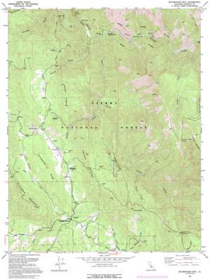
Buckingham Mountain Topo Map California
To zoom in, hover over the map of Buckingham Mountain
USGS Topo Quad 37119e7 - 1:24,000 scale
| Topo Map Name: | Buckingham Mountain |
| USGS Topo Quad ID: | 37119e7 |
| Print Size: | ca. 21 1/4" wide x 27" high |
| Southeast Coordinates: | 37.5° N latitude / 119.75° W longitude |
| Map Center Coordinates: | 37.5625° N latitude / 119.8125° W longitude |
| U.S. State: | CA |
| Filename: | o37119e7.jpg |
| Download Map JPG Image: | Buckingham Mountain topo map 1:24,000 scale |
| Map Type: | Topographic |
| Topo Series: | 7.5´ |
| Map Scale: | 1:24,000 |
| Source of Map Images: | United States Geological Survey (USGS) |
| Alternate Map Versions: |
Buckingham Mtn CA 1947, updated 1964 Download PDF Buy paper map Buckingham Mtn CA 1947, updated 1977 Download PDF Buy paper map Buckingham Mtn CA 1947, updated 1981 Download PDF Buy paper map Buckingham Mtn CA 1947, updated 1981 Download PDF Buy paper map Buckingham Mtn CA 1947, updated 1985 Download PDF Buy paper map Buckingham Mtn CA 1949 Download PDF Buy paper map Buckingham Mtn CA 1949, updated 1949 Download PDF Buy paper map Buckingham Mtn CA 1992, updated 1995 Download PDF Buy paper map Buckingham Mtn CA 1992, updated 1995 Download PDF Buy paper map Buckingham Mountain CA 2004, updated 2007 Download PDF Buy paper map Buckingham Mountain CA 2012 Download PDF Buy paper map Buckingham Mountain CA 2015 Download PDF Buy paper map |
| FStopo: | US Forest Service topo Buckingham Mountain is available: Download FStopo PDF Download FStopo TIF |
1:24,000 Topo Quads surrounding Buckingham Mountain
> Back to 37119e1 at 1:100,000 scale
> Back to 37118a1 at 1:250,000 scale
> Back to U.S. Topo Maps home
Buckingham Mountain topo map: Gazetteer
Buckingham Mountain: Bars
Peachtree Bar elevation 639m 2096′Buckingham Mountain: Capes
Casa Diablo elevation 869m 2851′Marble Point elevation 833m 2732′
Buckingham Mountain: Gaps
Granite Creek Saddle elevation 1776m 5826′Roundtree Saddle elevation 1639m 5377′
Buckingham Mountain: Mines
Comet Mine elevation 1105m 3625′Early Mine elevation 1278m 4192′
Buckingham Mountain: Parks
Darrah Park elevation 961m 3152′Buckingham Mountain: Populated Places
Darrah elevation 952m 3123′Jerseydale elevation 1152m 3779′
Buckingham Mountain: Ridges
Bear Wallow Spur elevation 1824m 5984′Footman Ridge elevation 1373m 4504′
Gimasol Ridge elevation 1253m 4110′
Granite Ridge elevation 1698m 5570′
Portuguese Ridge elevation 1215m 3986′
Snyder Ridge elevation 1331m 4366′
Windless Ridge elevation 1301m 4268′
Buckingham Mountain: Streams
Granite Creek elevation 785m 2575′Owl Creek elevation 777m 2549′
Skelton Creek elevation 697m 2286′
Virginia Creek elevation 899m 2949′
Zip Creek elevation 840m 2755′
Buckingham Mountain: Summits
Buckingham Mountain elevation 1367m 4484′Chowchilla Mountain elevation 2105m 6906′
Kirby Peak elevation 1642m 5387′
Buckingham Mountain: Trails
Hite Cove Trail elevation 821m 2693′Buckingham Mountain: Valleys
Clarks Valley elevation 1057m 3467′Devil Gulch elevation 573m 1879′
Sims Cove elevation 718m 2355′
Snyder Gulch elevation 603m 1978′
Buckingham Mountain digital topo map on disk
Buy this Buckingham Mountain topo map showing relief, roads, GPS coordinates and other geographical features, as a high-resolution digital map file on DVD:


