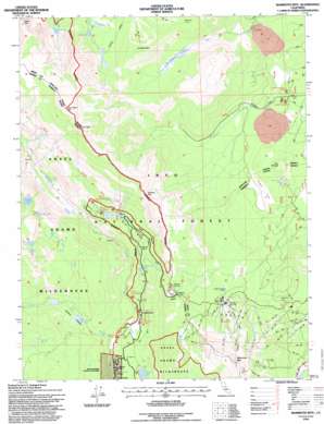
Mammoth Mountain Topo Map California
To zoom in, hover over the map of Mammoth Mountain
USGS Topo Quad 37119f1 - 1:24,000 scale
| Topo Map Name: | Mammoth Mountain |
| USGS Topo Quad ID: | 37119f1 |
| Print Size: | ca. 21 1/4" wide x 27" high |
| Southeast Coordinates: | 37.625° N latitude / 119° W longitude |
| Map Center Coordinates: | 37.6875° N latitude / 119.0625° W longitude |
| U.S. State: | CA |
| Filename: | o37119f1.jpg |
| Download Map JPG Image: | Mammoth Mountain topo map 1:24,000 scale |
| Map Type: | Topographic |
| Topo Series: | 7.5´ |
| Map Scale: | 1:24,000 |
| Source of Map Images: | United States Geological Survey (USGS) |
| Alternate Map Versions: |
Mammoth Mtn CA 1984, updated 1984 Download PDF Buy paper map Mammoth Mtn. CA 1984, updated 1992 Download PDF Buy paper map Mammoth Mtn CA 1992, updated 1995 Download PDF Buy paper map Mammoth Mtn CA 1994, updated 1997 Download PDF Buy paper map Mammoth Mountain CA 2012 Download PDF Buy paper map Mammoth Mountain CA 2015 Download PDF Buy paper map |
| FStopo: | US Forest Service topo Mammoth Mountain is available: Download FStopo PDF Download FStopo TIF |
1:24,000 Topo Quads surrounding Mammoth Mountain
> Back to 37119e1 at 1:100,000 scale
> Back to 37118a1 at 1:250,000 scale
> Back to U.S. Topo Maps home
Mammoth Mountain topo map: Gazetteer
Mammoth Mountain: Falls
Minaret Falls elevation 2470m 8103′Mammoth Mountain: Flats
Agnew Meadows elevation 2541m 8336′Crater Flat elevation 2462m 8077′
Glass Creek Meadow elevation 2699m 8854′
Johnston Meadow elevation 2477m 8126′
Pumice Flat elevation 2373m 7785′
Yost Meadow elevation 2748m 9015′
Mammoth Mountain: Gaps
Deadman Pass elevation 3045m 9990′Mammoth Mountain: Lakes
Castle Lake elevation 3009m 9872′Emily Lake elevation 3011m 9878′
Fern Lake elevation 2711m 8894′
Gladys Lake elevation 2912m 9553′
Inyo Crater Lakes elevation 2475m 8120′
Johnston Lake elevation 2477m 8126′
Lost Dog Lake elevation 2893m 9491′
Olaine Lake elevation 2453m 8047′
Reds Lake elevation 2832m 9291′
Rosalie Lake elevation 2843m 9327′
Sotcher Lake elevation 2332m 7650′
Starkweather Lake elevation 2432m 7979′
Trinity Lakes elevation 2836m 9304′
Vivian lake elevation 2872m 9422′
Yost Lake elevation 2770m 9087′
Mammoth Mountain: Springs
Soda Springs elevation 2301m 7549′Mammoth Mountain: Streams
Minaret Creek elevation 2330m 7644′Shadow Creek elevation 2450m 8038′
Mammoth Mountain: Summits
Carson Peak elevation 3312m 10866′Deer Mountain elevation 2666m 8746′
June Mountain elevation 3084m 10118′
Mammoth Mountain elevation 3355m 11007′
Minaret Summit elevation 2824m 9265′
San Joaquin Mountain elevation 3522m 11555′
Two Teats elevation 3452m 11325′
White Wing Mountain elevation 3050m 10006′
Mammoth Mountain digital topo map on disk
Buy this Mammoth Mountain topo map showing relief, roads, GPS coordinates and other geographical features, as a high-resolution digital map file on DVD:


