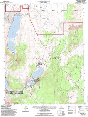
June Lake Topo Map California
To zoom in, hover over the map of June Lake
USGS Topo Quad 37119g1 - 1:24,000 scale
| Topo Map Name: | June Lake |
| USGS Topo Quad ID: | 37119g1 |
| Print Size: | ca. 21 1/4" wide x 27" high |
| Southeast Coordinates: | 37.75° N latitude / 119° W longitude |
| Map Center Coordinates: | 37.8125° N latitude / 119.0625° W longitude |
| U.S. State: | CA |
| Filename: | o37119g1.jpg |
| Download Map JPG Image: | June Lake topo map 1:24,000 scale |
| Map Type: | Topographic |
| Topo Series: | 7.5´ |
| Map Scale: | 1:24,000 |
| Source of Map Images: | United States Geological Survey (USGS) |
| Alternate Map Versions: |
June Lake CA 1986, updated 1986 Download PDF Buy paper map June Lake CA 1992, updated 1995 Download PDF Buy paper map June Lake CA 1994, updated 1997 Download PDF Buy paper map June Lake CA 2012 Download PDF Buy paper map June Lake CA 2015 Download PDF Buy paper map |
| FStopo: | US Forest Service topo June Lake is available: Download FStopo PDF Download FStopo TIF |
1:24,000 Topo Quads surrounding June Lake
> Back to 37119e1 at 1:100,000 scale
> Back to 37118a1 at 1:250,000 scale
> Back to U.S. Topo Maps home
June Lake topo map: Gazetteer
June Lake: Basins
Devils Punch Bowl elevation 2323m 7621′Punch Bowl elevation 2307m 7568′
June Lake: Craters
Mono Craters elevation 2768m 9081′June Lake: Dams
Grant Lake 6-033 Dam elevation 2175m 7135′June Lake: Lakes
Gull Lake elevation 2323m 7621′June Lake elevation 2323m 7621′
Silver Lake elevation 2202m 7224′
June Lake: Populated Places
June Lake elevation 2333m 7654′June Lake Junction elevation 2350m 7709′
June Lake: Post Offices
June Lake Post Office (historical) elevation 2333m 7654′June Lake: Reservoirs
Grant Lake elevation 2175m 7135′June Lake: Ridges
Oh Ridge elevation 2421m 7942′June Lake: Springs
Hartley Springs elevation 2678m 8786′June Lake: Streams
Fern Creek elevation 2227m 7306′Reversed Creek elevation 2204m 7230′
Yost Creek elevation 2257m 7404′
June Lake: Summits
Aeolian Buttes elevation 2183m 7162′Obsidian Dome elevation 2608m 8556′
Reversed Peak elevation 2882m 9455′
Wilson Butte elevation 2562m 8405′
June Lake: Tunnels
Mono Craters Tunnel elevation 2460m 8070′June Lake digital topo map on disk
Buy this June Lake topo map showing relief, roads, GPS coordinates and other geographical features, as a high-resolution digital map file on DVD:


