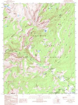
Falls Ridge Topo Map California
To zoom in, hover over the map of Falls Ridge
USGS Topo Quad 37119h4 - 1:24,000 scale
| Topo Map Name: | Falls Ridge |
| USGS Topo Quad ID: | 37119h4 |
| Print Size: | ca. 21 1/4" wide x 27" high |
| Southeast Coordinates: | 37.875° N latitude / 119.375° W longitude |
| Map Center Coordinates: | 37.9375° N latitude / 119.4375° W longitude |
| U.S. State: | CA |
| Filename: | o37119h4.jpg |
| Download Map JPG Image: | Falls Ridge topo map 1:24,000 scale |
| Map Type: | Topographic |
| Topo Series: | 7.5´ |
| Map Scale: | 1:24,000 |
| Source of Map Images: | United States Geological Survey (USGS) |
| Alternate Map Versions: |
Falls Ridge CA 1990, updated 1990 Download PDF Buy paper map Falls Ridge CA 1992, updated 1995 Download PDF Buy paper map Falls Ridge CA 1992, updated 1995 Download PDF Buy paper map Falls Ridge CA 2012 Download PDF Buy paper map Falls Ridge CA 2015 Download PDF Buy paper map |
1:24,000 Topo Quads surrounding Falls Ridge
> Back to 37119e1 at 1:100,000 scale
> Back to 37118a1 at 1:250,000 scale
> Back to U.S. Topo Maps home
Falls Ridge topo map: Gazetteer
Falls Ridge: Basins
Glen Aulin elevation 2376m 7795′Falls Ridge: Falls
California Falls elevation 2360m 7742′Le Conte Falls elevation 2150m 7053′
Tuolumne Falls elevation 2480m 8136′
Waterwheel Falls elevation 2071m 6794′
White Cascade elevation 2402m 7880′
Falls Ridge: Flats
Tuolumne Meadows elevation 2626m 8615′Falls Ridge: Lakes
Mattie Lake elevation 2815m 9235′McGee Lake elevation 2471m 8106′
Miller Lake elevation 2889m 9478′
Rodgers Lake elevation 2903m 9524′
Virginia Lake elevation 2813m 9229′
Falls Ridge: Ridges
Falls Ridge elevation 2770m 9087′Falls Ridge: Streams
Alkali Creek elevation 2457m 8061′Budd Creek elevation 2608m 8556′
Conness Creek elevation 2402m 7880′
Delaney Creek elevation 2609m 8559′
Dingley Creek elevation 2561m 8402′
Matterhorn Creek elevation 2430m 7972′
Regulation Creek elevation 2269m 7444′
Return Creek elevation 1891m 6204′
South Fork Cathedral Creek elevation 2130m 6988′
Spiller Creek elevation 2544m 8346′
Falls Ridge: Summits
Cold Mountain elevation 3138m 10295′Elbow Hill elevation 2827m 9274′
Hooper Peak elevation 2902m 9520′
Pettit Peak elevation 3277m 10751′
Pothole Dome elevation 2672m 8766′
Regulation Peak elevation 3222m 10570′
Tuolumne Peak elevation 3309m 10856′
West Peak elevation 3207m 10521′
Wildcat Point elevation 2879m 9445′
Falls Ridge: Valleys
Cold Canyon elevation 2399m 7870′Matterhorn Canyon elevation 2421m 7942′
Virginia Canyon elevation 2283m 7490′
Falls Ridge digital topo map on disk
Buy this Falls Ridge topo map showing relief, roads, GPS coordinates and other geographical features, as a high-resolution digital map file on DVD:


