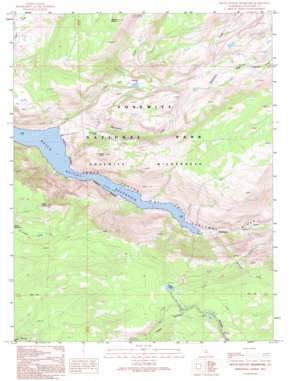
Hetch Hetchy Reservoir Topo Map California
To zoom in, hover over the map of Hetch Hetchy Reservoir
USGS Topo Quad 37119h6 - 1:24,000 scale
| Topo Map Name: | Hetch Hetchy Reservoir |
| USGS Topo Quad ID: | 37119h6 |
| Print Size: | ca. 21 1/4" wide x 27" high |
| Southeast Coordinates: | 37.875° N latitude / 119.625° W longitude |
| Map Center Coordinates: | 37.9375° N latitude / 119.6875° W longitude |
| U.S. State: | CA |
| Filename: | o37119h6.jpg |
| Download Map JPG Image: | Hetch Hetchy Reservoir topo map 1:24,000 scale |
| Map Type: | Topographic |
| Topo Series: | 7.5´ |
| Map Scale: | 1:24,000 |
| Source of Map Images: | United States Geological Survey (USGS) |
| Alternate Map Versions: |
Hetch Hetchy Reservoir CA 1990, updated 1990 Download PDF Buy paper map Hetch Hetchy Reservoir CA 1992, updated 1995 Download PDF Buy paper map Hetch Hetchy Reservoir CA 2012 Download PDF Buy paper map Hetch Hetchy Reservoir CA 2015 Download PDF Buy paper map |
1:24,000 Topo Quads surrounding Hetch Hetchy Reservoir
> Back to 37119e1 at 1:100,000 scale
> Back to 37118a1 at 1:250,000 scale
> Back to U.S. Topo Maps home
Hetch Hetchy Reservoir topo map: Gazetteer
Hetch Hetchy Reservoir: Areas
Harden Gardens elevation 2112m 6929′Hetch Hetchy Reservoir: Falls
Rancheria Falls elevation 1411m 4629′Hetch Hetchy Reservoir: Lakes
Harden Lake elevation 2289m 7509′Hetch Hetchy Reservoir: Streams
Breeze Creek elevation 1925m 6315′Morrison Creek elevation 1272m 4173′
Rancheria Creek elevation 1157m 3795′
Tiltill Creek elevation 1152m 3779′
Hetch Hetchy Reservoir: Summits
Le Conte Point elevation 1936m 6351′Mount Gibson elevation 2547m 8356′
Smith Peak elevation 2356m 7729′
Hetch Hetchy Reservoir: Valleys
Deep Canyon elevation 1924m 6312′Grand Canyon of the Tuolumne River elevation 1206m 3956′
Little Hetch Hetchy Valley elevation 1203m 3946′
Tiltill Valley elevation 1688m 5538′
Hetch Hetchy Reservoir digital topo map on disk
Buy this Hetch Hetchy Reservoir topo map showing relief, roads, GPS coordinates and other geographical features, as a high-resolution digital map file on DVD:


