El Nido Topo Map California
To zoom in, hover over the map of El Nido
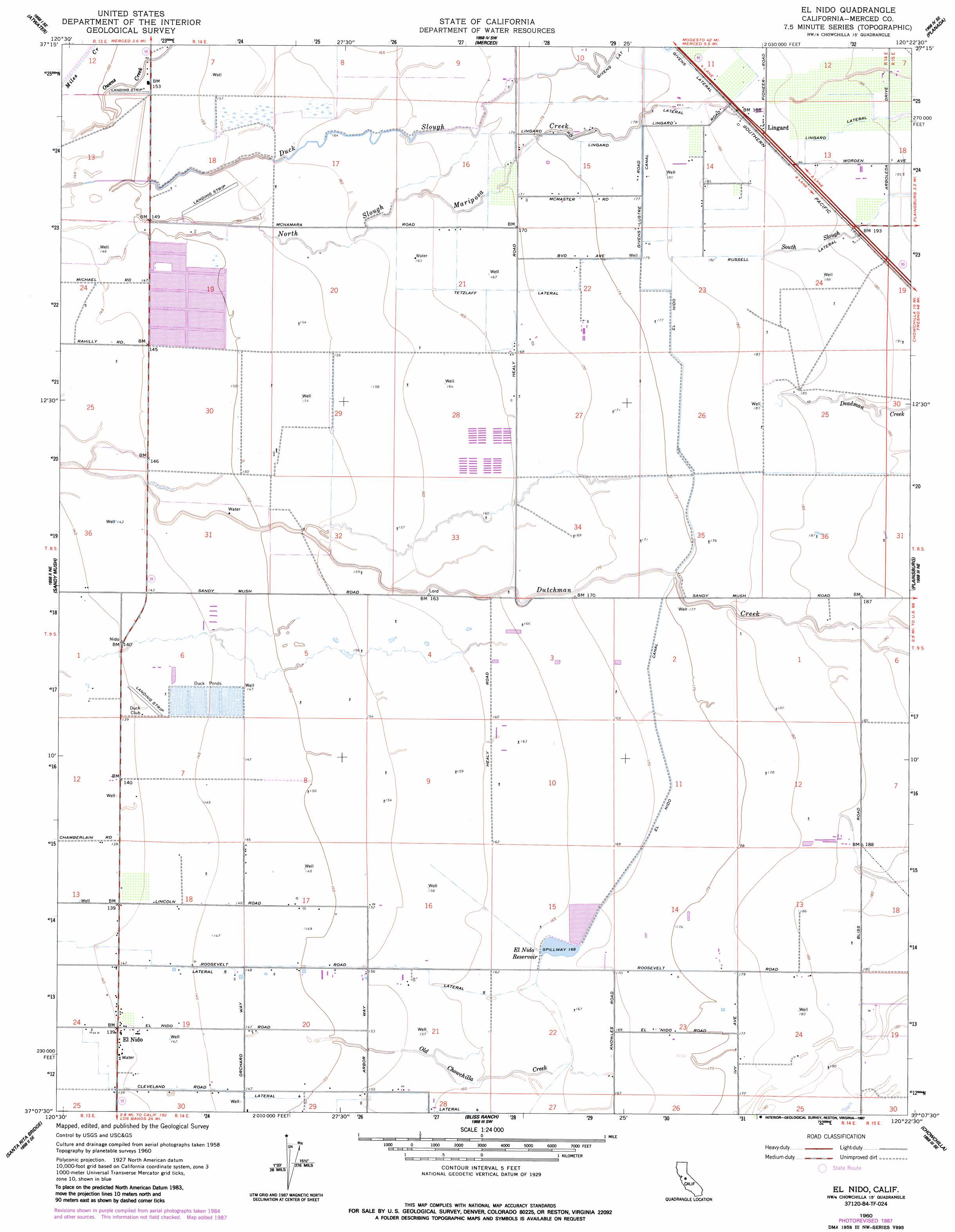
USGS Topo Quad 37120b4 - 1:24,000 scale
| Topo Map Name: | El Nido |
| USGS Topo Quad ID: | 37120b4 |
| Print Size: | ca. 21 1/4" wide x 27" high |
| Southeast Coordinates: | 37.125° N latitude / 120.375° W longitude |
| Map Center Coordinates: | 37.1875° N latitude / 120.4375° W longitude |
| U.S. State: | CA |
| Filename: | o37120b4.jpg |
| Download Map JPG Image: | El Nido topo map 1:24,000 scale |
| Map Type: | Topographic |
| Topo Series: | 7.5´ |
| Map Scale: | 1:24,000 |
| Source of Map Images: | United States Geological Survey (USGS) |
| Alternate Map Versions: |
Lingard CA 1948 Download PDF Buy paper map El Nido CA 1960, updated 1961 Download PDF Buy paper map El Nido CA 1960, updated 1987 Download PDF Buy paper map El Nido CA 2012 Download PDF Buy paper map El Nido CA 2015 Download PDF Buy paper map |
1:24,000 Topo Quads surrounding El Nido
Cressey |
Winton |
Yosemite Lake |
Haystack Mountain |
Indian Gulch |
Arena |
Atwater |
Merced |
Planada |
Owens Reservoir |
Turner Ranch |
Sandy Mush |
El Nido |
Plainsburg |
Le Grand |
Delta Ranch |
Santa Rita Bridge |
Bliss Ranch |
Chowchilla |
Berenda |
Dos Palos |
Oxalis |
Poso Farm |
Firebaugh Ne |
Bonita Ranch |
> Back to 37120a1 at 1:100,000 scale
> Back to 37120a1 at 1:250,000 scale
> Back to U.S. Topo Maps home
El Nido topo map: Gazetteer
El Nido: Airports
Flying M Ranch Airport elevation 47m 154′El Nido: Canals
El Nido Canal elevation 55m 180′Lateral Five elevation 50m 164′
Lateral Four elevation 46m 150′
Russel Lateral elevation 57m 187′
Tetzlaff Lateral elevation 52m 170′
El Nido: Guts
North Slough Mariposa Creek elevation 51m 167′South Slough elevation 59m 193′
El Nido: Populated Places
El Nido elevation 43m 141′Lingard elevation 59m 193′
El Nido: Reservoirs
El Nido Reservoir elevation 51m 167′El Nido: Streams
Dutchman Creek elevation 45m 147′Old Chowchilla Creek elevation 45m 147′
El Nido digital topo map on disk
Buy this El Nido topo map showing relief, roads, GPS coordinates and other geographical features, as a high-resolution digital map file on DVD: