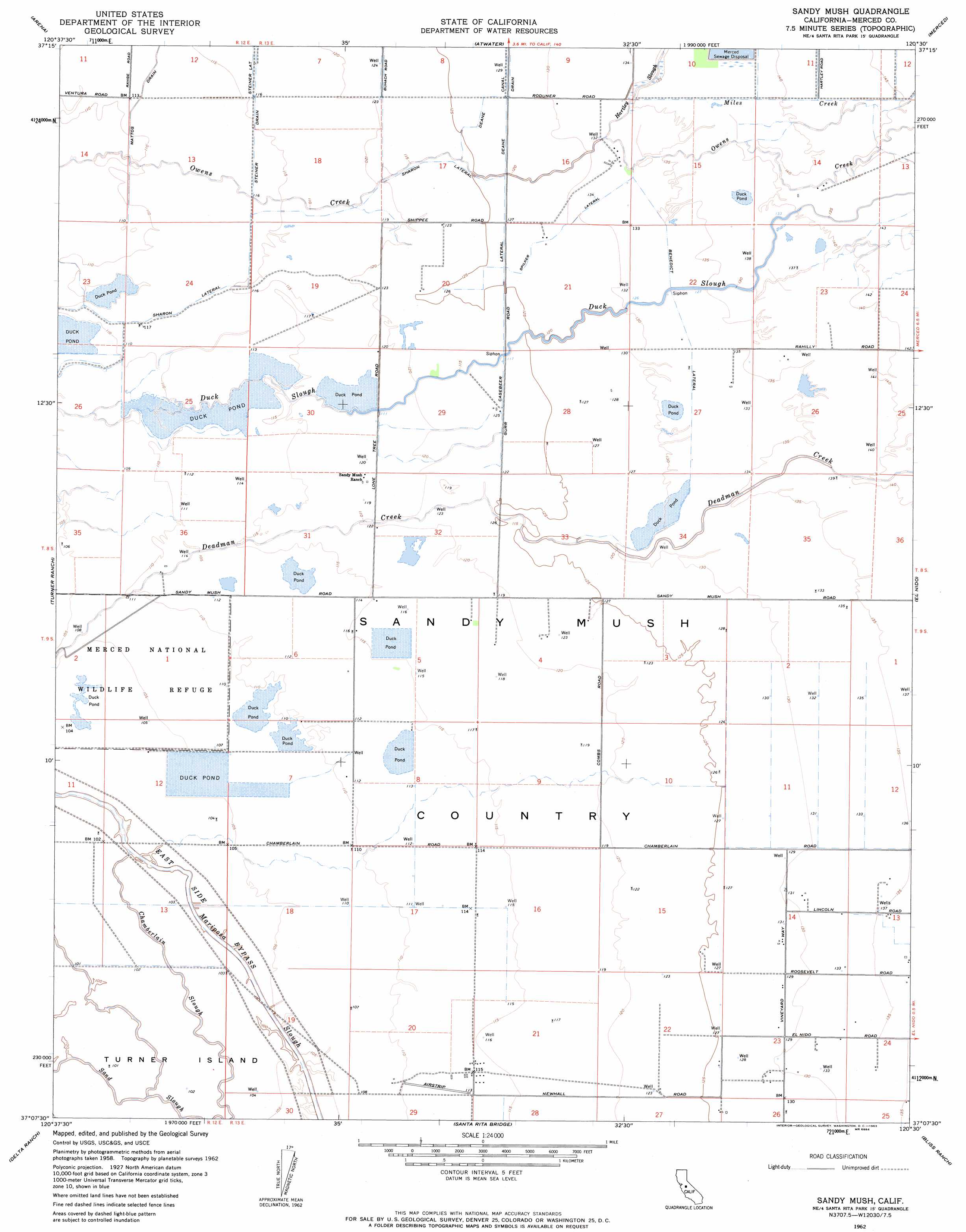
Sandy Mush Topo Map California
To zoom in, hover over the map of Sandy Mush
USGS Topo Quad 37120b5 - 1:24,000 scale
| Topo Map Name: | Sandy Mush |
| USGS Topo Quad ID: | 37120b5 |
| Print Size: | ca. 21 1/4" wide x 27" high |
| Southeast Coordinates: | 37.125° N latitude / 120.5° W longitude |
| Map Center Coordinates: | 37.1875° N latitude / 120.5625° W longitude |
| U.S. State: | CA |
| Filename: | o37120b5.jpg |
| Download Map JPG Image: | Sandy Mush topo map 1:24,000 scale |
| Map Type: | Topographic |
| Topo Series: | 7.5´ |
| Map Scale: | 1:24,000 |
| Source of Map Images: | United States Geological Survey (USGS) |
| Alternate Map Versions: |
Sandy Mush CA 1946, updated 1947 Download PDF Buy paper map Sandy Mush CA 1948 Download PDF Buy paper map Sandy Mush CA 1962, updated 1963 Download PDF Buy paper map Sandy Mush CA 2012 Download PDF Buy paper map Sandy Mush CA 2015 Download PDF Buy paper map |
1:24,000 Topo Quads surrounding Sandy Mush
Turlock |
Cressey |
Winton |
Yosemite Lake |
Haystack Mountain |
Stevinson |
Arena |
Atwater |
Merced |
Planada |
San Luis Ranch |
Turner Ranch |
Sandy Mush |
El Nido |
Plainsburg |
Los Banos |
Delta Ranch |
Santa Rita Bridge |
Bliss Ranch |
Chowchilla |
Charleston School |
Dos Palos |
Oxalis |
Poso Farm |
Firebaugh Ne |
> Back to 37120a1 at 1:100,000 scale
> Back to 37120a1 at 1:250,000 scale
> Back to U.S. Topo Maps home
Sandy Mush topo map: Gazetteer
Sandy Mush: Areas
Sandy Mush Country elevation 37m 121′Sandy Mush: Canals
Benedict Lateral elevation 41m 134′Casebeer Road Lateral elevation 38m 124′
Mattos Drain elevation 34m 111′
Sharon Lateral elevation 34m 111′
Spilker Lateral elevation 40m 131′
Steiner Drain elevation 35m 114′
Sandy Mush: Guts
Chamberlain Slough elevation 31m 101′Sand Slough elevation 30m 98′
Sandy Mush: Streams
Hartley Slough elevation 41m 134′Miles Creek elevation 41m 134′
Sandy Mush digital topo map on disk
Buy this Sandy Mush topo map showing relief, roads, GPS coordinates and other geographical features, as a high-resolution digital map file on DVD: