Owens Reservoir Topo Map California
To zoom in, hover over the map of Owens Reservoir
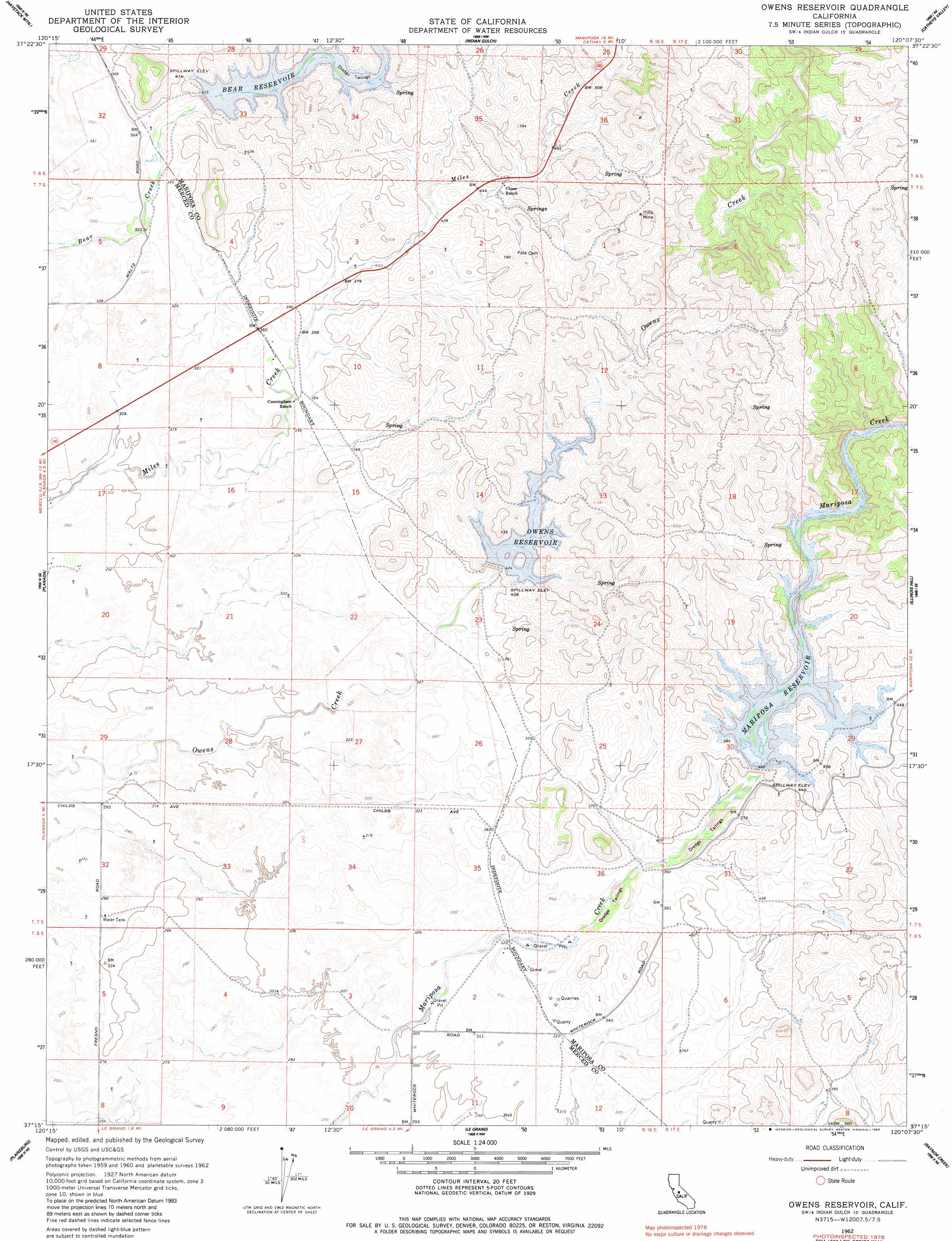
USGS Topo Quad 37120c2 - 1:24,000 scale
| Topo Map Name: | Owens Reservoir |
| USGS Topo Quad ID: | 37120c2 |
| Print Size: | ca. 21 1/4" wide x 27" high |
| Southeast Coordinates: | 37.25° N latitude / 120.125° W longitude |
| Map Center Coordinates: | 37.3125° N latitude / 120.1875° W longitude |
| U.S. State: | CA |
| Filename: | o37120c2.jpg |
| Download Map JPG Image: | Owens Reservoir topo map 1:24,000 scale |
| Map Type: | Topographic |
| Topo Series: | 7.5´ |
| Map Scale: | 1:24,000 |
| Source of Map Images: | United States Geological Survey (USGS) |
| Alternate Map Versions: |
Owens Creek CA 1915, updated 1957 Download PDF Buy paper map Owens Reservoir CA 1962, updated 1963 Download PDF Buy paper map Owens Reservoir CA 1963, updated 1983 Download PDF Buy paper map Owens Reservoir CA 1999, updated 2002 Download PDF Buy paper map Owens Reservoir CA 2012 Download PDF Buy paper map Owens Reservoir CA 2015 Download PDF Buy paper map |
1:24,000 Topo Quads surrounding Owens Reservoir
Snelling |
Merced Falls |
Hornitos |
Bear Valley |
Feliciana Mountain |
Yosemite Lake |
Haystack Mountain |
Indian Gulch |
Catheys Valley |
Mariposa |
Merced |
Planada |
Owens Reservoir |
Illinois Hill |
Ben Hur |
El Nido |
Plainsburg |
Le Grand |
Raynor Creek |
Raymond |
Bliss Ranch |
Chowchilla |
Berenda |
Kismet |
Daulton |
> Back to 37120a1 at 1:100,000 scale
> Back to 37120a1 at 1:250,000 scale
> Back to U.S. Topo Maps home
Owens Reservoir topo map: Gazetteer
Owens Reservoir: Dams
Bear Dam elevation 120m 393′Mariposa Dam elevation 119m 390′
Owens Dam elevation 115m 377′
Owens Reservoir: Mines
Hills Mine elevation 218m 715′Owens Reservoir: Reservoirs
Bear Reservoir elevation 120m 393′Mariposa Reservoir elevation 119m 390′
Owens Reservoir elevation 115m 377′
Owens Reservoir: Streams
Ganns Creek elevation 119m 390′Owens Reservoir digital topo map on disk
Buy this Owens Reservoir topo map showing relief, roads, GPS coordinates and other geographical features, as a high-resolution digital map file on DVD: