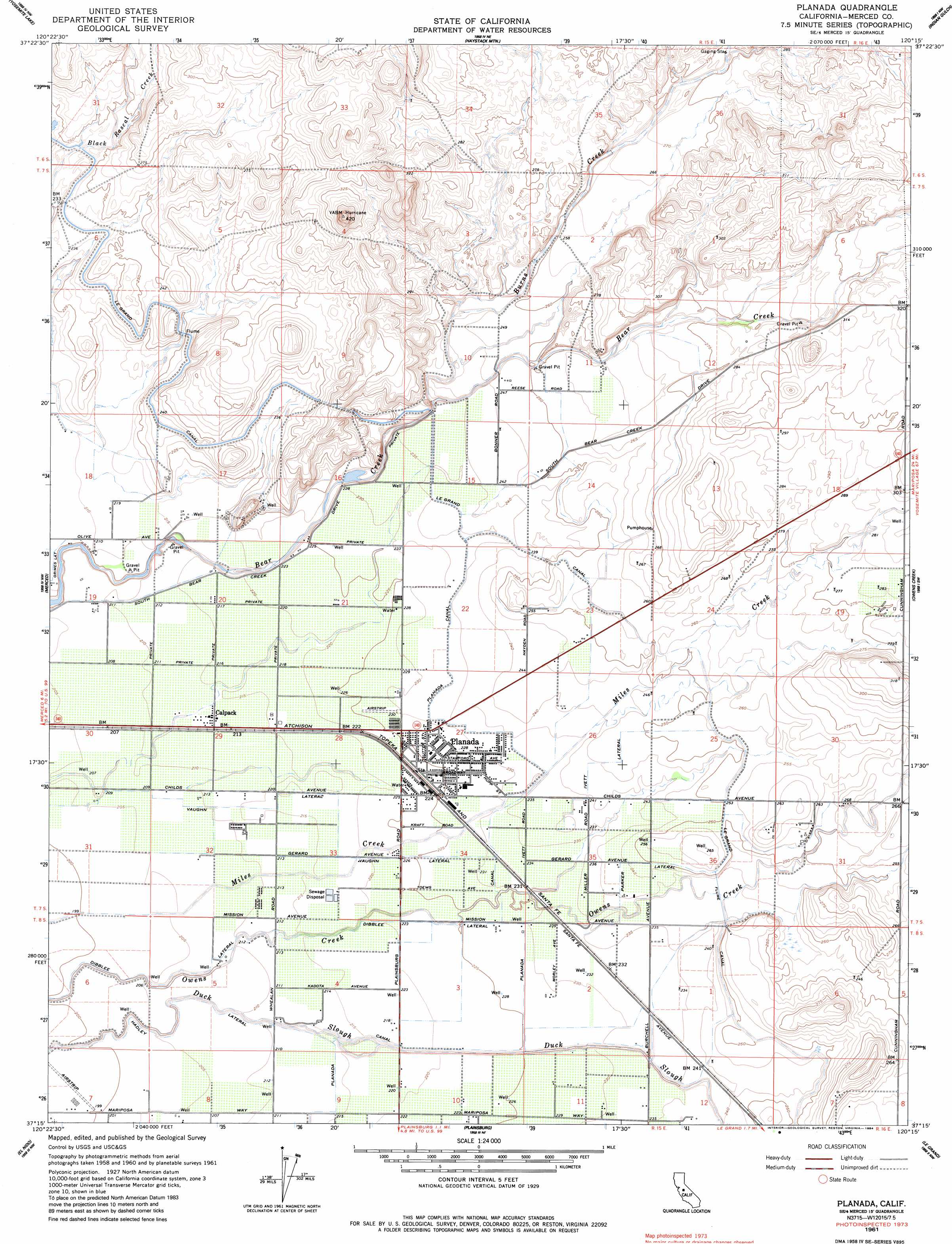
Planada Topo Map California
To zoom in, hover over the map of Planada
USGS Topo Quad 37120c3 - 1:24,000 scale
| Topo Map Name: | Planada |
| USGS Topo Quad ID: | 37120c3 |
| Print Size: | ca. 21 1/4" wide x 27" high |
| Southeast Coordinates: | 37.25° N latitude / 120.25° W longitude |
| Map Center Coordinates: | 37.3125° N latitude / 120.3125° W longitude |
| U.S. State: | CA |
| Filename: | o37120c3.jpg |
| Download Map JPG Image: | Planada topo map 1:24,000 scale |
| Map Type: | Topographic |
| Topo Series: | 7.5´ |
| Map Scale: | 1:24,000 |
| Source of Map Images: | United States Geological Survey (USGS) |
| Alternate Map Versions: |
Planada CA 1948 Download PDF Buy paper map Planada CA 1961, updated 1963 Download PDF Buy paper map Planada CA 1961, updated 1984 Download PDF Buy paper map Planada CA 2012 Download PDF Buy paper map Planada CA 2015 Download PDF Buy paper map |
1:24,000 Topo Quads surrounding Planada
Turlock Lake |
Snelling |
Merced Falls |
Hornitos |
Bear Valley |
Winton |
Yosemite Lake |
Haystack Mountain |
Indian Gulch |
Catheys Valley |
Atwater |
Merced |
Planada |
Owens Reservoir |
Illinois Hill |
Sandy Mush |
El Nido |
Plainsburg |
Le Grand |
Raynor Creek |
Santa Rita Bridge |
Bliss Ranch |
Chowchilla |
Berenda |
Kismet |
> Back to 37120a1 at 1:100,000 scale
> Back to 37120a1 at 1:250,000 scale
> Back to U.S. Topo Maps home
Planada topo map: Gazetteer
Planada: Airports
John Myers Airport elevation 88m 288′Planada: Canals
Dibblee Lateral elevation 62m 203′Hadley Lateral elevation 62m 203′
Ivett Lateral elevation 75m 246′
Le Grand Canal elevation 73m 239′
Parker Lateral elevation 77m 252′
Planada Canal elevation 72m 236′
Vaughn Lateral elevation 64m 209′
Planada: Populated Places
Burchell (historical) elevation 72m 236′Calpack elevation 65m 213′
Planada elevation 69m 226′
Planada: Streams
Burns Creek elevation 69m 226′Planada digital topo map on disk
Buy this Planada topo map showing relief, roads, GPS coordinates and other geographical features, as a high-resolution digital map file on DVD: