Arena Topo Map California
To zoom in, hover over the map of Arena
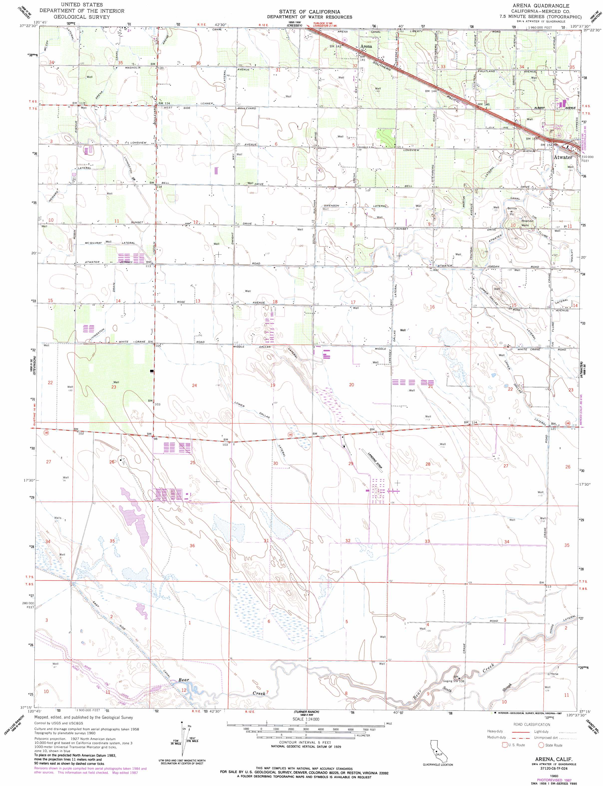
USGS Topo Quad 37120c6 - 1:24,000 scale
| Topo Map Name: | Arena |
| USGS Topo Quad ID: | 37120c6 |
| Print Size: | ca. 21 1/4" wide x 27" high |
| Southeast Coordinates: | 37.25° N latitude / 120.625° W longitude |
| Map Center Coordinates: | 37.3125° N latitude / 120.6875° W longitude |
| U.S. State: | CA |
| Filename: | o37120c6.jpg |
| Download Map JPG Image: | Arena topo map 1:24,000 scale |
| Map Type: | Topographic |
| Topo Series: | 7.5´ |
| Map Scale: | 1:24,000 |
| Source of Map Images: | United States Geological Survey (USGS) |
| Alternate Map Versions: |
Arena CA 1948 Download PDF Buy paper map Arena CA 1960, updated 1961 Download PDF Buy paper map Arena CA 1960, updated 1961 Download PDF Buy paper map Arena CA 1960, updated 1987 Download PDF Buy paper map Arena CA 2012 Download PDF Buy paper map Arena CA 2015 Download PDF Buy paper map |
1:24,000 Topo Quads surrounding Arena
Ceres |
Denair |
Montpelier |
Turlock Lake |
Snelling |
Hatch |
Turlock |
Cressey |
Winton |
Yosemite Lake |
Gustine |
Stevinson |
Arena |
Atwater |
Merced |
Ingomar |
San Luis Ranch |
Turner Ranch |
Sandy Mush |
El Nido |
Volta |
Los Banos |
Delta Ranch |
Santa Rita Bridge |
Bliss Ranch |
> Back to 37120a1 at 1:100,000 scale
> Back to 37120a1 at 1:250,000 scale
> Back to U.S. Topo Maps home
Arena topo map: Gazetteer
Arena: Canals
Arena Canal elevation 39m 127′Avenue Martin Lateral elevation 43m 141′
Lehner Lateral elevation 39m 127′
Livingston Drain elevation 32m 104′
Lower Dallas Lateral elevation 33m 108′
McGilvray Lateral elevation 33m 108′
Middle Dallas Lateral elevation 37m 121′
Swenson Lateral elevation 39m 127′
Upper Dallas Lateral elevation 38m 124′
Arena: Populated Places
Arena elevation 43m 141′Arena digital topo map on disk
Buy this Arena topo map showing relief, roads, GPS coordinates and other geographical features, as a high-resolution digital map file on DVD: