Yosemite Lake Topo Map California
To zoom in, hover over the map of Yosemite Lake
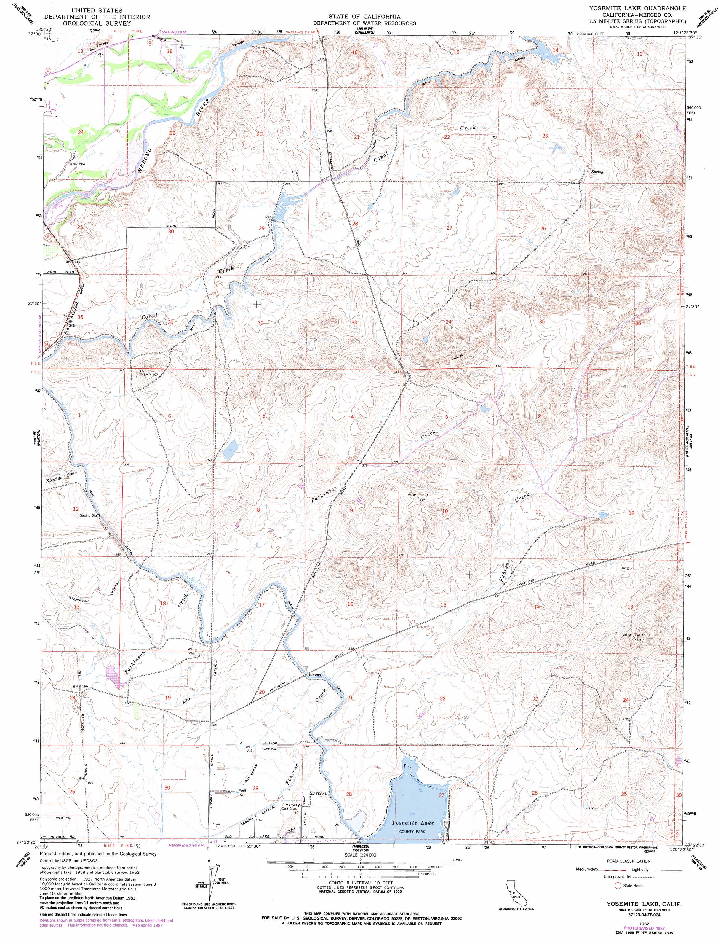
USGS Topo Quad 37120d4 - 1:24,000 scale
| Topo Map Name: | Yosemite Lake |
| USGS Topo Quad ID: | 37120d4 |
| Print Size: | ca. 21 1/4" wide x 27" high |
| Southeast Coordinates: | 37.375° N latitude / 120.375° W longitude |
| Map Center Coordinates: | 37.4375° N latitude / 120.4375° W longitude |
| U.S. State: | CA |
| Filename: | o37120d4.jpg |
| Download Map JPG Image: | Yosemite Lake topo map 1:24,000 scale |
| Map Type: | Topographic |
| Topo Series: | 7.5´ |
| Map Scale: | 1:24,000 |
| Source of Map Images: | United States Geological Survey (USGS) |
| Alternate Map Versions: |
Yosemite Lake CA 1948, updated 1948 Download PDF Buy paper map Yosemite Lake CA 1962, updated 1963 Download PDF Buy paper map Yosemite Lake CA 1962, updated 1975 Download PDF Buy paper map Yosemite Lake CA 1962, updated 1987 Download PDF Buy paper map Yosemite Lake CA 1962, updated 1987 Download PDF Buy paper map Yosemite Lake CA 2012 Download PDF Buy paper map Yosemite Lake CA 2015 Download PDF Buy paper map |
1:24,000 Topo Quads surrounding Yosemite Lake
Paulsell |
Cooperstown |
La Grange |
Penon Blanco Peak |
Coulterville |
Montpelier |
Turlock Lake |
Snelling |
Merced Falls |
Hornitos |
Cressey |
Winton |
Yosemite Lake |
Haystack Mountain |
Indian Gulch |
Arena |
Atwater |
Merced |
Planada |
Owens Reservoir |
Turner Ranch |
Sandy Mush |
El Nido |
Plainsburg |
Le Grand |
> Back to 37120a1 at 1:100,000 scale
> Back to 37120a1 at 1:250,000 scale
> Back to U.S. Topo Maps home
Yosemite Lake topo map: Gazetteer
Yosemite Lake: Bays
Rotary Cove elevation 78m 255′Yosemite Lake: Canals
Bird Lateral elevation 73m 239′Cadera Lateral elevation 60m 196′
Main Canal elevation 81m 265′
Rotterdam Lateral elevation 65m 213′
Upper Golf Lateral elevation 73m 239′
Yosemite Lake: Reservoirs
Yosemite Lake elevation 78m 255′Yosemite Lake digital topo map on disk
Buy this Yosemite Lake topo map showing relief, roads, GPS coordinates and other geographical features, as a high-resolution digital map file on DVD: