Snelling Topo Map California
To zoom in, hover over the map of Snelling
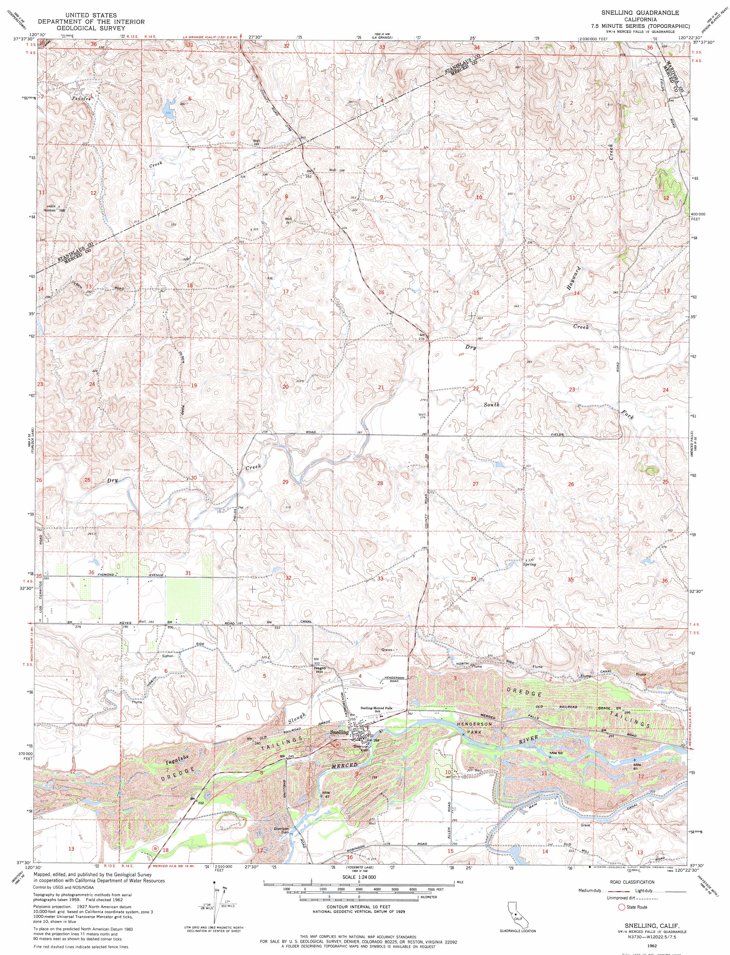
USGS Topo Quad 37120e4 - 1:24,000 scale
| Topo Map Name: | Snelling |
| USGS Topo Quad ID: | 37120e4 |
| Print Size: | ca. 21 1/4" wide x 27" high |
| Southeast Coordinates: | 37.5° N latitude / 120.375° W longitude |
| Map Center Coordinates: | 37.5625° N latitude / 120.4375° W longitude |
| U.S. State: | CA |
| Filename: | o37120e4.jpg |
| Download Map JPG Image: | Snelling topo map 1:24,000 scale |
| Map Type: | Topographic |
| Topo Series: | 7.5´ |
| Map Scale: | 1:24,000 |
| Source of Map Images: | United States Geological Survey (USGS) |
| Alternate Map Versions: |
Snelling CA 1953, updated 1955 Download PDF Buy paper map Snelling CA 1962, updated 1963 Download PDF Buy paper map Snelling CA 1962, updated 1980 Download PDF Buy paper map Snelling CA 1962, updated 1984 Download PDF Buy paper map Snelling CA 2012 Download PDF Buy paper map Snelling CA 2015 Download PDF Buy paper map |
1:24,000 Topo Quads surrounding Snelling
Knights Ferry |
Keystone |
Chinese Camp |
Moccasin |
Groveland |
Paulsell |
Cooperstown |
La Grange |
Penon Blanco Peak |
Coulterville |
Montpelier |
Turlock Lake |
Snelling |
Merced Falls |
Hornitos |
Cressey |
Winton |
Yosemite Lake |
Haystack Mountain |
Indian Gulch |
Arena |
Atwater |
Merced |
Planada |
Owens Reservoir |
> Back to 37120e1 at 1:100,000 scale
> Back to 37120a1 at 1:250,000 scale
> Back to U.S. Topo Maps home
Snelling topo map: Gazetteer
Snelling: Airports
Bonanza Hills Airport elevation 86m 282′Snelling: Canals
North Side Canal elevation 94m 308′Snelling: Parks
Henderson Park elevation 83m 272′Snelling: Populated Places
Snelling elevation 78m 255′Snelling: Post Offices
Snelling Post Office elevation 78m 255′Snelling: Streams
Hayward Creek elevation 86m 282′South Fork Dry Creek elevation 80m 262′
Snelling digital topo map on disk
Buy this Snelling topo map showing relief, roads, GPS coordinates and other geographical features, as a high-resolution digital map file on DVD: