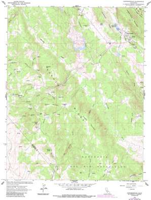
Copperopolis Topo Map California
To zoom in, hover over the map of Copperopolis
USGS Topo Quad 37120h6 - 1:24,000 scale
| Topo Map Name: | Copperopolis |
| USGS Topo Quad ID: | 37120h6 |
| Print Size: | ca. 21 1/4" wide x 27" high |
| Southeast Coordinates: | 37.875° N latitude / 120.625° W longitude |
| Map Center Coordinates: | 37.9375° N latitude / 120.6875° W longitude |
| U.S. State: | CA |
| Filename: | o37120h6.jpg |
| Download Map JPG Image: | Copperopolis topo map 1:24,000 scale |
| Map Type: | Topographic |
| Topo Series: | 7.5´ |
| Map Scale: | 1:24,000 |
| Source of Map Images: | United States Geological Survey (USGS) |
| Alternate Map Versions: |
Copperopolis CA 1962, updated 1963 Download PDF Buy paper map Copperopolis CA 1962, updated 1975 Download PDF Buy paper map Copperopolis CA 1962, updated 1987 Download PDF Buy paper map Copperopolis CA 1962, updated 1987 Download PDF Buy paper map Copperopolis CA 1962, updated 1987 Download PDF Buy paper map Copperopolis CA 2012 Download PDF Buy paper map Copperopolis CA 2015 Download PDF Buy paper map |
1:24,000 Topo Quads surrounding Copperopolis
> Back to 37120e1 at 1:100,000 scale
> Back to 37120a1 at 1:250,000 scale
> Back to U.S. Topo Maps home
Copperopolis topo map: Gazetteer
Copperopolis: Dams
Copperopolis 1024 Dam elevation 306m 1003′Mountain King 501 Dam elevation 321m 1053′
R N Flower 507 Dam elevation 267m 875′
Copperopolis: Flats
Smith Flat elevation 276m 905′Thompson Flat elevation 357m 1171′
Copperopolis: Mines
Collier Mine elevation 292m 958′Discovery Mine elevation 293m 961′
Empire Mine elevation 298m 977′
Empire Mine elevation 315m 1033′
Gold Knoll Mine elevation 327m 1072′
Gopher Hill Mine elevation 258m 846′
Keystone Mine elevation 306m 1003′
Little Quail Hill Mine elevation 283m 928′
McCarty Mine elevation 281m 921′
McNulty Mine elevation 252m 826′
Napoleon Mine elevation 250m 820′
North Keystone Mine elevation 312m 1023′
Pioneer Mine elevation 294m 964′
Quail Hill Mine elevation 232m 761′
Shirley Queen Mine elevation 339m 1112′
Skyrocket Mine elevation 298m 977′
South Shaft elevation 295m 967′
Star elevation 265m 869′
Tecumseh Mine elevation 320m 1049′
Union Mine elevation 295m 967′
Wilbur Womble Mine elevation 304m 997′
Copperopolis: Populated Places
Copper Cove Subdivision elevation 326m 1069′Copper Cove Village elevation 266m 872′
Copperopolis elevation 304m 997′
Hodson (historical) elevation 296m 971′
Telegraph City elevation 199m 652′
Copperopolis: Post Offices
Copperopolis Post Office elevation 302m 990′Copperopolis: Reservoirs
Copperopolis Reservoir elevation 306m 1003′Copperopolis: Ridges
Big Seven Ridge elevation 416m 1364′Gopher Ridge elevation 399m 1309′
Homestead Ridge elevation 395m 1295′
Copperopolis: Springs
Churchs Spring elevation 165m 541′Hicks Spring elevation 321m 1053′
Turners Spring elevation 322m 1056′
Copperopolis: Streams
Big Springs Creek elevation 130m 426′Clover Creek elevation 266m 872′
McCarty Creek elevation 238m 780′
Penny Creek elevation 250m 820′
Rocky Creek elevation 232m 761′
Underwood Creek elevation 291m 954′
Copperopolis: Summits
Boucher Mountain elevation 471m 1545′Copperopolis Mountain elevation 542m 1778′
Flowers Mountain elevation 477m 1564′
Hog Hill elevation 395m 1295′
Iron Mountain elevation 298m 977′
Quail Hill elevation 337m 1105′
Shirley Mountain elevation 406m 1332′
Copperopolis: Valleys
Ramsey Gulch elevation 237m 777′Sailor Gulch elevation 249m 816′
Texas Gulch elevation 281m 921′
Copperopolis digital topo map on disk
Buy this Copperopolis topo map showing relief, roads, GPS coordinates and other geographical features, as a high-resolution digital map file on DVD:


