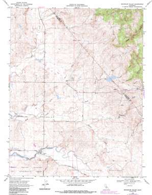
Bachelor Valley Topo Map California
To zoom in, hover over the map of Bachelor Valley
USGS Topo Quad 37120h7 - 1:24,000 scale
| Topo Map Name: | Bachelor Valley |
| USGS Topo Quad ID: | 37120h7 |
| Print Size: | ca. 21 1/4" wide x 27" high |
| Southeast Coordinates: | 37.875° N latitude / 120.75° W longitude |
| Map Center Coordinates: | 37.9375° N latitude / 120.8125° W longitude |
| U.S. State: | CA |
| Filename: | o37120h7.jpg |
| Download Map JPG Image: | Bachelor Valley topo map 1:24,000 scale |
| Map Type: | Topographic |
| Topo Series: | 7.5´ |
| Map Scale: | 1:24,000 |
| Source of Map Images: | United States Geological Survey (USGS) |
| Alternate Map Versions: |
Bachelor Valley CA 1953, updated 1955 Download PDF Buy paper map Bachelor Valley CA 1968, updated 1971 Download PDF Buy paper map Bachelor Valley CA 1968, updated 1971 Download PDF Buy paper map Bachelor Valley CA 1968, updated 1987 Download PDF Buy paper map Bachelor Valley CA 2012 Download PDF Buy paper map Bachelor Valley CA 2015 Download PDF Buy paper map |
1:24,000 Topo Quads surrounding Bachelor Valley
> Back to 37120e1 at 1:100,000 scale
> Back to 37120a1 at 1:250,000 scale
> Back to U.S. Topo Maps home
Bachelor Valley topo map: Gazetteer
Bachelor Valley: Canals
Rock Creek Ditch elevation 79m 259′Bachelor Valley: Dams
Orvis 560 Dam elevation 93m 305′Orvis Dam elevation 101m 331′
Bachelor Valley: Flats
Bachelor Valley elevation 58m 190′Bachelor Valley: Mines
Quail Hill Mine elevation 193m 633′Bachelor Valley: Populated Places
Eugene elevation 53m 173′Bachelor Valley: Streams
Shirley Creek elevation 58m 190′Smith Creek elevation 47m 154′
Snow Creek elevation 83m 272′
Telegraph Creek elevation 61m 200′
Bachelor Valley: Summits
Black Hill elevation 140m 459′Bachelor Valley: Valleys
Buckham Gulch elevation 104m 341′Copper Gulch elevation 105m 344′
Shirley Gulch elevation 96m 314′
Bachelor Valley digital topo map on disk
Buy this Bachelor Valley topo map showing relief, roads, GPS coordinates and other geographical features, as a high-resolution digital map file on DVD:


