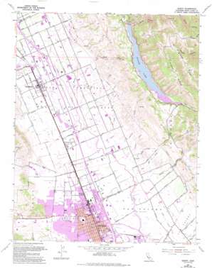
Gilroy Topo Map California
To zoom in, hover over the map of Gilroy
USGS Topo Quad 37121a5 - 1:24,000 scale
| Topo Map Name: | Gilroy |
| USGS Topo Quad ID: | 37121a5 |
| Print Size: | ca. 21 1/4" wide x 27" high |
| Southeast Coordinates: | 37° N latitude / 121.5° W longitude |
| Map Center Coordinates: | 37.0625° N latitude / 121.5625° W longitude |
| U.S. State: | CA |
| Filename: | o37121a5.jpg |
| Download Map JPG Image: | Gilroy topo map 1:24,000 scale |
| Map Type: | Topographic |
| Topo Series: | 7.5´ |
| Map Scale: | 1:24,000 |
| Source of Map Images: | United States Geological Survey (USGS) |
| Alternate Map Versions: |
Gilroy CA 1955, updated 1956 Download PDF Buy paper map Gilroy CA 1955, updated 1966 Download PDF Buy paper map Gilroy CA 1955, updated 1970 Download PDF Buy paper map Gilroy CA 1955, updated 1974 Download PDF Buy paper map Gilroy CA 1955, updated 1974 Download PDF Buy paper map Gilroy CA 1955, updated 1982 Download PDF Buy paper map Gilroy CA 1955, updated 1994 Download PDF Buy paper map Gilroy CA 1973, updated 1979 Download PDF Buy paper map Gilroy CA 2012 Download PDF Buy paper map Gilroy CA 2015 Download PDF Buy paper map |
1:24,000 Topo Quads surrounding Gilroy
> Back to 37121a1 at 1:100,000 scale
> Back to 37120a1 at 1:250,000 scale
> Back to U.S. Topo Maps home
Gilroy topo map: Gazetteer
Gilroy: Airports
South County Arpt of Santa Clara County Airport elevation 85m 278′South Valley Hospital Heliport elevation 66m 216′
Gilroy: Crossings
Exit 356 elevation 58m 190′Exit 357 elevation 62m 203′
Exit 360 elevation 75m 246′
Exit 362 elevation 87m 285′
Gilroy: Dams
Coyote 72-002 Dam elevation 236m 774′Peabody 627 Dam elevation 178m 583′
Selvage Number 2 625 Dam elevation 132m 433′
Gilroy: Flats
Cebada Flat elevation 360m 1181′Gilroy: Parks
Butcher Park elevation 58m 190′Christmas Hills Park elevation 70m 229′
El Roble Park elevation 66m 216′
Forest Street Park elevation 60m 196′
Las Animas Park elevation 62m 203′
Miller Park elevation 65m 213′
Ousley Park elevation 90m 295′
Renz Park elevation 63m 206′
San Ysidro Park elevation 59m 193′
Gilroy: Populated Places
Gilroy elevation 61m 200′Lonoke elevation 65m 213′
Rucker elevation 74m 242′
San Martin elevation 88m 288′
Gilroy: Post Offices
Gilray Hot Springs Post Office (historical) elevation 61m 200′Gilroy Post Office elevation 62m 203′
San Martin Post Office elevation 87m 285′
Gilroy: Reservoirs
Coyote Lake elevation 236m 774′Gilroy: Ridges
Sheep Ridge elevation 635m 2083′Timber Ridge elevation 630m 2066′
Gilroy: Streams
Alamias Creek elevation 59m 193′Center Creek elevation 88m 288′
Church Creek elevation 77m 252′
Day Creek elevation 68m 223′
Little Llagas Creek elevation 74m 242′
Live Oak Creek elevation 62m 203′
New Creek elevation 84m 275′
Panther Creek elevation 65m 213′
Rucker Creek elevation 69m 226′
San Martin Creek elevation 80m 262′
Skillet Creek elevation 68m 223′
South Panther Creek elevation 67m 219′
West Branch Llagas Creek elevation 62m 203′
Gilroy: Summits
Larios Peak elevation 840m 2755′Gilroy: Valleys
Larios Canyon elevation 240m 787′Ousley Canyon elevation 73m 239′
Ruby Canyon elevation 115m 377′
Gilroy digital topo map on disk
Buy this Gilroy topo map showing relief, roads, GPS coordinates and other geographical features, as a high-resolution digital map file on DVD:


