Howard Ranch Topo Map California
To zoom in, hover over the map of Howard Ranch
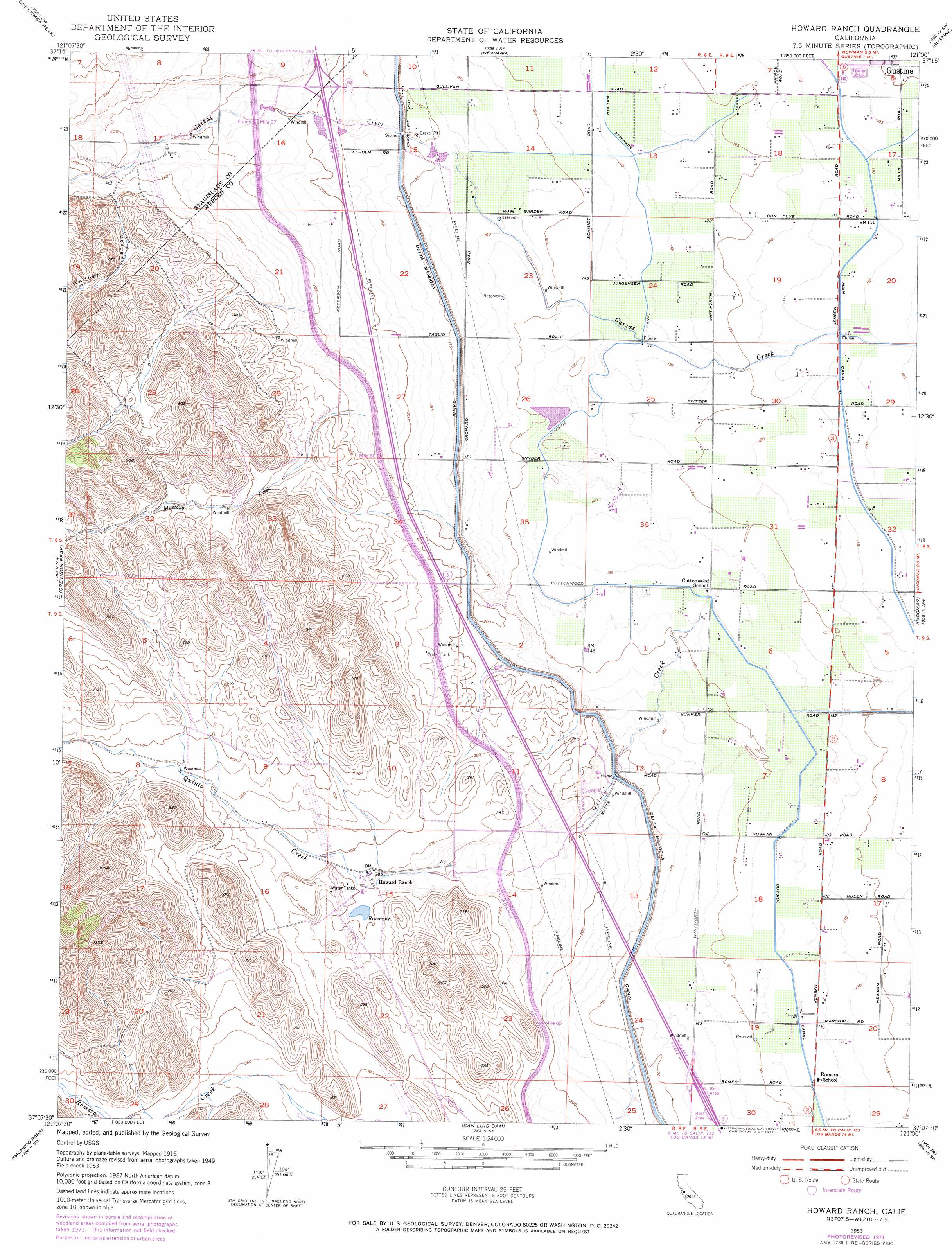
USGS Topo Quad 37121b1 - 1:24,000 scale
| Topo Map Name: | Howard Ranch |
| USGS Topo Quad ID: | 37121b1 |
| Print Size: | ca. 21 1/4" wide x 27" high |
| Southeast Coordinates: | 37.125° N latitude / 121° W longitude |
| Map Center Coordinates: | 37.1875° N latitude / 121.0625° W longitude |
| U.S. State: | CA |
| Filename: | o37121b1.jpg |
| Download Map JPG Image: | Howard Ranch topo map 1:24,000 scale |
| Map Type: | Topographic |
| Topo Series: | 7.5´ |
| Map Scale: | 1:24,000 |
| Source of Map Images: | United States Geological Survey (USGS) |
| Alternate Map Versions: |
Howard Ranch CA 1953, updated 1954 Download PDF Buy paper map Howard Ranch CA 1953, updated 1967 Download PDF Buy paper map Howard Ranch CA 1953, updated 1973 Download PDF Buy paper map Howard Ranch CA 1953, updated 1973 Download PDF Buy paper map Howard Ranch CA 1999, updated 2002 Download PDF Buy paper map Howard Ranch CA 2012 Download PDF Buy paper map Howard Ranch CA 2015 Download PDF Buy paper map |
1:24,000 Topo Quads surrounding Howard Ranch
Copper Mountain |
Patterson |
Crows Landing |
Hatch |
Turlock |
Wilcox Ridge |
Orestimba Peak |
Newman |
Gustine |
Stevinson |
Mustang Peak |
Crevison Peak |
Howard Ranch |
Ingomar |
San Luis Ranch |
Pacheco Peak |
Pacheco Pass |
San Luis Dam |
Volta |
Los Banos |
Three Sisters |
Mariposa Peak |
Los Banos Valley |
Ortigalita Peak Nw |
Charleston School |
> Back to 37121a1 at 1:100,000 scale
> Back to 37120a1 at 1:250,000 scale
> Back to U.S. Topo Maps home
Howard Ranch topo map: Gazetteer
Howard Ranch: Canals
Delta-Mendota Canal elevation 53m 173′Howard Ranch: Streams
Mustang Creek elevation 70m 229′Quinto Creek elevation 45m 147′
Howard Ranch: Valleys
Whitney Canyon elevation 85m 278′Howard Ranch digital topo map on disk
Buy this Howard Ranch topo map showing relief, roads, GPS coordinates and other geographical features, as a high-resolution digital map file on DVD: