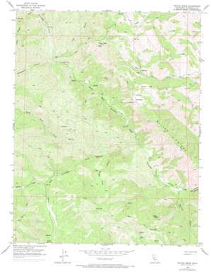
Wilcox Ridge Topo Map California
To zoom in, hover over the map of Wilcox Ridge
USGS Topo Quad 37121c3 - 1:24,000 scale
| Topo Map Name: | Wilcox Ridge |
| USGS Topo Quad ID: | 37121c3 |
| Print Size: | ca. 21 1/4" wide x 27" high |
| Southeast Coordinates: | 37.25° N latitude / 121.25° W longitude |
| Map Center Coordinates: | 37.3125° N latitude / 121.3125° W longitude |
| U.S. State: | CA |
| Filename: | o37121c3.jpg |
| Download Map JPG Image: | Wilcox Ridge topo map 1:24,000 scale |
| Map Type: | Topographic |
| Topo Series: | 7.5´ |
| Map Scale: | 1:24,000 |
| Source of Map Images: | United States Geological Survey (USGS) |
| Alternate Map Versions: |
Wilcox Ridge CA 1956, updated 1957 Download PDF Buy paper map Wilcox Ridge CA 1956, updated 1968 Download PDF Buy paper map Wilcox Ridge CA 1956, updated 1972 Download PDF Buy paper map Wilcox Ridge CA 2012 Download PDF Buy paper map Wilcox Ridge CA 2015 Download PDF Buy paper map |
1:24,000 Topo Quads surrounding Wilcox Ridge
> Back to 37121a1 at 1:100,000 scale
> Back to 37120a1 at 1:250,000 scale
> Back to U.S. Topo Maps home
Wilcox Ridge topo map: Gazetteer
Wilcox Ridge: Flats
Jackass Flat elevation 185m 606′Wilcox Ridge: Gaps
Days Pass elevation 479m 1571′Wilcox Ridge: Ridges
Wilcox Ridge elevation 633m 2076′Wilcox Ridge: Streams
North Fork Orestimba Creek elevation 204m 669′Robison Creek elevation 288m 944′
Sheep Thief Creek elevation 268m 879′
South Fork Orestimba Creek elevation 204m 669′
Wilcox Ridge: Summits
Mikes Peak elevation 788m 2585′Wilcox Ridge: Valleys
Beartrap Canyon elevation 182m 597′Crow Spring Canyon elevation 259m 849′
Gooseberry Canyon elevation 348m 1141′
Lion Canyon elevation 318m 1043′
Lions Canyon elevation 426m 1397′
Long Canyon elevation 342m 1122′
Wilcox Ridge digital topo map on disk
Buy this Wilcox Ridge topo map showing relief, roads, GPS coordinates and other geographical features, as a high-resolution digital map file on DVD:


