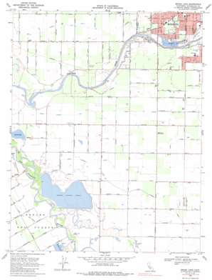
Brush Lake Topo Map California
To zoom in, hover over the map of Brush Lake
USGS Topo Quad 37121e1 - 1:24,000 scale
| Topo Map Name: | Brush Lake |
| USGS Topo Quad ID: | 37121e1 |
| Print Size: | ca. 21 1/4" wide x 27" high |
| Southeast Coordinates: | 37.5° N latitude / 121° W longitude |
| Map Center Coordinates: | 37.5625° N latitude / 121.0625° W longitude |
| U.S. State: | CA |
| Filename: | o37121e1.jpg |
| Download Map JPG Image: | Brush Lake topo map 1:24,000 scale |
| Map Type: | Topographic |
| Topo Series: | 7.5´ |
| Map Scale: | 1:24,000 |
| Source of Map Images: | United States Geological Survey (USGS) |
| Alternate Map Versions: |
Brush Lake CA 1953, updated 1954 Download PDF Buy paper map Brush Lake CA 1953, updated 1954 Download PDF Buy paper map Brush Lake CA 1969, updated 1971 Download PDF Buy paper map Brush Lake CA 1969, updated 1971 Download PDF Buy paper map Brush Lake CA 1969, updated 1986 Download PDF Buy paper map Brush Lake CA 1969, updated 1986 Download PDF Buy paper map Brush Lake CA 2012 Download PDF Buy paper map Brush Lake CA 2015 Download PDF Buy paper map |
1:24,000 Topo Quads surrounding Brush Lake
> Back to 37121e1 at 1:100,000 scale
> Back to 37120a1 at 1:250,000 scale
> Back to U.S. Topo Maps home
Brush Lake topo map: Gazetteer
Brush Lake: Canals
Hatch Drain elevation 17m 55′Lateral A elevation 17m 55′
Lateral B elevation 20m 65′
Lateral Number One elevation 25m 82′
Lower Lateral Number Two elevation 19m 62′
Lower Lateral Number Two and One Half elevation 21m 68′
Westport Drain elevation 17m 55′
Brush Lake: Parks
Adamsville State Historic Landmark elevation 18m 59′Bellenita Park elevation 20m 65′
Bret Harte Park elevation 27m 88′
Fairview Park elevation 24m 78′
John Thurman Field elevation 27m 88′
Paradise Park elevation 24m 78′
Riverdale Park elevation 18m 59′
Robertson Road Park elevation 23m 75′
Tuolumne River Regional Park elevation 21m 68′
Brush Lake: Populated Places
Riverdale Park elevation 21m 68′Brush Lake: Reservoirs
Brush Lake elevation 11m 36′Brush Lake: Streams
Del Puerto Creek elevation 9m 29′Brush Lake digital topo map on disk
Buy this Brush Lake topo map showing relief, roads, GPS coordinates and other geographical features, as a high-resolution digital map file on DVD:


