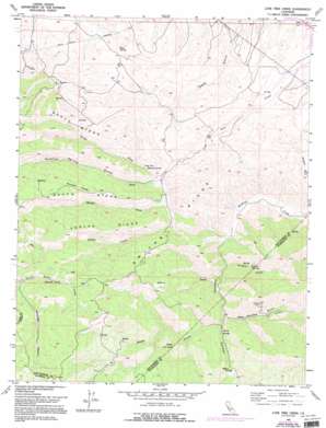
Lone Tree Creek Topo Map California
To zoom in, hover over the map of Lone Tree Creek
USGS Topo Quad 37121e4 - 1:24,000 scale
| Topo Map Name: | Lone Tree Creek |
| USGS Topo Quad ID: | 37121e4 |
| Print Size: | ca. 21 1/4" wide x 27" high |
| Southeast Coordinates: | 37.5° N latitude / 121.375° W longitude |
| Map Center Coordinates: | 37.5625° N latitude / 121.4375° W longitude |
| U.S. State: | CA |
| Filename: | o37121e4.jpg |
| Download Map JPG Image: | Lone Tree Creek topo map 1:24,000 scale |
| Map Type: | Topographic |
| Topo Series: | 7.5´ |
| Map Scale: | 1:24,000 |
| Source of Map Images: | United States Geological Survey (USGS) |
| Alternate Map Versions: |
Lone Tree Creek CA 1955, updated 1956 Download PDF Buy paper map Lone Tree Creek CA 1955, updated 1965 Download PDF Buy paper map Lone Tree Creek CA 1955, updated 1972 Download PDF Buy paper map Lone Tree Creek CA 1955, updated 1976 Download PDF Buy paper map Lone Tree Creek CA 1955, updated 1994 Download PDF Buy paper map Lone Tree Creek CA 2012 Download PDF Buy paper map Lone Tree Creek CA 2015 Download PDF Buy paper map |
1:24,000 Topo Quads surrounding Lone Tree Creek
> Back to 37121e1 at 1:100,000 scale
> Back to 37120a1 at 1:250,000 scale
> Back to U.S. Topo Maps home
Lone Tree Creek topo map: Gazetteer
Lone Tree Creek: Mines
Buckeye Mines elevation 562m 1843′Ladd Mine elevation 321m 1053′
Lone Tree Creek: Ridges
Buzzard Roost elevation 636m 2086′North Ridge elevation 452m 1482′
Pegleg Ridge elevation 677m 2221′
Smiths Ridge elevation 487m 1597′
South Ridge elevation 613m 2011′
Lone Tree Creek: Springs
Bluerock Spring elevation 778m 2552′Elder Spring elevation 267m 875′
Lone Tree Mineral Spring elevation 291m 954′
Sperry Springs elevation 315m 1033′
Sulphur Springs elevation 339m 1112′
Willow Springs elevation 398m 1305′
Lone Tree Creek: Streams
Middle Fork Lone Tree Creek elevation 240m 787′North Fork Lone Tree Creek elevation 240m 787′
Pegleg Creek elevation 267m 875′
Lone Tree Creek: Summits
Cedar Knob elevation 615m 2017′Lone Tree Creek: Valleys
Buckeye Gulch elevation 301m 987′Hospital Canyon elevation 228m 748′
Sulphur Gulch elevation 260m 853′
Sulphur Spring Gulch elevation 252m 826′
West Fork Hospital Canyon elevation 305m 1000′
Lone Tree Creek digital topo map on disk
Buy this Lone Tree Creek topo map showing relief, roads, GPS coordinates and other geographical features, as a high-resolution digital map file on DVD:


