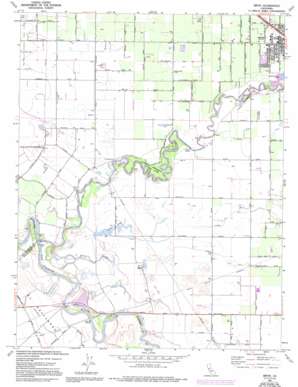
Ripon Topo Map California
To zoom in, hover over the map of Ripon
USGS Topo Quad 37121f2 - 1:24,000 scale
| Topo Map Name: | Ripon |
| USGS Topo Quad ID: | 37121f2 |
| Print Size: | ca. 21 1/4" wide x 27" high |
| Southeast Coordinates: | 37.625° N latitude / 121.125° W longitude |
| Map Center Coordinates: | 37.6875° N latitude / 121.1875° W longitude |
| U.S. State: | CA |
| Filename: | o37121f2.jpg |
| Download Map JPG Image: | Ripon topo map 1:24,000 scale |
| Map Type: | Topographic |
| Topo Series: | 7.5´ |
| Map Scale: | 1:24,000 |
| Source of Map Images: | United States Geological Survey (USGS) |
| Alternate Map Versions: |
Ripon CA 1952, updated 1954 Download PDF Buy paper map Ripon CA 1969, updated 1977 Download PDF Buy paper map Ripon CA 1969, updated 1980 Download PDF Buy paper map Ripon CA 1969, updated 1986 Download PDF Buy paper map Ripon CA 1969, updated 1994 Download PDF Buy paper map Ripon CA 2012 Download PDF Buy paper map Ripon CA 2015 Download PDF Buy paper map |
1:24,000 Topo Quads surrounding Ripon
> Back to 37121e1 at 1:100,000 scale
> Back to 37120a1 at 1:250,000 scale
> Back to U.S. Topo Maps home
Ripon topo map: Gazetteer
Ripon: Airports
Mapes Ranch Airport elevation 10m 32′Yandell Ranch Airport elevation 13m 42′
Ripon: Bends
Sturgeon Bend elevation 9m 29′Ripon: Falls
Finnegan Falls elevation 7m 22′Ripon: Parks
Acacia Park elevation 20m 65′Caswell Memorial State Park elevation 13m 42′
Wilma Avenue Park elevation 19m 62′
Ripon: Post Offices
Ripon Post Office elevation 19m 62′Ripon: Reservoirs
Miller Lake elevation 10m 32′Ripon: Streams
Riley Slough elevation 7m 22′Stanislaus River elevation 6m 19′
Ripon: Woods
Oak Forest elevation 13m 42′Ripon digital topo map on disk
Buy this Ripon topo map showing relief, roads, GPS coordinates and other geographical features, as a high-resolution digital map file on DVD:


