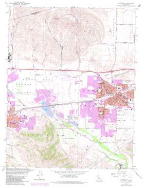
Livermore Topo Map California
To zoom in, hover over the map of Livermore
USGS Topo Quad 37121f7 - 1:24,000 scale
| Topo Map Name: | Livermore |
| USGS Topo Quad ID: | 37121f7 |
| Print Size: | ca. 21 1/4" wide x 27" high |
| Southeast Coordinates: | 37.625° N latitude / 121.75° W longitude |
| Map Center Coordinates: | 37.6875° N latitude / 121.8125° W longitude |
| U.S. State: | CA |
| Filename: | o37121f7.jpg |
| Download Map JPG Image: | Livermore topo map 1:24,000 scale |
| Map Type: | Topographic |
| Topo Series: | 7.5´ |
| Map Scale: | 1:24,000 |
| Source of Map Images: | United States Geological Survey (USGS) |
| Alternate Map Versions: |
Livermore CA 1953, updated 1954 Download PDF Buy paper map Livermore CA 1961, updated 1961 Download PDF Buy paper map Livermore CA 1961, updated 1966 Download PDF Buy paper map Livermore CA 1961, updated 1969 Download PDF Buy paper map Livermore CA 1961, updated 1974 Download PDF Buy paper map Livermore CA 1961, updated 1981 Download PDF Buy paper map Livermore CA 1961, updated 1981 Download PDF Buy paper map Livermore CA 2012 Download PDF Buy paper map Livermore CA 2015 Download PDF Buy paper map |
1:24,000 Topo Quads surrounding Livermore
> Back to 37121e1 at 1:100,000 scale
> Back to 37120a1 at 1:250,000 scale
> Back to U.S. Topo Maps home
Livermore topo map: Gazetteer
Livermore: Airports
Livermore Municipal Airport elevation 117m 383′Livermore: Basins
Livermore Valley elevation 138m 452′Livermore: Crossings
Exit 47 elevation 106m 347′Exit 48 elevation 108m 354′
Exit 50 elevation 121m 396′
Exit 52A elevation 131m 429′
Exit 52B elevation 144m 472′
Livermore: Lakes
Heron Pond elevation 94m 308′Livermore: Parks
Al Caffodio Park elevation 135m 442′Amador Valley Park elevation 106m 347′
Bothwell Recreation Center elevation 156m 511′
Carnegie Park elevation 151m 495′
Centennial Park elevation 145m 475′
Civic Center Park elevation 164m 538′
Doolan Park elevation 150m 492′
El Padro Park elevation 135m 442′
Fairlands Park elevation 105m 344′
Hagemann Park elevation 137m 449′
Hansen Park elevation 143m 469′
Henry Park elevation 132m 433′
Holmwell Park elevation 126m 413′
Independence Park elevation 146m 479′
Jack Williams Park elevation 143m 469′
John Belucchi Memorial Park elevation 108m 354′
Kottinger Village Park elevation 119m 390′
Lincoln Highway Park elevation 144m 472′
Livermore Downs Park elevation 130m 426′
Livermore Valley Stadium elevation 162m 531′
Madeira Park elevation 153m 501′
Madeiros Parkway elevation 148m 485′
Main Street Green elevation 107m 351′
Max Baer Park elevation 132m 433′
May Nissen Park elevation 138m 452′
McKinley Park elevation 122m 400′
Meadows Park elevation 106m 347′
Mission Hills Park elevation 115m 377′
Mocho Park elevation 144m 472′
Nielsen Park elevation 105m 344′
Oak Knoll Pioneer Memorial Park elevation 137m 449′
Orloff Park elevation 106m 347′
Pleasanton Upper Playfields elevation 109m 357′
Pleasure Island Park elevation 130m 426′
Ravenswood Park elevation 160m 524′
Robertson Park elevation 159m 521′
Shadow Cliffs Regional Recreation Area elevation 107m 351′
Sunken Gardens Park elevation 158m 518′
Sunset Park elevation 153m 501′
Sycamore Grove Park elevation 144m 472′
Tawny Park elevation 116m 380′
Veterans Park elevation 156m 511′
Vintage Hills Park elevation 146m 479′
Vista Meadows Park elevation 157m 515′
Wente Park elevation 159m 521′
Livermore: Populated Places
Asco elevation 107m 351′East Pleasanton elevation 118m 387′
Elliot (historical) elevation 114m 374′
Hacienda Mobile Home Park elevation 122m 400′
Livermore elevation 150m 492′
Pleasanton elevation 106m 347′
Radum elevation 110m 360′
Remillard (historical) elevation 113m 370′
Vineyard Mobile Villa elevation 114m 374′
Livermore: Post Offices
Livermore Post Office elevation 151m 495′Pleasanton Post Office elevation 107m 351′
Livermore: Streams
Arroyo Las Positas elevation 106m 347′Arroyo Seco elevation 147m 482′
Cayetano Creek elevation 129m 423′
Cottonwood Creek elevation 113m 370′
Dry Creek elevation 149m 488′
Livermore: Summits
Oak Knoll elevation 142m 465′Livermore: Valleys
Collier Canyon elevation 135m 442′Doolan Canyon elevation 133m 436′
Livermore digital topo map on disk
Buy this Livermore topo map showing relief, roads, GPS coordinates and other geographical features, as a high-resolution digital map file on DVD:


