Union Island Topo Map California
To zoom in, hover over the map of Union Island
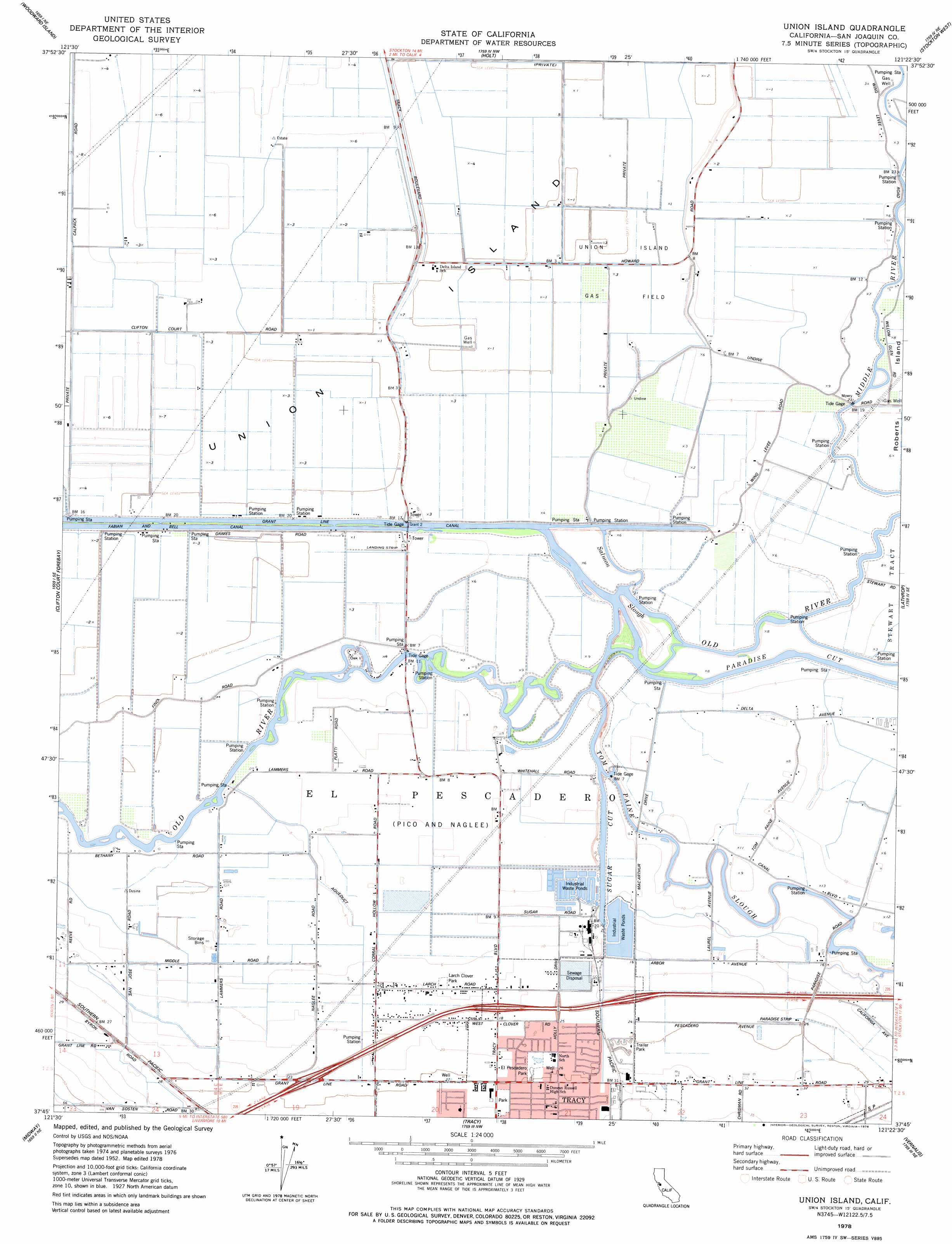
USGS Topo Quad 37121g4 - 1:24,000 scale
| Topo Map Name: | Union Island |
| USGS Topo Quad ID: | 37121g4 |
| Print Size: | ca. 21 1/4" wide x 27" high |
| Southeast Coordinates: | 37.75° N latitude / 121.375° W longitude |
| Map Center Coordinates: | 37.8125° N latitude / 121.4375° W longitude |
| U.S. State: | CA |
| Filename: | o37121g4.jpg |
| Download Map JPG Image: | Union Island topo map 1:24,000 scale |
| Map Type: | Topographic |
| Topo Series: | 7.5´ |
| Map Scale: | 1:24,000 |
| Source of Map Images: | United States Geological Survey (USGS) |
| Alternate Map Versions: |
Union Island CA 1952, updated 1953 Download PDF Buy paper map Union Island CA 1952, updated 1966 Download PDF Buy paper map Union Island CA 1952, updated 1969 Download PDF Buy paper map Union Island CA 1978, updated 1978 Download PDF Buy paper map Union Island CA 2012 Download PDF Buy paper map Union Island CA 2015 Download PDF Buy paper map |
1:24,000 Topo Quads surrounding Union Island
Jersey Island |
Bouldin Island |
Terminous |
Lodi South |
Waterloo |
Brentwood |
Woodward Island |
Holt |
Stockton West |
Stockton East |
Byron Hot Springs |
Clifton Court Forebay |
Union Island |
Lathrop |
Manteca |
Altamont |
Midway |
Tracy |
Vernalis |
Ripon |
Mendenhall Springs |
Cedar Mountain |
Lone Tree Creek |
Solyo |
Westley |
> Back to 37121e1 at 1:100,000 scale
> Back to 37120a1 at 1:250,000 scale
> Back to U.S. Topo Maps home
Union Island topo map: Gazetteer
Union Island: Canals
Fabian and Bell Canal elevation 0m 0′Grant Line Canal elevation 1m 3′
Lower Main Canal elevation 17m 55′
Union Island: Guts
Salmon Slough elevation 2m 6′Sugar Cut elevation 7m 22′
Union Island: Islands
Union Island elevation 0m 0′Union Island: Oilfields
Union Island Gas Field elevation 1m 3′Union Island: Parks
El Pescadero Park elevation 7m 22′Kenner Park elevation 7m 22′
Larch Clover Park elevation 3m 9′
Slayter Park elevation 8m 26′
Tracy Ball Park elevation 9m 29′
Union Island: Streams
Tom Paine Slough elevation 7m 22′Union Island digital topo map on disk
Buy this Union Island topo map showing relief, roads, GPS coordinates and other geographical features, as a high-resolution digital map file on DVD: