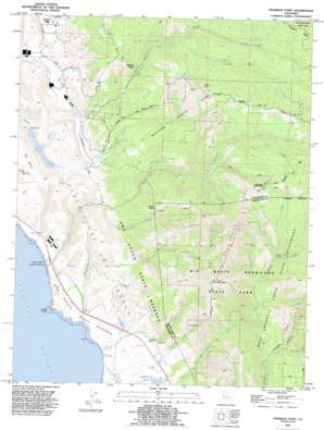
Franklin Point Topo Map California
To zoom in, hover over the map of Franklin Point
USGS Topo Quad 37122b3 - 1:24,000 scale
| Topo Map Name: | Franklin Point |
| USGS Topo Quad ID: | 37122b3 |
| Print Size: | ca. 21 1/4" wide x 27" high |
| Southeast Coordinates: | 37.125° N latitude / 122.25° W longitude |
| Map Center Coordinates: | 37.1875° N latitude / 122.3125° W longitude |
| U.S. State: | CA |
| Filename: | o37122b3.jpg |
| Download Map JPG Image: | Franklin Point topo map 1:24,000 scale |
| Map Type: | Topographic |
| Topo Series: | 7.5´ |
| Map Scale: | 1:24,000 |
| Source of Map Images: | United States Geological Survey (USGS) |
| Alternate Map Versions: |
Franklin Point CA 1955, updated 1957 Download PDF Buy paper map Franklin Point CA 1955, updated 1962 Download PDF Buy paper map Franklin Point CA 1955, updated 1969 Download PDF Buy paper map Franklin Point CA 1955, updated 1973 Download PDF Buy paper map Franklin Point CA 1955, updated 1973 Download PDF Buy paper map Franklin Point CA 1991, updated 1995 Download PDF Buy paper map Franklin Point CA 1991, updated 1995 Download PDF Buy paper map Franklin Point CA 1998, updated 2002 Download PDF Buy paper map Franklin Point CA 2012 Download PDF Buy paper map Franklin Point CA 2015 Download PDF Buy paper map |
1:24,000 Topo Quads surrounding Franklin Point
Half Moon Bay |
Woodside |
Palo Alto |
Mountain View |
|
San Gregorio |
La Honda |
Mindego Hill |
Cupertino |
|
Pigeon Point |
Franklin Point |
Big Basin |
Castle Rock Ridge |
|
Ano Nuevo * |
Davenport |
Felton |
||
Santa Cruz |
> Back to 37122a1 at 1:100,000 scale
> Back to 37122a1 at 1:250,000 scale
> Back to U.S. Topo Maps home
Franklin Point topo map: Gazetteer
Franklin Point: Capes
Franklin Point elevation 12m 39′Franklin Point: Dams
Bean Hollow Number 2 602-002 Dam elevation 48m 157′Bean Hollow Number 3 602-003 Dam elevation 56m 183′
Franklin Point: Falls
Berry Creek Falls elevation 127m 416′Butano Falls elevation 123m 403′
Golden Falls elevation 232m 761′
Silver Falls elevation 206m 675′
Franklin Point: Parks
Butano State Park elevation 427m 1400′Cascade Ranch State Park elevation 189m 620′
Gazos Creek State Beach elevation 4m 13′
Franklin Point: Populated Places
Butano Park elevation 91m 298′Franklin Point: Reservoirs
Bean Hollow Lake elevation 53m 173′Reservoir de los Frijole elevation 56m 183′
Reservoir de los Frijoles elevation 48m 157′
Franklin Point: Ridges
Butano Ridge elevation 497m 1630′The Chalks elevation 357m 1171′
Franklin Point: Streams
Berry Creek elevation 107m 351′Cascade Creek elevation 4m 13′
East Waddell Creek elevation 25m 82′
Gazos Creek elevation 2m 6′
Henry Creek elevation 71m 232′
Kelly Creek elevation 150m 492′
Last Chance Creek elevation 42m 137′
Little Butano Creek elevation 38m 124′
Middle Fork Gazos Creek elevation 97m 318′
Middle Fork Gazos Creek elevation 84m 275′
North Fork Gazos Creek elevation 73m 239′
Old Womans Creek elevation 25m 82′
South Fork Butano Creek elevation 158m 518′
South Fork Gazos Creek elevation 73m 239′
Timms Creek elevation 170m 557′
West Waddell Creek elevation 25m 82′
Whitehouse Creek elevation 4m 13′
Franklin Point: Summits
Chalk Mountain elevation 492m 1614′Franklin Point: Trails
Ano Nuevo Trail elevation 293m 961′Atkinson Bluff Trail elevation 9m 29′
Berry Creek Falls Trail elevation 177m 580′
Canyon Trail elevation 332m 1089′
Cascade Creek Trail elevation 18m 59′
Creek Trail elevation 153m 501′
Doe Ridge Trail elevation 369m 1210′
Franklin Point Trail elevation 13m 42′
Gazos Trail elevation 360m 1181′
Goat Hill Trail elevation 334m 1095′
Henry Creek Trail elevation 208m 682′
Howard King Trail elevation 374m 1227′
Indian Trail elevation 405m 1328′
Jackson Flats Trail elevation 241m 790′
McCrady Ridge Trail elevation 286m 938′
Mill Ox Trail elevation 150m 492′
Roy Linder Memorial Trail elevation 432m 1417′
Six Bridge Trail elevation 85m 278′
Timms Creek Trail elevation 235m 770′
Franklin Point digital topo map on disk
Buy this Franklin Point topo map showing relief, roads, GPS coordinates and other geographical features, as a high-resolution digital map file on DVD:


